Omsk Region
Description
Omsk Oblast is a federal subject of Russia (an oblast), located in southwestern Siberia. The oblast has an area of 139,700 square km. Its population is 1,977,665 (2010 Census) with the majority, 1.15 million, living in Omsk, the administrative center.
The oblast borders with Tyumen Oblast in the north and west, Novosibirsk and Tomsk Oblasts in the east, and with Kazakhstan in the south.
History
Prehistory and the Middle Ages
Archeological findings indicate that the present day territory of the oblast has been inhabited for the last 14,000 years. Neolithic societies in the area lived by fishing and hunting. About three thousand years ago, pastoralism began to take hold.
Various Turkic states dominated the area throughout the Medieval era. The most notable of these were the Western Turkic Khaganate and the Siberian Khanate. Siberian Tatars, Mongols, Khanty and Mansi tribes, along with others, inhabited the territory.
Exploration of Siberia
The Russian history of Omsk began with the 1584 arrival of a Cossack force under the command of ataman Yermak, who defeated local rulers and established nominal Russian control of the area. To support further expansion tsars Feodor I and Boris Godunov initiated the construction of fortified settlements and military outposts in the south of Siberia in order to defend their subjects from raiding nomadic tribesmen and to exert authority over local populations, specifically over the tribute-paying Siberian Tatars of The Baraba Lands. The first permanent Russian settlement in the region, the сity of Tara, was founded in 1594, soon it began to play an important part in fur trade that connected Russia with Central Asia and China.
In 1716 a fortress was constructed at the confluence of the Om and Irtysh rivers on the orders of sublieutenant Ivan Bugholtz.The fortress would form the nucleus for the development of the future city of Omsk. By the second half of the 18th century, Omsk fortress was the largest building of any kind in the eastern part of Russia.
As Russian settlements continued to spread through the Yenisei, Tobol and Irtysh watersheds in the course of 18th century, so did the development of the Omsk and the surrounding region. In 1753 a customs post was established to tax goods brought into the city by the ever increasing trade with Kazakh tribesmen. In 1764, when he Siberian provinces of Russia were organized into two governorates with centers in Irkutsk and Tobolsk, the city of Tara and the fortress of Omsk were assigned to the latter. In 1780, on the orders of Catherine the Great the fortress was transferred to Kolyvan Oblast. By this time Omsk had grown to the size of a small city, however, from 1797 to 1804 it did not possess its own uyezd.
Russian Empire
In 1804, the territories surrounding Omsk were organized into the Omsk Okrug. The city rose to prominence when Siberia was once again reorganized in 1822, Omsk became the administrative center of the General Governorate of Eastern Siberia rising above the old center of Siberia, Tobolsk. The new governorate was divided into oblasts around the cities of Omsk, Petropavlovsk, Semipalatinsk and Ust-Kamenogrsk populated by Russian colonists and okrugs populated by Kazakh nomads. In subsequent reforms the name of the Oblast was changed repeatedly to The Oblast of The Siberian Kyrgyz (1854), Akmolinsk Oblast (1868), and Omsk Oblast (1917) before finally reverting to the Omsk Governorate in 1918. The authority of the oblast followed further expansion of the empire to Central Asia and included significant parts of modern day Kazakhstan.
In the 19th century, Omsk, given its strong system of frontier fortresses, became notorious as a premier destination for political exiles and prisoners from the European part of the Russian Empire. Decembrists, Polish rebels, French prisoners of war and political activists of every stripe found their way to Siberia. Among them was Fyodor Dostoyevsky, who spent four years (1850–1854) at the Omsk prison.
The early nineteenth century also saw the growth of industry in the city and in the rest of the Irtysh basin. The Siberian Cossack Army was headquartered in Omsk after 1808 and contributed to the development of the city, by the beginning of the 20th century the Cossacks were a dominant component in the society of both the city of Omsk and the surrounding lands, having reached a population of 174 thousand and holding title to five million hectares of agricultural land. The 18th and 19th centuries also saw the influx of a significant number of German immigrants both from Russia's Volga Regions and from abroad.
Soviet Years
In 1925 the Omsk governorate was dissolved into the newly formed Siberian Krai and again reorganized, this time as an Oblast by order of the All-Russian Central Executive Committee on the 7th of December, 1934. Parts of the Ob-Irtysh Oblast and the West Siberian Krai as well as the southern part of Chelyabinsk Oblast were given over to Omsk. In 1943, Kurgan Oblast created from the western portion of the Chelyabinsk Oblast also got a number of Omsk territories. In 1944, the northern part of the Omsk Oblast along with the districts previously transferred to Kurgan became newly established Tyumen Oblast that included Khanty-Mansi and Yamalo-Nenets autonomous okrugs.
The 1950s saw the creation of the petroleum processing industry, as well as the development of various high-technology facilities that came to define the economy of the Oblast for the remainder of the century.
Post-Soviet era
With the dissolution of the Soviet Union the oblast became part of the newly independent Russian Federation. The independence of the Union Republic of Kazakhstan gave Omsk an international border to the south, while continued federal policy aiming to rectify the effects of Stalin Era population transfers a national German district created an area with a significant, although not a dominant, German population around the town of Azovo.
Geography
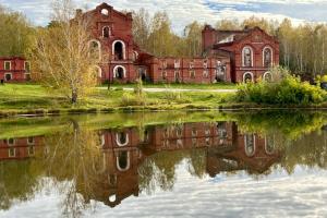
Omsk Oblast spans 600 km north to south and 300 km west to east. The geography of the oblast is dominated by the Irtysh River and its larger tributaries, the Ishim, Om, Osha, and Tara. The region is part of the West Siberian Plain, and as such is fairly level. The south of the oblast consists predominantly of grassy plains, which gradually transition to wooded plains, forests and, eventually, marshy taiga forest in the north. The most fertile lands are concentrated about the Irtysh river, this area, is also more wooded, and more uneven than the rest of the Oblast. Numerous lakes can be found in the oblast, with the largest being the Saltaim, Tenis, Ik, Ebeity, Ul'jai and Tobol-Kushly.
The highest point in the oblast, is an elevation of 150 meters lying near the town of Nagornoye, while the lowest is a section of the Irtysh river lying near Malaya Bicha.
Towns

All accomodation types
Hotels
 Serebryanyy bereg Hotel
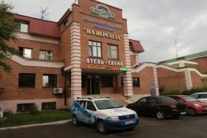 Na Perelyota Hotel
 Myagkaya posadka Hotel
 Admiral Hotel
 Vokrug sveta Hotel
 Vizit Hotel
 Teremok Hotel
 High ratingSibirskiy senat Hotel
 Nadezhda Hotel
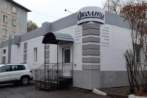 Okolitsa Hotel
 Megapolis Hotel
 Kupidon Hotel
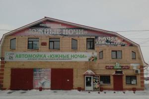 Yuzhnye nochi Hotel
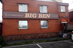 BigBen Hotel
 Abrikos Hotel
 Four Rooms
 Blagodat Hotel
 Avanta Hotel
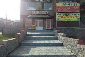 Rodos Hotel
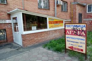 Agata Hotel
 Berezovaya Hotel 2
Hostels
 Neftyanik Hostel
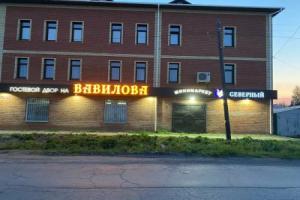 High ratingGostevoi dvor na Vavilova
 Hostel Chey Chemodan
 Hostel na zavodskoy