Dnipropetrovsk Region
Description
Dnipropetrovsk Oblast is an oblast (province) of central Ukraine, the most important industrial region of the country. It was created on February 27, 1932. Dnipropetrovsk has a population of about 3,307,795 (2013 est.), approximately 80% of whom live centering on administrative center of Dnipropetrovsk, Kryvyi Rih, Dniprodzerzhynsk, Nikopol. The Dnieper River runs through the oblast.
Geography
The Dnipropetrovsk Oblast is located in southeastern Ukraine. The area of the oblast (31,974 km²), comprises about 5.3% of the total area of the country. Its longitude from north to south is 130 km, from east to west – 300 km. The oblast borders the Poltava and Kharkiv Oblasts on the north, the Donetsk Oblast on the east, the Zaporizhzhia and Kherson Oblasts on the south, and the Mykolayiv and Kirovohrad Oblasts on the west.
Black Sea Lowland almost completely within the south oblast, covering half of its territory. In Ternivka located meteorite crater. It is 11 km in diameter and the age is estimated to be 280 ± 10 million years (Permian). The crater is not exposed at the surface. The Dnieper Upland contains a number of minerals including iron, manganese, granite, graphite, brown coal, kaolin etc. Kryvbas is an important economic region, specializing in iron ore mining and the steel industry. It is arguably the main iron ore region of Eastern Europe. Named after the city of Kryvyi Rih, the region occupies the southwestern part of the Dnipropetrovsk, as well as a small neighbouring part of the Kirovohrad Oblast.
The region possesses major deposits of iron ore and some other metallurgical ores. To exploit them, several large mining companies were founded here in the middle of the 20th century. Most of them are located in Kryvyi Rih itself, which is the longest city in Europe.
History
At the beginning of the 15th century, Tatar tribes inhabiting the right bank of the Dnieper were driven away by the Grand Duchy of Lithuania. However, by the mid-15th century, the Nogai (who lived north of the Sea of Azov) and the Crimean Khanate invaded these lands. The Grand Duchy of Lithuania and the Crimean Khanate agreed to a border along the Dnieper, and farther east along the Samara River, i.e. through what is today the city of Dnipropetrovsk. It was in this time that there appeared a new force–the Cossacks, armed freemen not subject to any feudal lord– who were to soon dominate the region . They later became known as Zaporozhian Cossacks, from Zaporizhia–the lands south of Prydniprovye– which translates as "the Land Beyond the Weirs [Rapids]"). This was a period of raids and fighting causing considerable devastation and depopulation in that area; the area became known as the 'Wilderness'.
In 1635, the Polish Government built the Kodak fortress above the Dnieper Rapids at Kodaky , partly as a result of rivalry in the region between Poland, Turkey and the Crimean Khanate, and partly to maintain control over Cossack activity (i.e. to suppress the Cossack raiders and to prevent peasants moving out of the area). On the night of 3 or 4 August 1635, the Cossacks of Ivan Sulyma captured the fort by surprise, burning it down and butchering the garrison of about 200 West European mercenaries under Jean Marion. The fort was rebuilt by French engineer Guillaume Le Vasseur de Beauplan for the Polish Government in 1638, and had a mercenary garrison. Kodak was captured by Zaporozhian Cossacks on 1 October 1648, and was garrisoned by the Cossacks until its demolition in accordance with the Treaty of the Pruth in 1711.
Under the Treaty of Pereyaslav of 1654, the territory became part of the Russian Empire. In 1774 Prince Grigori Potemkin was appointed governor of Novorossiysk Governorate, and after the destruction of the Zaporozhian Sich, he started founding cities in the region and encouraging foreign settlers. The city of Yekaterinoslav was founded in 1776, not in the current location, but at the confluence of the River Samara with the River Kil'chen' at Loshakivka, north of the Dnieper. On May 8, 1775, after the end of the Russian-Turkish War, Russian authorities opened a postal station and track which linked Kremenchuk, Kinburn foreland and Ochakov, all locations of the Imperial Russian Army.
In December 1796, Paul I reestablished the Novorossiysk Governorate, mostly with land from the former Yekaterinoslav Viceroyalty. In 1802, this province was divided into the Nikolayev Governorate (known as the Kherson Governorate from 1803), Yekaterinoslav Governorate, and the Taurida Governorate. Its capital was the city of Yekaterinoslav (modern Dnipropetrovsk) created in 1802 out the Yekaterinoslav Vice-regency. It was located within the former lands of Zaporizhian Sich. The government bordered to the north with the Kharkov Governorate and Poltava Governorate, to the west and southwest with the Kherson Governorate, to the south with the Taurida Governorate and Sea of Azov, and to the east with Don Host Oblast.
Olexander Paul discovered and initiated iron ore investigation and production, and this in turn caused the formation of a mining district. In 1874 Alexander II initiated the founding project of a railway, running 505 kilometres (314 mi). This enabled transportation directly to the nearest factories and greatly sped up the development of the region.
On 1 August 1925, the Yekaterinoslav Governorate administration was discontinued. Before the introduction of oblasts in 1932, Ukraine comprised 40 okrugs, which had replaced the former Russian Imperial guberniya (governorate) subdivisions. In 1932 the territory of the Ukrainian SSR was re-established based on oblasts. The first oblasts were Vinnytsia Oblast, Kiev Oblast, Odessa Oblast, Kharkiv Oblast, and Dnipropetrovsk Oblast. Soon after that in the summer of 1932 Donetsk Oblast was formed out of eastern parts of Kharkiv and Dnipropetrovsk.
During the 1991 referendum, 90.36% of votes in Dnipropetrovsk Oblast were in favor of the Declaration of Independence of Ukraine. A survey conducted in December 2014 by the Kyiv International Institute of Sociology found 2.2% of the oblast's population supported their region joining Russia, 89.9% did not support the idea, and the rest were undecided or did not respond.
Transport
There are 8 over-Dnieper bridges and dozens of grade-separated intersections. Several new intersections are under construction. European route E105 cross Left-bank Dnipropetrovsk from North to South. Highway M04 (Ukraine) and Highway M18 (Ukraine) cross Dnipro and Dnipropetrovsk from West to East, entering Kryvyi Rih. Overall, roads are in poor technical condition and maintained inadequately.
Near-Dnipro Railway (NDZ), headquartered in Dnipropetrovsk, is a component part of the Ukrzaliznytsia (UZ) company. NDR's route map includes all the railroads in the Dnipropetrovsk, Zaporizhya, Kharkiv, Kherson and Crimea oblasts (provinces of Ukraine). As of 2008, NDR's rail system included 3,275 km (2,035 mi) of track, of which 93,3% were electrified. The PDR consists of five sections (directions), the Dnipropetrovsk, Zaporizhya, Kryvyi Rih, and Crimea directions. There are 244 railway stations in the NDR system. More than a dozens of elektrichka stops are located within the city allowing residents of different neighborhoods to use the suburban trains.
The cities of Dnipropetrovsk and Kryvyi Rih are served by a local sales-tax-funded bus, tram, metro and trolleybus systems.
Dnipropetrovsk International Airport is the only international airport in the state and serves as one of the hubs for Dniproavia. The airport has non-stop service to over 20 destinations throughout Ukraine, Russia, and Turkey, as well as to Vienna and Tel Aviv. Kryvyi Rih International Airport provide limited commercial air service.
Environment
Dnipro River in DnipropetrovskThe oblast is situated in the steppe region. Forests in the oblast occupy about 3.9% of the oblast's total territory. The average temperature in the winter balances from −5 to −7 °C and in the summer from 22 to 23 °C. The average annual rainfall is 400–490 mm. During the summer, Dnipropetrovsk is very warm (average day temperature in July is 24 to 28 °C (75 to 82 °F), even hot sometimes 32 to 36 °C (90 to 97 °F). Temperatures as high as 36 °C (97 °F) have been recorded in May. Winter is not so cold (average day temperature in January is −4 to 0 °C (25 to 32 °F), but when there is no snow and the wind blows hard, it feels extremely cold. A mix of snow and rain happens usually in December.
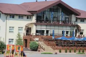
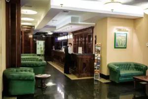
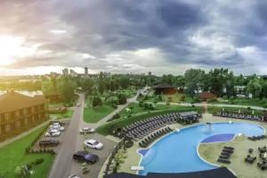
The tender climate, mineral sources, and the curative mud allow opportunities for rest and cure within the region. Here there are 21 health-centers and medicated pensions, 10 rest homes, recreation departments and rest camps for children.
The Dnipropetrovsk Oblast has splendid flora and fauna. Here, there are more than 1700 kinds of vegetation, 7500 kinds of animals (including elk, wild boar, dappled deer, roe, hare, fox, wolf, etc.) There are also 114 park and nature objects, including 15 state reserves; 3 nature memorials, 24 local parks; 7 landscape parks; 3 park tracts, which altogether make up approximately 260 square kilometres.
217 rivers flow within the area, including 55 rivers which are longer than 25 km, the major one being the Dnieper, which crosses through the center of the oblast. Also flowing through the region are three major reservoirs, the Dniprodzerzhynsk, Dnieper and Kakhovka, and the Dnieper-Kryvyi Rih Canal.
Culture
Historically, Dnieper Ukraine comprised territory that roughly corresponded to the area of Ukraine within the expanding Russian Empire. Ukrainians sometimes call it Great Ukraine (Velyka Ukrayina). Historically, this region is tightly entwined with the history of Ukraine and is considered as the heart of the country.
Ukrainian (Middle Dnieprian dialect, 67,0%) and Russian (31,9%) language are both equally used officially, with Russian being more common in cities, while Ukrainian is the dominant language in rural communities. These details result in a significant difference across different survey results, as even a small restating of a question switches responses of a significant group of people. The speaking of Surzhyk instead of Russian or Ukrainian is wide and viewed negatively by nationalist language activists. Because it is neither the one nor the other, they regard Surzhyk as a threat to the uniqueness of Ukrainian culture.
Petrykivsky Painting originates from Petrykivka village. The distinctive features of this handicraft are the patterns, unusual technique and white background. It was included to the UNESCO Representative List of the Intangible Cultural Heritage of Humanity.
People from Dnipropetrovsk Oblast
- Leonid Brezhnev – General Secretary of the Central Committee of the Communist Party of the Soviet Union
- Marharyta Dorozhon – Ukrainian/Israeli Olympic javelin thrower
- Ihor Kolomoyskyi
- Tihon Konstantinov – Moldavian SSR and Moldavian ASSR politician
- Leonid Kuchma – second President of independent Ukraine
- Yulia Tymoshenko – politician and businesswoman
- Pavlo Lazarenko
- Viktor Pinchuk
- Mikhail Nekrich
- Oksana Baiul – figure skater; 1993 World champion and 1994 Olympic champion in ladies' singles
- The Lubavitcher Rebbe – Orthodox rabbi, and third Rebbe (spiritual leader) of the Chabad Lubavitch chasidic movement
- Dmytro Yavornytsky
- Valeriy Lobanovskyi
- Oles Honchar
- Olexander Paul
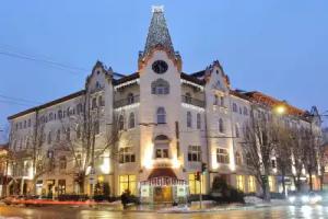
Landmarks
The following historical-cultural sites were nominated to the Seven Wonders of Ukraine.
- Tomb of kosh otaman Sirko
- Troitsk Cathedral
- Church of Virgin Mary Birth
- The walls of Ukrainian defensive line
- Kurgan stelae or Balbals are anthropomorphic stone stelae, images cut from stone, installed atop, within or around kurgans (i.e. tumuli), in kurgan cemeteries, or in a double line extending from a kurgan. The stelae are also described as "obelisks" or "statue menhirs". Spanning more than three millennia, they are clearly the product of various cultures. The earliest are associated with the Pit Grave culture of the Pontic-Caspian steppe (and therefore with the Proto-Indo-Europeans according to the mainstream Kurgan hypothesis). There are Iron Age specimens are identified with the Scythians and medieval examples with Turkic peoples. Such stelae are found in large numbers in Dnipropetrovsk, Kherson and Nikolaev.
- Kodak fortress was a fort built in 1635 by the order of Polish king Władysław IV Vasa and the Sejm over the Dnieper River, near what was to become the town of Stari Kodaky (by modern day: Dnipropetrovsk). It was constructed by Stanisław Koniecpolski to control Cossacks of Zaporizhian Sich, prevent Ukrainian peasants from joining forces with the Cossacks and guard the southeastern corner of the Polish-Lithuanian Commonwealth. The Poles tried to establish order in that area, and commissioned French military cartographer and engineer William le Vasseur de Beauplan to construct it. The fortress cost around 100,000 Polish zlotys. The dragoon garrison was commanded by the French officer Jean de Marion. Soviet government attempted to destroy remnants of fortress in order to eradicate traces of Polish influences on Ukraine by setting quarry on that site in 1944. Quarry was closed in 1994, but to that moment two third of fortress was completely destroyed. Today the site is just ruins, but it is a popular tourist attraction.
- The Saviour's Transfiguration Cathedral (Ukrainian: Спасо-Преображенський кафедральний собор) is the main Orthodox church of Dnipropetrovsk, Ukraine. The foundation stone was laid in 1786 by Catherine II of Russia and Emperor Joseph II. The event is described in the memoirs of comte de Ségur. Prince Grigory Potemkin envisioned the church as one of the spiritual centres of New Russia. Ivan Starov submitted to Potemkin his designs for a Roman-style basilica, but construction was postponed until the end of the Russo-Turkish War.