Pazardzhik Province
Description
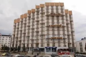
Pazardzhik Province is a province in Southern Bulgaria, named after its administrative and industrial centre - the city of Pazardzhik. The territory is 4,456.9 km that is divided into 12 municipalities with a total population of 275,548 inhabitants, as of February 2011.
History
The territory of the Pazardzhik Province has been inhabited since very early times. There are more than 50 discovered Stone Age and Bronze Age settlements. The earliest civilization to inhabit the region were the Thracians. The remains of the Thracian town Besapara are located in the hills near the provincial capital Pazardzhik. The Panagyurishte Treasure unearthed near the northern town of the same name is known as one of the finest examples of Thracian art. The 6.164 kg of 23-karat gold treasure which consists of nine vessels has been dated back to the 4th and 3rd century BC. In the 1st century BC the region became a Roman province and remained in the Byzantine Empire after the fall of Rome.
Most of the region became part of the Bulgarian Empire in the beginning of the 9th century and remained in Bulgarian hands until the fall of the First Empire. With the rise of the Second Bulgarian Empire the region once again became part of the country until it was overran by the Ottomans in the late 14th century. Some of medieval fortresses are Tsepina near the village of Dorkovo and Krasen in the vicinities of Bata.
The April Uprising of 1876 against the Ottoman rule was widely supported within the region and the town of Panagyurishte became the center of the uprising. The Bulgarian population also rebelled to the south where the Ottoman atrocities culminated in the Batak massacre. According to the Treaty of Berlin after the Liberation of Bulgaria in 1878 the region was included in the autonomous region Eastern Rumelia which united with the Principality of Bulgaria on 6 September 1885.
Geography
The Pazardzhik Province is situated in central part of southern Bulgaria and borders the provinces of Plovdiv, Smolyan, Blagoevgrad and Sofia. The total area of the region is 4,458 km² which is 4% of the national territory. Forests account for more than half of the area (57.1%); the arable land is 35.6%, urban territory is 3.3%, rivers and lakes occupy 2.6%, road infrastructure - 0.6% and quarries and mines - 0,4%.
The northern parts of the region include the middle ridges of the Sredna Gora mountain, to the south the relief flattens and forms the western-most parts of the Upper Thracian Plain and to the south are located the Rhodope Mountains where most of the forests are situated. The highest point of the region is Savov Vrah at an altitude of 2,306 m while the lowest altitude is around 200 m in the plains of the central area. The climate is transcontinental with milder winter than northern Bulgaria in the lowlands but with very low temperatures and high snowfall in the mountain areas. The average annual temperature is 11.3 °C.
The province is abundant in water resources, its main waterway is the river Maritsa and its catchment basin includes the Topolnitsa River and Luda Yana River from the north and Stara Reka from the south. There are three main reservoirs all situated in the Rhodope Mountains within the municipal limits of Batak - Batak Reservoir, Golyam Beglik and Shiroka Polyana. A fourth large dam lake, the Dospat Reservoir is only partially in the region. In Sredna Gora to the north is Topolnitsa Reservoir shared with the Sofia Province and a dam near Panagyurishte which is in initial stages of construction.
Population
The Pazardzhik province had a population of 310,741 (310,723 also given) according to a 2001 census, of which 7001493000000000000♠49.3% were male and 7001507000000000000♠50.7% were female. As of the end of 2009, the population of the province, announced by the Bulgarian National Statistical Institute, numbered 290,614 of which 7001227000000000000♠22.7% are inhabitants aged over 60 years.
Total population (2011 census): 275 548
The following table represents the change of the population in the province after World War II:
Pazardzhik Province Year 1946 1956 1965 1975 1985 1992 2001 2005 2007 2009 2011 Population 247,014 278,777 296,641 314,006 325,971 326,123 310,741 297,781 294,086 290,614 275,548 Sources: National Statistical Institute, „Census 2001“, „Census 2011“, „pop-stat.mashke.org“,??Ethnic groups
Ethnic groups in Pazardzhik Province (2011 census) Ethnic group Percentage Bulgarians 83.8% Gypsies 8.3% Turks 5.7% others and indefinable 2.2%Total population (2011 census): 275 548
Ethnic groups (2011 census): Identified themselves: 246,002 persons:
- Bulgarians: 206 110 (83,78%)
- Gypsies: 20 350 (8,27%)
- Turks: 14 062 (5,72%)
- Others and indefinable: 5 480 (2,23%)
A further 30,000 persons in Pazardzhik Province did not declare their ethnic group at the 2011 census.
Ethnic groups in the province according to 2001 census: 261,260 Bulgarians (7001841009999900000♠84.1%),
23,970 Roma (Gypsy) (7000770000000000000♠7.7%), 20,448 Turks (7000660000000000000♠6.6% )and 5045 others and unspecified (7000160000000000000♠1.6%).
Languages
Mother tongues in the province according to 2001 census: 260,817 Bulgarian (7001839000000000000♠83.9%),
24,204 Roma (Gypsy) (7000780000000000000♠7.8%), 21,902 Turkish (7000700000000000000♠7%) and 3800 others and unspecified (7000120000000000000♠1.2%).
Religion
Religions in Pazardzhik Province (2001 census) Religious group Percentage Orthodox Christian 80.6% Muslim 14.9% Protestant Christian 0.9% Roman Catholic Christian 0.1% others and indefinable 3.4%Religious adherence in the province according to 2001 census:
Census 2001 religious adherence population % Orthodox Christians 250,556 80.64% Muslims 46,338 14.91% Protestants 2,913 0.94% Roman Catholics 260 0.08% Other 1,142 0.37% Religion not mentioned 9,514 3.06% total 310,723 100%Transportation and communications
The road network is not dense. The Trakiya motorway runs through the middle of the region. The main railway between Sofia and Plovdiv also runs through it. There are two other railways: to Panagyurishte and to Peshtera. There are several military airports. As everywhere in Bulgaria, every town and village in the region is provided with electricity, drinking water and telephone network. Each town and some villages are provided with Internet connection, and the cellular phone coverage is almost 100%, as most people own GSMs. Some of the interconnecting roads, especially higher up the mountain, are currently in a very bad state following heavy downpours in 2005 and 2006.