Amur Region
Description
Amur Oblast is a federal subject of Russia (an oblast), located on the banks of the Amur and Zeya Rivers in the Russian Far East. The administrative center of the oblast, the city of Blagoveshchensk, is one of the oldest settlements in the Russian Far East, founded in 1856. It is a traditional center of trade and gold mining. The territory is accessed by two railways: the Trans-Siberian Railway and the Baikal–Amur Mainline. As of the 2010 Census, the oblast's population was 830,103.
Amur Krai (Аму́рский край) or Priamurye (Приаму́рье) were unofficial names for the Russian territories by the Amur River used in the late Russian Empire that approximately correspond to modern Amur Oblast.
Geography
Amur Oblast is located in the southeast of Russia, between Stanovoy Range in the north and the Amur River in the south, and borders with the Sakha Republic in the north, Khabarovsk Krai and the Jewish Autonomous Oblast in the east, the Heilongjiang Province of China in the south, and with Zabaykalsky Krai in the west. The Stanovoy Range forms the dividing line between the Sakha Republic and Amur Oblast and spreads across the oblast's entire northern border. The Amur–Zeya and Zeya–Bureya Plains cover about 40% of the oblast's territory, but the rest is hilly. Several mountain ranges are to the south of Stanovoy Range and parallel to it, and another mountain chain stretches along the oblast's eastern border with Khabarovsk Krai.
Many rivers flow through the oblast, especially in the north, accounting for 75% of the hydropower resources in the Russian Far East. Most of the oblast is in the Amur's drainage basin, although the rivers in the northwest drain into the Lena and the rivers in the northeast drain into the Uda. The longest rivers include the Amur, Bureya, Gilyuy, Nyukzha, Olyokma, Selemdzha, and Zeya. The Zeya begins in the mountains in the northeast, and its middle reaches are dammed to create the huge Zeya Reservoir, which sprawls over 2,400 square km.
Climate is temperate continental, with cold, dry winters and hot, rainy summers. Average January temperatures vary from −24 °C (−11 °F) in the south to −33 °C (−27 °F) in the north. Average July temperatures are +21 °C (70 °F) in the south and +18 °C (64 °F) in the north. Annual precipitation is about 850 millimeters (33 in).
Dwarf Siberian pine and alpine tundra grow at higher elevations and larch forests with small stands of flat-leaved birch and pine forests grow alongside the river plains. These larch and fir-spruce forests form the watershed of the Selemdzha River. The Bureya and Arkhara Rivers, southeast of the Selemdza, have the richest remaining forests in the oblast with Korean pine, Schisandra chinensis, Mongolian Oak, and other Manchurian flora. The Zeya–Bureya Plain, located between the Zeya, Amur, and Bureya Rivers, has the highest biodiversity in Amur Oblast. Much of this plain has been burned for agriculture, but large patches still remain. Japanese Daurian and Far Eastern western cranes nest here, as well as a host of other rare birds.
Natural resources
Amur Oblast has considerable reserves of many types of mineral resources; proven reserves are estimated to be worth US$400 billion. Among the most important are gold (the largest reserves in Russia), silver, titanium, molybdenum, tungsten, copper, and tin. Black coal and lignite reserves are estimated to be seventy billion tons. Probable iron deposits are estimated to be 3.8 billion tons. The Garin deposit is fully explored and known to contain 389 million tons of iron ore. Estimated reserves of the deposit are 1,293 million tons. The deposit's ore contains a low concentration of detrimental impurities; the ore contains 69.9% iron. Amur Oblast is also a promising source of titanium, with the Bolshoy Seyim deposit being the most important.
History
5th–10th centuries
According to the Bei Shi (Dynastic History of Northern Dynasties) and the Sui Shu (Chronicles of the Sui Dynasty), both Chinese records, this area belong originally to the territory one of the five semi-nomadic Shiwei, the Bo Shiwei tribes (Chinese: 钵室韋). Their settlements were located on the north of the Yilehuli Mountains in the upper reaches of the Nen River, south of the Stanovoy Range, west of the Bureinsky and the Malyi Khingan ranges and reaching the Okhotsk Sea on the northeast. They brought tributary presents to the Tang court and disappeared at the dawn of the tenth century with the foundation of the Liao empire.
Medieval period
Later, in the 13th century, the middle-Amur and the Zeya River basin area became the homeland of the Daurs and (further south) the Duchers. The ancestors of the Daurs are thought to be closely related to the Khitans and the Mongols, while the Duchers may have been a branch of the Jurchen people, later known as the Manchus.
17th century-1850s
The area was conquered by the Manchus in 1639-1640, after defeating the Evenk Federation led by Bombogor, it was returned to the Qing Dynasty in the Treaty of Nerchinsk and annexed by Russia in 1858 by the Treaty of Aigun between Russia and Qing Dynasty.
The region received its first influx of Russian settlers in the mid-seventeenth century. They were looking for a more temperate climate as an escape from the north. After the Opium War, when the Chinese Empire was exposed to the outside world, Russian explorers once again moved to the region (mostly Cossacks and peasant farmers). The last influx of people arrived upon the completion of the Trans-Siberian Railroad.
20th century
In April 1920, the Far Eastern Republic, with its capital in Chita, was formed from Amur, Transbaikal, Kamchatka, Sakhalin, and Primorye regions as a democratic "buffer" state in order to avoid war with Japan. It existed until November 1922, when it joined the RSFSR. In January 1926, Amur Region became part of the Far Eastern Territory, which was subsequently divided into Khabarovsk and Primorye territories in 1938. Amur Region itself was included in Khabarovsk Territory.
In 1948, Amur Oblast was finally separated from Khabarovsk Territory and became an independent region of the RSFSR. Rapid economic growth based on gold production began at that time, and living standards improved with the arrival of young specialists. As the Far Eastern District expanded, the demand for services such as electric power and housing also increased, which stimulated a new round of construction projects. New cities were built, along with the Zeya Hydroelectric Power Plant (Zeiskaya GES), which still supplies electricity to most of the Far Eastern District.
Towns

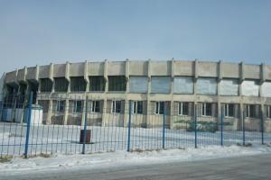
Hotels
All accomodation types
Hotels
 Sportivnaya Hotel
 from 66 USDFortuna Hotel
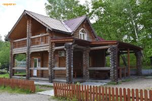 High ratingSemeynyy Berloga Hotel
 Royal Hotel
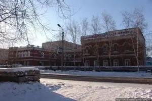 from 10 USDOrbita Hotel
 from 11 USDPremium Hotel
 from 11 USDSelena Hotel
 from 19 USDSputnik Hotel
 from 20 USDVesna Hotel
Apartments
 from 27 USDApartamenty na Ostrovskogo 75/1
Hostels
 from 6 USDBlagCity hotel & hostel
 from 10 USDLaki Star Hostel
 from 11 USDNa Naberezhnoy Hostel
 from 11 USDApartments Marina Islands
 from 12 USDTsentr Hostel
 from 19 USDHostel "zhivi I Puteshestvuj" Na Kalinina
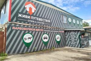 High ratingfrom 18 USDZhivi i Puteshestvuy Hostel