Belgorod Region
Description
Belgorod Oblast is a federal subject of Russia . Its administrative center is the city of Belgorod. Population: 1,532,526 (2010 Census results).
History
Map of Belgorod Governorate (1745)At the turn of the 17th century, a solid line of military fortifications was built in the area, stretching for almost 800 km. Ukrainian Cossacks, who moved here because of the nobility and the tax burden, were in charge of the line defenses. Even more Cossacks moved to the area during the Khmelnytsky Uprising (1648–1657) and the internecine wars in the Cossack Hetmanate (1659–1679). Belgorod became the military and administrative center, after originating as an outpost on the southern borders of Russia.
Following the Battle of Poltava, Peter I granted to soldiers of Greater Belgorod the regiment flag.
From 1708 to 1727, the territory of the modern Belgorod Oblast was part of Kiev and Azov Governorates. In 1727, Belgorod Governorate was established from parts of Kiev Governorate. The governorate lasted until 1779. This territory was much greater than that of today, and the governorate incorporated territories of modern Kursk, Oryol, and parts of Bryansk and Kharkiv Oblasts. The coat of arms of the then-Governorate is still used by the modern Belgorod Oblast.
In 1775–1779, the territory of Belgorod Governorate was abolished and divided between the newly formed governorates and vice-royalties. The city of Belgorod and the area around it became a part of Kursk Vice-Royalty, while the southeastern uyezds became a part of Voronezh Governorate.
Nikolo-Tikhvinsky Monastery in 1900During the 19th century and up until 1928 the territory of modern Belgorod Oblast remained part of Kursk and Voronezh Governorates. After the signing of the Treaty of Brest-Litovsk in April 1918, in January 1919 the territory was incorporated into the Ukrainian State under hetman Pavlo Skoropadskyi.
The current administrative-territorial boundaries of Belgorod Oblast were formed by the Decree of the Presidium of the Supreme Soviet of the USSR on January 6, 1954. The oblast was formed from several districts of Kursk and Voronezh Oblasts.
For the courage and resilience shown by the people of Belgorod Oblast in defense of the Motherland during the Great Patriotic War, and for progress in reconstruction and development of national economy, on January 4, 1967 Belgorod Oblast was awarded the Order of Lenin, and in 1980 the city of Belgorod was awarded the Order of the Patriotic War, first degree.
In 2007, the city of Belgorod received the honorary title of the City of Military Glory.
Geography
Belgorod Oblast is part of the Central Black Earth economic region and the Central Federal District. It borders with Luhansk, Kharkiv, and Sumy Oblasts of Ukraine in the south and west, Kursk Oblast in the north and northwest, and Voronezh Oblast in the east. The total length of its borders is about 1,150 km, of which 540 km are on the border with Ukraine.
The area of the oblast is 27,100 square km; the oblast stretches for about 190 km from north to south and for about 270 km from east to west. The oblast is located in the southwestern and southern slopes of the Russian Upland in the Dnieper and Don River basins, in the steppe zone of elevated hilly plain with an average height of 200 meters (660 ft) above the sea level. The highest point is 277 meters (909 ft) above sea level, in Prokhorovsky District. The lowest point is located at the bottom of the Oskol and Seversky Donets River valleys.
Natural resources
Over 40% of known iron ore reserves of Russia are concentrated in the oblast. Deposits are confined to the Kursk Magnetic Anomaly area. Among them are Korobkovsky, Lebedinskoye, Stoylenskoye, and prospective Prioskolskoye iron ore deposits in Stary Oskol District, Bolshetroitskoye in Shebekinsky District, as well as Yakovlevskoye and Pogremetskoye fields.
Identified and explored in varying degrees are the large deposits of bauxites, apatites, underground mineral waters, and numerous deposits of construction materials such as chalk, sand, clay, and more. There are also known occurrences of gold, graphite, and other rare metals. Geographical features make the oblast likely to have deposits of platinum, hydrocarbons, and other minerals.
Hydrography
Rivers, lakes, and marshes occupy about 1% of the oblast's territory. There are more than 480 small rivers and streams. The largest of them are in the northwest — the Seversky Donets, Vorskla, Vorsklitsa, Psyol, and in the eastern regions — the Oskol, Tikhaya Sosna, Chyornaya Kalitva, Valuy. The total length of the river network is roughly 5,000 km, and in addition, there are 1,100 ponds and four artificial reservoirs.
Wildlife
The fauna of Belgorod Oblast is predominantly of the meadow-steppe variety and comprises, by various estimates, from ten to fifteen thousand species.
About 10% of the animal species are in need of special protection. Fifty species are included in the IUCN Red List. There are about 279 species of birds, including 152 which breed in the oblast. The richest bird populations include sparrows (111 species); waders (45 species); geese (up to 30 species); day predators (21 species). The richest bird populations include sparrows (111 species); waders (45 species); geese (up to 30 species); day predators (21 species). The numbers of game animal species are as follows: moose – 387; deer – 501; roe deer – 4474; boar – 2574; hare – 18361; fox – 3856; marten – 2025; polecat – 1120; wolf – 36. The annual number of game animals remains stable.
Vegetation
Vegetation in Belgorod Oblast reflects the features of the northern forest-steppe, characterized by the alternation of forests with the meadow steppes. It is chiefly represented by two types of vegetation — the zonal and extrazonal. In all, there are 1,284 flora species. Woodlands cover 9.8% of the total area, of which over 800 hectares are classified as protected areas because their rare species of plants and habitats of animals are on the IUCN red list.
Transport
Left: Belgorod International Airport. Right: Belgorod Train Station.Important railways and highways of regional significance cross the oblast's territory, connecting Moscow with the southern and western regions of Russia and Ukraine. Of major importance is the Crimea Highway, or federal highway M-2 Crimea, and the Moscow-Kharkiv-Sevastopol railway line. The length of railways for general use is 694.6 km; the length of paved roads is 8,500 km; roughly 87% of the total road surface in the oblast.
Towns

All accomodation types
Hotels
 Michurinskiy Hotel
 Karat Hotel
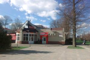 Emelya Hotel
 High ratingParadiz Hotel
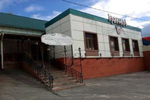 Novaya legenda Hotel
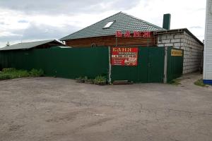 Banya Ideal Hotel
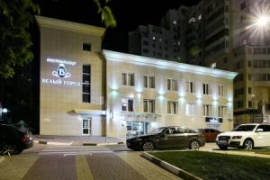 Bely Gorod
 from 10 USDBonotel Hotel

Apartments
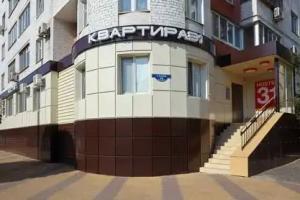 from 10 USDKvartira 31 ZhD Hostel
Hostels
 Hostel Barack
 Hostel Parkoviy
 from 6 USDTsentrHostel
 High ratingfrom 8 USDHostel Kak v Evrope
 from 9 USDLoft Hostel
 FullHouse Hostel