Crimea
Description
The Crimean Peninsula , also known simply as Crimea, is a major land mass on the northern coast of the Black Sea that is almost completely surrounded by water. The peninsula is located south of the Ukrainian region of Kherson and west of the Russian region of Kuban. It is surrounded by two seas: the Black Sea and the smaller Sea of Azov to the northeast. It is connected to Kherson by the Isthmus of Perekop and is separated from Kuban by the Strait of Kerch. The Arabat Spit is located to the northeast; a narrow strip of land that separates a system of lagoons named Sivash from the Sea of Azov.
Crimea—or the Tauric Peninsula, as it was formerly known—has historically been at the boundary between the classical world and the Pontic–Caspian steppe. Its southern fringe was colonised by the ancient Greeks, the ancient Persians, the ancient Romans, the Byzantine Empire, the Genoese and the Ottoman Empire, while at the same time its interior was occupied by a changing cast of invading steppe nomads, such as the Cimmerians, Scythians, Sarmatians, Goths, Alans, Bulgars, Huns, Khazars, Kipchaks, and the Golden Horde. Crimea and adjacent territories were united in the Crimean Khanate during the 15th to 18th century before falling to the Russian Empire and being included into the Russian Taurida Governorate in 1802.
After the Russian Revolution of 1917, Crimea became a republic within the Russian Soviet Federative Socialist Republic in the USSR. In World War Two it was downgraded to the Crimean Oblast, and in 1954, the Crimean Oblast was transferred to the Ukrainian Soviet Socialist Republic. It became the Autonomous Republic of Crimea within newly independent Ukraine in 1991, with Sevastopol having its own administration, within Ukraine but outside of the Autonomous Republic. Sovereignty and control of the peninsula became the subject of an ongoing territorial dispute between Russia and Ukraine, with Russia signing a treaty of accession in March 2014 with the self-declared independent Republic of Crimea, absorbing it into the Russian Federation, though this is not recognised by Ukraine or most of the international community.
Name
The classical name Tauris or Taurica is from the Greek Ταυρική, after the peninsula's Scytho-Cimmerian inhabitants, the Tauri. Strabo and Ptolemy refer to the Strait of Kerch as the Bosporus Cimmerius, and to Cimmerium as the capital of the Taurida, whence the peninsula, or its easternmost part, was also named Promontorium Cimmerium.
In English, the Crimean Khanate is referred to as Crim Tartary in the early modern period. The Italian form Crimea (and "Crimean peninsula") also becomes current during the 18th century, gradually replacing the classical name of Tauric peninsula in the course of the 19th century. The omission of the definite article in English ("Crimea" rather than "the Crimea") becomes common during the later 20th century.
The name "Crimea" ultimately, via Italian, takes its origin with the name of Qırım (today's Stary Krym) which served as a capital of the Crimean province of the Golden Horde. The name of the capital was extended to the entire peninsula at some point during Ottoman suzerainty. The origin of the name Qırım itself is uncertain. It is mostly explained as:
- a corruption of Cimmerium.
- a derivation from the Greek Cremni (κρήμνοι kremnoi "cliffs", mentioned in Herodotus 4.20).
- a derivation from the Mongolian appellation kerm designating "wall", which, however, is phonetically incompatible with the original Mongolian literal appellation of the Crimean peninsula Qaram,
- a derivation from the Crimean Tatar Turkic appellation Qırım designating "fortress" or "fosse", from the Turkic term qurum ("defence, protection"), qurimaq ("to fence, protect").
The classical name was revived in the name of the Russian Taurida Governorate. While it was abandoned in the Soviet Union, and has had no official status since 1921, it is still used by some institutions in Crimea, such as the Taurida National University, or the Tavriya Simferopol football club.
History
Ruins of ancient Greek colony of Chersonesos
In ancient times, it was the home of Cimmerians and Scythians, as well as the site of Greek colonies. The most important city was Chersonesos at the edge of today's Sevastopol.
Later occupiers included the Romans, Goths, Huns, Bulgars, Khazars, the state of Kievan Rus', the Byzantine Empire, the Kipchaks, and the Golden Horde. In the 13th century CE, portions were controlled by the Republic of Venice and by the Republic of Genoa.
In the 9th century CE, Byzantium established the Cherson theme to fend against incursions by the Rus' Khaganate, and the Crimean peninsula from this time was contested between Byzantium, Rus' and Khazaria. The area remained the site of overlapping interests and contact between the early medieval Slavic, Turkic and Greek spheres, and became a center of slave trade, Slavs were sold to Byzantium and other places in Anatolia and the Middle-East during this period. In the 1230s, this status quo was swept away by the Mongol invasions, and Crimea was incorporated into the territory of the Golden Horde throughout the 14th century CE.
The Crimean Khanate, a vassal state of the Ottoman Empire, succeeded the Golden Horde and lasted from 1449 to 1779 In 1571, the Crimean Tatars attacked and sacked Moscow, burning everything but the Kremlin. Until the late 18th century, Crimean Tatars maintained a massive slave trade with the Ottoman Empire, exporting about 2 million slaves from Russia and Ukraine over the period 1500–1700.
Russian control 1783–1954
In 1774, the Khanate was proclaimed independent under the Treaty of Küçük Kaynarca, and was then annexed by Russia in 1783.
From 1853 to 1856, the peninsula was the site of the principal engagements of the Crimean War, a conflict fought between the Russian Empire and an alliance of France, Britain, the Ottoman Empire and Sardinia.
During the Russian Civil War Crimea was controlled by the White Army, under the command of Pyotr Nikolayevich Wrangel, before remnants were driven out by the Red Army in November 1920. Crimea became part of the Russian Soviet Federative Socialist Republic in 1921 as the Crimean Autonomous Soviet Socialist Republic, which became part of the Soviet Union in 1922.
During the Second World War the peninsula was invaded by Nazi Germany in summer 1941 across the Isthmus of Perekop. Following the capture of Sevastopol on 4 July 1942, the Crimea was occupied until German forces were expelled in an offensive by Soviet forces ending in May 1944. After Crimea was liberated, it was downgraded to the Crimean Oblast and the Crimean Tatars were deported for alleged collaboration with the Nazi forces. A total of more than 230,000 people were deported, mostly to Uzbekistan, at the time about a fifth of the total population of the Crimean Peninsula.
Ukrainian control 1954–2014
In 1954, by an internal political action by Communist Party General Secretary Nikita Khrushchev, it became a territory of the Ukrainian Soviet Socialist Republic within the Soviet Union.
In January 1991, a referendum was held in the Crimean Oblast, and voters approved restoring the Crimean Autonomous Soviet Socialist Republic. However, after the dissolution of the Soviet Union less than a year later, the Autonomous Republic of Crimea was formed as a constituent entity of independent Ukraine, with a majority of Crimean voters approving Ukrainian independence in a December referendum. On 5 May 1992, the Crimean legislature declared conditional independence, but a referendum to confirm the decision was never held amid opposition from Kiev. The Verkhovna Rada voted to grant Crimea "extensive home rule" during the dispute.
2014 Russian annexation and aftermath
As a result of the 2014 Ukrainian revolution and subsequent annexation of Crimea by the Russian Federation, the sovereignty over the peninsula is currently disputed between Ukraine and the Russian Federation.
Immediately after the flight of former Ukrainian President Viktor Yanukovych from Kiev on 21 February 2014, planning began in the Kremlin to take control of Crimea. Within days, unmarked Russian forces took over the Autonomous Republic of Crimea and Sevastopol, also occupying several localities in Kherson Oblast on the Arabat Spit, which is geographically a part of Crimea. Following a controversial referendum that purported to show majority support for joining Russia, Russian President Vladimir Putin signed a treaty of accession with the self-declared independent Republic of Crimea, absorbing it into the Russian Federation, though the annexation was not recognised by Ukraine or most of the international community. The United Nations General Assembly adopted a non-binding resolution calling upon states not to recognise changes to the integrity of Ukraine. Russia withdrew its forces from southern Kherson in December 2014 The peninsula is now controlled by Russia, which administers it as two federal subjects: the Republic of Crimea and the federal city of Sevastopol. Ukraine now effectively only controls the northern areas of the Arabat Spit and Syvash Sea.
Geography
Covering an area of 27,000 km2 (10,425 sq mi), Crimea is located on the northern coast of the Black Sea and on the western coast of the Sea of Azov, the only land border is shared with Ukraine's Kherson Oblast from the north.
The natural border between the Crimean Peninsula and the Ukrainian mainland is formed by the Sivash or "Rotten Sea", a large system of shallow lagoons. The peninsula is connected to the Kherson Oblast's Henichesk Raion, and thus the European mainland, via the Isthmus of Perekop, a strip of land about 5–7 kilometres (3.1–4.3 mi) wide, as well as by bridges over the narrow Chongar and Henichesk straits. The northern part of Arabat Spit is administratively part of Henichesk Raion in Kherson Oblast, including its two rural communities of Shchaslyvtseve and Strilkove. The eastern tip of the peninsula is the Kerch Peninsula, separated from Taman Peninsula on the Russian mainland by the Kerch Strait, which connects the Black Sea with the Sea of Azov, at a width of between 3–13 kilometres (1.9–8.1 mi).
Geographically, the peninsula is generally divided into three zones: steppe, mountains and southern coast.
Coastline
The Crimean peninsula comprises many smaller peninsulas, such as the mentioned Kerch peninsula, Heracles Peninsula, Tarhankut Peninsula and many others. Crimea also possesses lots of headlands such as Cape Priboiny, Cape Tarkhankut, Sarych, Cape Fonar, Kazantyp, Cape Akburun, and many others.
The Crimean coastline is broken by several bays and harbors. These harbors lie west of the Isthmus of Perekop by the Bay of Karkinit; on the southwest by the open Bay of Kalamita between the port cities of Eupatoria and Sevastopol.
The Kerch Peninsula is attached to the Crimean mainland by Isthmus of Yenikale, delimited by the Bay of Arabat to the north (interrputed by the incoming Arabat Spit), and the Bay of Caffa to the south (arching eastward from the port of Feodosiya).
Crimean Mountains
The southeast coast is flanked at a distance of 8–12 kilometres (5.0–7.5 mi) from the sea by a parallel range of mountains, the Crimean Mountains. These mountains are backed by secondary parallel ranges.
The main range of these mountains shoots up with extraordinary abruptness from the deep floor of the Black Sea to an altitude of 600–1,545 metres (1,969–5,069 ft), beginning at the southwest point of the peninsula, called Cape Fiolente. It was believed that this cape was supposedly crowned with the temple of Artemis, where Iphigeneia is said to have officiated as priestess. Uchan-su waterfall on the south slope of the mountains is the highest in Ukraine.
Steppe
Seventy-five percent of the remaining area of Crimea consists of semiarid prairie lands, a southward continuation of the Pontic-Caspian steppe, which slope gently to the northwest from the foot of the Crimean Mountains. Numerous kurgans, or burial mounds, of the ancient Scythians are scattered across the Crimean steppes.
Crimean Riviera
The terrain that lies beyond the sheltering Crimean Mountain range is of an altogether different character. Here, the narrow strip of coast and the slopes of the mountains are smothered with greenery. This "riviera" stretches along the southeast coast from capes Fiolente and Aya, in the south, to Feodosiya, and is studded with summer sea-bathing resorts such as Alupka, Yalta, Gurzuf, Alushta, Sudak, and Feodosiya. During the years of Soviet rule, the resorts and dachas of this coast served as the prime perquisites of the politically loyal.why here? and ref? In addition, vineyards and fruit orchards are located in the region. Fishing, mining, and the production of essential oils are also important. Numerous Crimean Tatar villages, mosques, monasteries, and palaces of the Russian imperial family and nobles are found here, as well as picturesque ancient Greek and medieval castles.
The Crimean Mountains and the southern coast are part of the Crimean Submediterranean forest complex ecoregion. The natural vegetation consists of scrublands, woodlands, and forests, with a climate and vegetation similar to the Mediterranean Basin.
Strategic value
The Black Sea ports of Crimea provide quick access to the Eastern Mediterranean, Balkans and Middle East. Historically, possession of the southern coast of Crimea was sought after by most empires of the greater region since antiquity (Roman, Byzantine, Ottoman, Russian, British and French, Nazi German, Soviet).
The Dnieper River is a major waterway and transportation route that crosses the European continent from north to south and ultimately links the Black Sea with the Baltic Sea, of strategic importance since the historical trade route from the Varangians to the Greeks. The Black Sea serves as an economic thoroughfare connecting the Caucasus region and the Caspian Sea to central and Eastern Europe.
According to the International Transport Workers' Federation, in 2013 there were at least 12 operating merchant seaports in Crimea.
Within 200 nautical miles of the Crimean shoreline there are an estimated 45 trillion cubic meters of gas reserves. Hydrocarbons in the Black Sea shelf could yield as much as 1.5 billion cubic meters per year.
Economy
The main branches of the modern Crimean economy are tourism and agriculture. Industrial plants are situated for the most part in the northern regions of the republic. Important industrial cities include Dzhankoy, housing a major railway connection, Krasnoperekopsk and Armyansk, among others.
The most important industries in Crimea include food production, chemical fields, mechanical engineering and metal working, and fuel production industries. Sixty percent of the industry market belongs to food production. There are a total of 291 large industrial enterprises and 1002 small business enterprises.
Agriculture in the region includes cereals, vegetable-growing, gardening, and wine-making, particularly in the Yalta and Massandra regions. Livestock production includes cattle breeding, poultry keeping, and sheep breeding. Other products produced on the Crimean Peninsula include salt, porphyry, limestone, and ironstone (found around Kerch) since ancient times.
In 2014, the republic's annual GDP was $4.3 billion (500 times smaller than the size of Russia's economy). The average salary was $290 per month. The budget deficit was $1 billion. Crimea expects until 2017/2018 in Russian investment amount of $5 billion.
Energy
Crimea also possesses several natural gas fields both onshore and offshore, which were starting to be drilled by western oil and gas companies before annexation. The inland fields are located in Chornomorske and Dzhankoy, while offshore fields are located in the western coast in the Black Sea and in the northeastern coast in the Azov Sea:
Name Type Location Reserves Dzhankoyske gas field onshore Dzhankoy Golitsyna gas field offshore Black Sea Karlavske gas field onshore Chornomorske Krym gas field offshore Black Sea Odessa gas field offshore Black Sea 21 billion m3 Schmidta gas field offshore Black Sea Shtormvaya gas field offshore Black Sea Strilkove gas field offshore Sea of Azov
The republic also possesses two oil fields: one onshore, the Serebryankse oil field in Rozdolne, and one offshore, the Subbotina oil field in the Black Sea.
Infrastructure
Trolleybus near Alushta The cableway in Yalta Public transportation
Almost every settlement in Crimea is connected with another settlement by bus lines. Crimea contains the longest (96 km or 59 mi) trolleybus route in the world, stretching from Simferopol to Yalta. The trolleybus line starts near Simferopol's Railway Station (at Soviet age start near Simferopol International Airport) through the mountains to Alushta and on to Yalta. The length of line is about 90 km. It was founded in 1959.
Railroad lines running through Crimea include Armyansk—Kerch (with a link to Feodosiya), and Melitopol—Sevastopol (with a link to Yevpatoria), connecting Crimea to the Ukrainian mainland.
Sea transport
The cities of Yalta, Feodosiya, Kerch, Sevastopol, Chornomorske and Yevpatoria are connected to one another by sea routes. In the cities of Yevpatoria and nearby townlet Molochnoye are tram systems.
Tourism
The development of Crimea as a holiday destination began in the second half of the 19th century. The development of the transport networks brought masses of tourists from central parts of the Russian Empire. At the beginning of the 20th century, a major development of palaces, villas, and dachas began—most of which remain. These are some of the main attractions of Crimea as a tourist destination. There are many Crimean legends about famous touristic places, which attract the attention of tourists.
A new phase of tourist development began when the Soviet government realised the potential of the healing quality of the local air, lakes and therapeutic muds. It became a "health" destination for Soviet workers, and hundreds of thousands of Soviet tourists visited Crimea.
Artek is a former Young Pioneer camp on the Black Sea in the town of Hurzuf, near Ayu-Dag, established in 1925. In 1969 it had an area of 3.2 km². The camp consisted of 150 buildings Unlike most of the young pioneer camps, Artek was an all-year camp, due to the warm climate. Artek was considered to be a privilege for Soviet children during its existence, as well as for children from other communist countries. During its heyday, 27,000 children a year vacationed at Artek. Between 1925 and 1969 the camp hosted 300,000 children. After the breaking up of the Young Pioneers in 1991 its prestige declined, though it remained a popular vacation destination.
In the 1990s, Crimea became more of a get-away destination than a "health-improvement" destination. The most visited areas are the south shore of Crimea with cities of Yalta and Alushta, the western shore - Eupatoria and Saki, and the south-eastern shore - Feodosia and Sudak. According to National Geographic, Crimea was among the top 20 travel destinations in 2013.
Crimea possesses significant historical and natural resources and is a region where it is possible to find practically any type of landscape; mountain ranges and plateaus, grasslands, caves. Furthermore, Saki poses unique therapeutic mud and Eupatoria has vast empty beaches with the purest sand.
Places of interest include
- Koktebel
- Livadia Palace
- Mount Mithridat
- Scythian Treasure
- Swallow's Nest
- Tauric Chersonesos
- Vorontsov Palace
- Bakhchisaray Palace
- Massandra Palace and Winery
- Novyi Svit
- Nikitsky Botanical Garden
- Aivazovsky National Art Gallery in Feodosia
- Naval museum complex Balaklava
Sanctions
Following Russia's unrecognized annexation of Crimea, the European Union, the United States, Canada, Australia, Japan, and several other countries (including Ukraine) imposed economic sanctions against Russia, including some specifically targeting Crimea. Many of these sanctions were directed at individuals—both Russian and Crimean.
The European Union, the United States, Canada, Australia, and several countries aspiring to European Union membership have imposed economic sanctions directly against Crimea and Crimean individuals. In general they prohibit the sale, supply, transfer, or export of goods and technology in several sectors, including services directly related to tourism and infrastructure. They list seven ports where cruise ships cannot dock. Sanctions against individuals include travel bans and asset freezes. Since December 2014, Visa and MasterCard have stopped service in Crimea.
Culture
Ivan Aivazovsky, the 19th-century marine painter of Armenian origin, who is considered one of the major artists of his era was born in Feodosia and lived there for the most part of his life. Many of his paintings depict the Black Sea. He also created battle paintings during the Crimean War.
Almost 100 broadcasters and around 1,200 publications are registered in Crimea, although no more than a few dozen operate or publish regularly. Of them most use the Russian language only. Crimea's first Tatar-owned, Tatar-language TV launched in 2006.
Crimea was the background for Adam Mickiewicz's seminal work, The Crimean Sonnets. A series of 18 sonnets constitute an artistic telling of a journey through the Crimea, they feature romantic descriptions of the oriental nature and culture of the East which show the despair of an exile longing for the homeland, driven from his home by a violent enemy.
-
Painting of the Russian squadron in Sevastopol by Ivan Aivazovsky (1846)
-
The grave of Russian poet and artist Maximilian Voloshin
-
People at the Kazantip music festival in 2007
Towns


All accomodation types
Hotels
 Solnechnaya Dacha Hotel
 S. Dali Hotel
 Piligrim Hotel
 Dacha Podgornaya Hotel
 U Tamary Hotel
 Teplo Feodosii Hotel
 Krym-sport Hotel
 Kalipso Hotel
 High ratingDzhango-haus Hotel
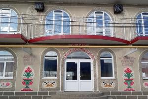 Ali-Baba Hotel
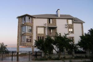 Angelina Hotel
Hostels
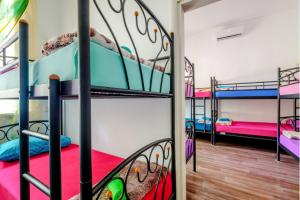 Хостел Марракеш
 Filin Hostel