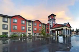
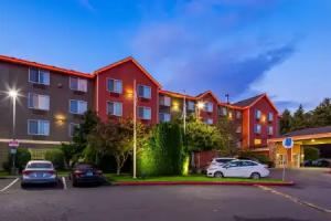
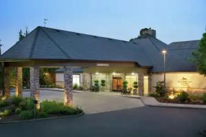
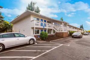
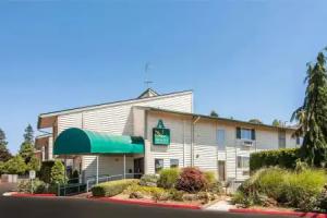
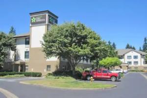
Vancouver
Description
Vancouver is a city on the north bank of the Columbia River in the U.S. State of Washington. Incorporated in 1857, it is the fourth-largest city in the state, with a population of 161,791 as of April 1, 2010 census. Vancouver is the county seat of Clark County and forms part of the Portland-Vancouver metropolitan area, the 23rd-largest metropolitan area in the United States. Originally established in 1825 around Fort Vancouver, a fur trading outpost, the city is located on the Washington-Oregon border along the Columbia River, directly north of Portland. In 2005, Money magazine named it No. 91 on its list of best places in America to live. In 2015, WalletHub ranks Vancouver the 60th best place to live for families in US.
Etymology
Vancouver shares its name with the larger city of Vancouver in southern British Columbia, Canada, approximately 300 mi (480 km) to the north. Both cities were named after sea captain George Vancouver, but the American city is older; Vancouver, B.C. was incorporated 29 years after the incorporation of Vancouver, Washington and more than 60 years after the name Vancouver was first used in reference to the historic Fort Vancouver trading post on the Columbia River. City officials have periodically suggested changing the U.S. city's name to Fort Vancouver to reduce confusion with its larger and better-known northern neighbor. Many Pacific Northwest residents distinguish between the two cities by referring to the Canadian city as "Vancouver, B.C." and the United States city as "Vancouver, Washington," or "Vancouver, USA." Local nicknames include: "Vantucky" (though the nickname is often used as a derogatory term)" and "The 'Couv(e)". In 2013, the nickname "Vansterdam" surfaced as a result of the legalization of marijuana in the state of Washington. This nickname has also long been used to refer to Vancouver, B.C., as well. This name is a clear reference to the cannabis-legal city of Amsterdam in the Netherlands.
History
The Vancouver, Washington, area was inhabited by a variety of Native American tribes, most recently the Chinook and Klickitat nations, with permanent settlements of timber longhouses. The Chinookan and Klickitat names for the area were reportedly Skit-so-to-ho and Ala-si-kas, respectively, meaning "land of the mud-turtles." First European contact was made in 1775, with approximately half of the indigenous population dead from smallpox before the Lewis and Clark expedition camped in the area in 1806. Within another fifty years, other actions and diseases such as measles, malaria and influenza had reduced the Chinookan population from an estimated 80,000 "to a few dozen refugees, landless, slaveless and swindled out of a treaty."
Meriwether Lewis wrote that the Vancouver area was "the only desired situation for settlement west of the Rocky Mountains." The first permanent European settlement did not occur until 1824, when Fort Vancouver was established as a fur trading post of the Hudson's Bay Company. From that time on, the area was settled by both the US and Britain under a "joint occupation" agreement. Joint occupation led to the Oregon boundary dispute and ended on June 15, 1846, with the signing of the Oregon Treaty, which gave the United States full control of the area. Before 1845, American Henry Williamson laid out a large claim west of the Hudson's Bay Company (including part of the present-day Port of Vancouver), called Vancouver City and properly registered his claim at the U.S. courthouse in Oregon City, before leaving for California. In 1850, Amos Short traced over the claim of Williamson and named the town Columbia City. It changed to Vancouver in 1855. The City of Vancouver was incorporated on January 23, 1857.
Based on an act in the 1859–60 legislature, Vancouver was briefly the capital of Washington Territory, before capital status was returned to Olympia, Washington by a 2–1 ruling of the territory's supreme court, in accordance with Isaac Stevens' preference and concern that proximity to border with Oregon might give some of the state's influence away to Oregon.
U.S. Army Captain (and future President) Ulysses S. Grant was quartermaster at what was then known as Columbia Barracks for 15 months beginning in September 1852. Soon after leaving Vancouver, he resigned from the army and did not serve again until the outbreak of the American Civil War. Other notable generals to have served in Vancouver include George B. McClellan, Philip Sheridan, Oliver O. Howard and 1953 Nobel Peace Prize recipient George Marshall.
Army presence in Vancouver was very strong, as the Department of the Columbia built and moved to Vancouver Barracks, the military reservation for which stretched from the river to what is currently Fourth Plain Boulevard and was the largest Army base in the region until surpassed by Fort Lewis, 120 miles (190 km) to the north. Built on the old company gardens and skirmish range, Pearson Army Field (later Pearson Field) was a key facility, and at one point the US Army Signal Corps operated the largest spruce cut-up plant in the world to provide much-needed wood for airplanes. Vancouver became the end point for two ultra-long flights from Moscow, USSR over the North Pole. The first of these flights was performed by Valery Chkalov in 1937 on a Tupolev ANT-25RD airplane. Chkalov was originally scheduled to land at an airstrip in nearby Portland, Oregon, but redirected at the last minute to Vancouver's Pearson Airfield. Today there is a street named for him in Vancouver. In 1975 an obelisk was erected at Pearson Field commemorating this event.
Separated from Oregon until 1917, when the Interstate Bridge began to replace ferries, Vancouver had three shipyards just downstream which produced ships for World War I before World War II brought an enormous economic boom. An Alcoa aluminum plant opened on September 2, 1940, using inexpensive power from the nearby New Deal hydropower turbines at Bonneville Dam. After the bombing of Pearl Harbor, Henry Kaiser opened a shipyard next to the U.S. Army base, which by 1944 employed as many as 36,000 people in a twenty-four hours a day, seven days a week production of liberty ships, LST's, and "baby flat tops." This influx of shipyard workers boosted the population from 18,000 to over 80,000 in just a few months, leading to the creation of the Vancouver Housing Authority and six new residential developments: Fruit Valley, Fourth Plain Village, Bagley Downs, Ogden Meadows, Burton Homes and McLoughlin Heights. Each of these was later incorporated into the city, and are well-known neighborhoods, while the neighboring "shipyard city" of Vanport, Oregon, would be destroyed by the Memorial Day flood of 1948.
Vancouver has recently experienced conflicts with other Clark County communities because of rapid growth in the area. The city's first annexation more than doubled its size in 1909, with the largest annexation of 1997 adding 11,258 acres (45.56 km2) and 58,171 residents. As a result of urban growth and the 1997 annexation, Vancouver is often thought of as split between two areas, East and West Vancouver, divided by NE Andresen Road. West Vancouver is home to downtown Vancouver and some of the more historical parts of the city, as well as recent high-density mixed-use development.
More than one-third of the Vancouver urban area's population lives in unincorporated urban area north of the city limits, including the communities of Hazel Dell, Felida, Orchards and Salmon Creek. If county leaders had approved a major annexation plan in 2006, Vancouver would have passed Tacoma and Spokane to become the state's second-largest city.
Geography and climate
Vancouver is located just north of the Columbia River, just west of where the Columbia River Gorge bisects the volcanic Cascade Range and just east of where the Willamette River enters the Columbia. The city of Vancouver is in the Western Lowlands region of Washington. When clouds do not blanket the Puget-Willamette trough formed by the Cascade and Coast Range, Mount Hood, Mount Saint Helens, Mount Jefferson and Mount Adams are all visible from Vancouver.
According to the United States Census Bureau, the city has a total area of 49.86 square miles (129.14 km2), of which, 46.46 square miles (120.33 km2) is land and 3.40 square miles (8.81 km2) is water.
Vancouver lies just north of Portland, Oregon and shares a similar climate. Both are classified as dry-summer subtropical (Csb) on the Köppen climate classification, with certain key exceptions. High pressures east of the Cascade Range create something of a venturi effect, leading to cold east winds down the Columbia River Gorge. Unsheltered by the Willamette Valley, Vancouver has historically seen colder temperatures, including "silver thaw" storms where freezing rain cakes limbs and power lines. Such storms can paralyze Vancouver. This occasionally freezes the river, and in 1916 cut electric power in the city for almost two weeks. Rainfall occurs frequently throughout the fall, winter, and spring, but ceases around the middle of June, with dry and warm weather lasting through September. Average annual precipitation is 42 inches (1,100 mm). Heavy snowfalls are infrequent and snow often falls and doesn't stick, with major snowstorms only occurring every 2–4 years. Close proximity to the river was also a concern for flooding, before dams constricted the river, destroying features such as Celilo Falls. Periodic floods have been a nuisance, with two of the most destructive in June 1894 and May, 1948. The 1948 Memorial Day flood almost topped the Interstate Bridge's support piers and completely destroyed nearby Vanport, Oregon. Other unusual storms include the Columbus Day windstorm of 1962 and an April 5, 1972 tornado which rated F3 on the Fujita scale, striking a local school. A F1 tornado struck on January 10, 2008 just after noon causing moderate damage along a 2-mile (3.2 km) path from Vancouver Lake to the unincorporated Hazel Dell area.
Because many Vancouver residents work in Portland, there is typically significant rush hour traffic congestion on two bridges that cross the Columbia River — the Interstate Bridge and the Glenn Jackson Bridge. In 2006 there were 278,043 weekday vehicle crossings on the two bridges.
Architecture and notable buildings
Evergreen Hotel Smith Tower Elks Building Heritage Building House of Providence U.S. National Bank BuildingMother Joseph was one of the first architects in the region, and because of its relatively long history, Vancouver contains a variety of buildings. Homes vary from Victorians and craftsman bungalows downtown, to small wartime tract housing and ranch-styles mid-town, with rural styles and larger homes in the outer ring. In addition to the reconstructed Fort Vancouver at the Fort Vancouver National Historic Site, the city was named one of the National Register of Historic Places' "Dozen Distinctive Destinations" for 2003.
Other notable buildings in Vancouver include:
- The Covington House at 4201 Main Street, a log cabin and boarding school built 1846-1848.
- Officers Row, including The Grant House (first house on the Columbia Barracks) and the Queen Anne-style 1866 Marshall House
- Mother Joseph's Providence Academy, dedicated in 1873, where Evergreen Boulevard crosses Interstate 5
- St. James Catholic Church (originally St. James Cathedral), saw its first Roman Catholic mass celebrated August 16, 1885
- The Carnegie library at Sixteenth and Main, which opened on New Year's Eve, 1909, to showcase its unusual electric lights; it is now the site of the Clark County Historical Museum
- The 1914 Chicago-style U.S. National Bank (now the Heritage Building) at sixth and Main
- The 1916 U.S. Post Office at 1211 Daniels Street
- The vertical-lift Interstate Bridge, which opened on February 14, 1917, Oregon's 58th anniversary
- The 1935 art deco telephone exchange building at Eleventh and Washington
- The 1941 Clark County Courthouse, designed by prolific local architect Day Hillborn
- Smith Tower, a round downtown apartment building for the elderly, built in 1965
- The Hilton Hotel and Vancouver Convention Center across from Esther Short Park
Many of these buildings have been re-purposed. The 1867 Slocum House, an Italianate villa style residence originally built one block south of its current location in Esther Short Park, was moved to its present location in 1966 and now houses a winery and art gallery. The Carnegie Library was expanded in the 1940s, becoming the Clark County Historical Museum after a new library was built in 1963. Other buildings have been torn down for urban renewal or renovated to house professional offices such as lawyers and accountants.
Art and culture
In the early 2000s, Vancouver began seeing a revitalization of local art scene and cultural events. In 2010 there was a movement among local artists to form cooperatives and meet with established local gallery owners for a monthly forum known as "Art Conversations." Many of Vancouver's art galleries are located in downtown Vancouver, and in 2014, the City Council formally designated an "Arts District" in the downtown core.
The Kiggins Theatre located within the Downtown Vancouver Art District, was built in 1936 by architect Day Hillborn. It was named for J.P. Kiggins, an entrepreneur and politician who cut a swath through town in the early 20th century, serving as Vancouver's mayor for 15 non-consecutive years between 1908 and 1935. It was renovated and reopened in 2011 as independent film and community event venue.
The Vancouver Symphony Orchestra first formed in the late 1970s. Conducted and directed by Dr. Salvadore Brotons, the Symphony performs regular season concerts, a chamber music series and occasional theme concerts throughout the year.
Annual events
Since the mid-1960s, Vancouver hosted a Fourth of July fireworks display on the grounds of Fort Vancouver National Historic Site that draws many people to the city. The display routinely ran to 45 minutes, attracted up to 60,000 visitors and was broadcast on area television, one of the largest west of the Mississippi River. Due to the death of key organizer "Mister Fireworks" Jim Larson and a poor economy, the show was not held in 2009. A shorter, redesigned show debuted in 2010 and brought in approximately 35,000 people. The annual event is now managed by the Fort Vancouver National Trust and features live music, food and entertainment all day on the Fort Vancouver parade grounds, along with a fireworks display synchronized with music.
Late August features the Vancouver Wine and Jazz Festival in Esther Short Park, which brought 13,500 attendees and which is considered the largest jazz festival in the Pacific Northwest.
Local media
Vancouver is located within the Portland media market for print, radio, and television media. It does however serve as the hometown for some media.
- The Columbian
- The Independent: A student-operated newspaper of Clark College published bi-monthly during the Fall, Winter and Spring terms of the academic year.
- The Oregonian (based in Portland, Oregon; this paper also covers some southwest Washington news)
- The VanCougar: Weekly newspaper of Washington State University Vancouver
- The Vancouver Business Journal covers local business news
- The Vancouver Voice was southwest Washington's only alternative periodical, published from 2006 to 2011.
- The Vancouver Vector is Vancouver's newest alternative newspaper, beginning publication in February 2013.
- Vancouver Social is a news/media website utilizing social media to cover Clark County.
Transportation
Vancouver has two interstate freeways, I-5 and I-205, both of which run north–south, across the Columbia River into Portland and toward Seattle. It also has two heavily travelled state highways within the city limits. SR 14 begins at I-5 in downtown Vancouver and makes its way east. It is a freeway all the way until Camas. SR 500 begins from I-5 at 39th Street in north Vancouver, travels east connecting with I-205, and continues east into the suburb of Orchards where the freeway terminates at Fourth Plain Boulevard, and meets with the south end of north-south-oriented 117th Ave., SR 503. A third state highway, SR 501, starts at I-5 and heads west through downtown and continues along a path that runs between the Columbia River and Vancouver Lake. Route 501 – SR501 dead ends a few miles north of Vancouver.
The area's mass transit system is C-Tran, the Clark County Public Transportation Benefit Area Authority, which operates 135 buses, vanpools, and paratransit vehicles. There are also a number of express routes into Portland's downtown.
In 1995, Clark County voters defeated a ballot measure that would have funded extension of Portland's MAX Light Rail system north into Vancouver. Opposition to paying for light rail was strong at that time, but slowly declined over the following several years, eventually leading Vancouver officials to begin discussing the idea again. Meanwhile, TriMet reconstituted its planned MAX line to Vancouver as a shorter line running only within Portland, which potentially could later be extended across the river and into Clark County. This extension of the MAX system opened in 2004 as the Yellow Line, running as far north as the Portland Expo Center, approximately 1 mile (2 km) south of downtown Vancouver. Vancouver voters have rejected light rail operations monies in connection with the Columbia River Crossing proposal.
Vancouver has always been well served by rail; current freight railroads operating in Vancouver include the BNSF, Union Pacific, and the local shortline Lewis and Clark Railway. Amtrak, the national passenger rail system, provides service to Vancouver Station. Three routes, the Coast Starlight, the Empire Builder, and the Amtrak Cascades, serve the city.
Pearson Field, located near downtown Vancouver, is the main airport serving the city. The airport is intended primarily for general aviation without any commercial air service. The nearest commercial airport is Portland International Airport (PDX).
In 2008, Vancouver passed a citywide law requiring anyone on a wheeled device such as a bicycle, skateboard, scooter or skates to wear a helmet while on any sidewalk, street, trail or other public property. Many local cyclists opposed the law as a misuse of city funds and police efforts, as well as encroachment on personal freedoms. Despite opposition from the public, the Vancouver City Council passed the measure 5-1 with then Mayor Royce Pollard saying, "[S]tatistics be damned. I support this."
