Styria
Description
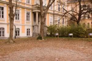
Styria , Slovene/Croatian: Štajerska, Hungarian: Stájerország) is a state or Bundesland, located in the southeast of Austria. In area it is the second largest of the nine Austrian federated states, covering 16,401 km². It borders Slovenia as well as the other Austrian states of Upper Austria, Lower Austria, Salzburg, Burgenland, and Carinthia. The population (as of 2011) was 1,210,700. The capital city is Graz which had 276,526 inhabitants at the beginning of 2015.
Etymology
The March of Styria derived its name from the original seat of its ruling Otakar dynasty: Steyr, in today's Upper Austria. In German, the area is still called "Steiermark" while in English the Latin name "Styria" is used. The ancient link between Steyr and Styria is also apparent in their nearly identical coats of arms, a white Panther on a green background.
Geography
The term "Upper Styria" (German: Obersteiermark) used by an Austrian refers to the northern and northwestern parts of the federal-state (districts Liezen, Murau, Judenburg, Knittelfeld, Leoben, Bruck an der Mur, and Mürzzuschlag). The term "West Styria" (Weststeiermark) is used for the districts to the west of Graz (Voitsberg, Deutschlandsberg, western part of the district Leibnitz); the districts east of Graz (Weiz, Hartberg, Feldbach, Fürstenfeld, and Radkersburg) are referred to as "East Styria" (Oststeiermark). The western and eastern parts of the district Graz-Umgebung may or may not be considered parts of West and East Styria, respectively. The southern parts of the Duchy of Styria, which have formed part of Yugoslavia or Slovenia since 1918 (with the exception of World War II), were (and sometimes colloquially still are) referred to as "Lower Styria" (Untersteiermark; Slovene: Štajerska).
History
During early Roman times, Styria was inhabited by Celtic tribes. After its conquest by the Romans, the eastern part of what is now Styria was part of Pannonia, while the western one was included in Noricum. During the Barbarian invasions, it was conquered or crossed by the Visigoths, the Huns, the Ostrogoths, the Rugii, the Lombards, the Franks and the Avars. In 595 the latter were defeated by the Slavs, who thenceforth ruled it.
In 1180 Styria separated from the Duchy of Carinthia and became a Grand Duchy of its own; in 1192 it became part of Austria. After the hereditary subdivision of the latter, Styria formed the central part of Inner Austria. Styria developed culturally and economically under Archduke John between 1809 and 1859. In 1918, after World War I, it was divided into a northern section (forming what is the current Austrian state), and a southern one, called Lower Styria, inhabited mostly by ethnic Slovenians, and which was annexed to Yugoslavia, and later in Slovenia.