Tver region
Description
Tver Oblast is a federal subject of Russia (an oblast). Its administrative center is the city of Tver. From 1935 to 1990, it was known as Kalinin Oblast (Кали́нинская о́бласть), named after Mikhail Kalinin. Population: 1,353,392 (2010 Census).
Tver Oblast is a region of lakes, such as Seliger and Brosno. Much of the remaining area is occupied by the Valdai Hills, where the Volga, the Western Dvina, and the Dnieper have their source.
Tver Oblast is one of the tourist regions of Russia with a modern tourist infrastructure. There are also many historic towns: Torzhok, Toropets, Zubtsov, Kashin, Vyshny Volochyok, and Kalyazin. The oldest of these is Rzhev, primarily known for the Battles of Rzhev in World War II. Staritsa was the seat of the last appanage principality in Russia. Ostashkov is a major tourist center.
Geography
Tver Oblast is located in the west of the middle part of the East European Plain. It stretches for 260 km from north to south and 450 km from west to east. The area borders Yaroslavl, Vologda and Novgorod oblasts in the north, Moscow and Smolensk oblasts in the south, and Pskov Oblast in the west.
The area of Tver Oblast is 84201 km², the 38th of 83 subjects. This is 0.49% of the territory of Russia. The largest area the size of the territory of the Central Federal District.
Relief
Tver Oblast as a whole is characterized by flat terrain with alternating lowlands and highlands. In the western part of the province, occupying about one-third of its area is Valdai Hills, with elevations of 200–300 m above sea level. It is surrounded by depressions, lowlands have a height of 100–150 m highest point of the area has a height of 347 m, is located on a hill Tsninsky (The top of the Valdai). The low point (61 m) - the extreme north-west area of the river's edge Kunya on the border with the Novgorod Oblast.
Natural resources
Minerals discovered and developed in the Tver Oblast are mainly deposits of ancient seas, lakes and swamps, and partly a consequence of glaciers (clastic rocks).
Minerals of industrial importance are the seams of brown coal Moscow coal basin. The largest deposit is Bolshoy Nelidovskiy, which gave between 1948 and 1996 about 21 million tons.
Widespread powerful peat deposits totaling 15.4 billion m³. The estimated reserves of peat are 2,051 million tonnes, representing approximately 7% of the stock of European Russia. On an industrial scale mastered 43 peat deposits with a total area of about 300 hectares, the main exploited stocks are concentrated in five fields located in the central and southern parts of the oblast. From 1971 to 1999, has developed more than 44 million tons of peat.
Distributed limestones ( near the town of Bayou several centuries developed reserves of white Staritskogo stone). Dolomitic limestones are common along rivers Vazuza, Osugi, Tsna ( marble-like limestone), there are deposits of tile, brick and pottery ( refractory ) of clay and quartz sand, sapropel are numerous underground fresh water and mineral formations, open sources (the best known medicinal table water Kashinskaya).
Rivers
The region is a watershed of the Caspian Sea and Baltic Sea. In the south, Belsky district has several tributaries of the upper reaches of the river Vop, the right tributary of the Dnieper River (basin of the Black Sea). Go to the Caspian Sea basin owns 70% of the region, the Baltic Sea - 29.7%.
In the region of more than 800 rivers longer than 10 km total length of about 17,000 km. The main river - Volga ( 685 km within the region). Its source is in Ostashkov area. The most important tributaries of the Volga: Mologa (280 km), Dipper (269 km), Tvertsa (188 km). Other important rivers: the Western Dvina and its tributary Meza (259 km), Mtsa (Vyshnevolotsk source in the area) and Cna (160 km).
Climate
The climate is humid continental, transitional from continental Russia to the more humid north-western regions. The area lies in a zone of comfort for living and recreation climatic conditions. Average January temperatures range from −8 °C (18 °F) in west to −13 °C (9 °F) in northeast, and July from +17 °C (63 °F) to +19 °C (66 °F) °C. The average annual rainfall ranges from 560 to 720 mm, the greatest amount of precipitation falls on the western slopes of the Valdai Hills . The snow cover starts at the mid-November, the period with snow cover lasts 130–150 days, snow depth is about 40–60 cm, with a maximum of 80 cm.
History
There was already a settlement on the point of land at the confluence of the Tmaka River and Volga rivers in the 9th and 10th centuries. A fortress was built on the site much later, during the fighting between the Rostov-Suzdal princes and Novgorod Republic.
Economy
Tver Oblast has a very strong economy due to its machinery industry in the automobile and aeronautics sectors.
Transportation
The Oblast has a well-developed infrastructure consisting of railway, river, motor vehicle, air, and pipeline transportation systems. Tver Oblast has one of the highest proportions of paved roads in the country. The region's location between Russia's two major cities, Moscow and St. Petersburg, has an obvious influence on traffic flows from Northern Europe and the Baltic countries to central Russia.
Passes through the region connecting the main "two capitals" Railway - October single-track railway with branches in Rzhev and Vyazma, Kuvshinovo and Selizharovo through Torzhok . Equally important are single-track diesel Moscow - Kashin - St. Petersburg and Moscow - Riga, and Yaroslavl - Bologoe - Great Luke and Bologoe - The bottom of the (station ), but very popular .
The area is crossed by two federal highways: M10 "Russia" and M9 "Baltic" . Of internal roads are significant Torzhok A111 - A112 Ostashkov and Tver-Rzhev. The length of paved roads - 16,032 km .
Near Tver two civilian airports : Migalovo airport with a runway for commercial aviation, 2500m in length, airport local lines Zmeevo (now - heliport ) .
The development of navigation on the Volga river port "Tver" with a cargo jetty for boats "river -sea" with a draft of up to four meters.
The region is crossed four beams railways going from Moscow to the north, northwest and west:
to St. Petersburg via Tver - Bologoye (main course of the Oktyabrskaya Railway), west across the Rzhev - Velikiye Luki (branch of Riga, Vilnius, Warsaw and Kaliningrad - Berlin. to Kimry - Sonkovo - Pestovo - St. Petersburg; to Pskov through Tver - Bologoe . The largest railway junction of Tver Oblast is located in Bologoye. Bologovskiy assembly includes five areas : Moscow, St. Petersburg, Pskov, Yaroslavl, Great Luke.
The narrow gauge railway of KSM-2 factory, Tver serves a factory of building materials №2 in Tver.
Tver Karelians
A branch of Karelians, known as Tver Karelians used to live in the oblast. They numbered 140,567 in 1926. Due to heavy casualties suffered during the World War II, they vanished as a separate ethnic group from most parts of the oblast. The Tver Karelians numbered 14,633 according to the 2002 Census.
Religion
Russian Orthodox (30%) Unaffiliated Christian (9%) Muslim (1%) Spiritual but not religious (34%) Atheist (20%) Other or undeclared (6%)
According to a 2012 official survey 30% of the population of Tver Oblast adheres to the Russian Orthodox Church, 9% are unaffiliated generic Christians, and 1% are Muslims. In addition, 34% of the population deems itself to be "spiritual but not religious", 20% is atheist, and 6% follows other religions or did not give an answer to the question.
Towns


All accomodation types
Hotels
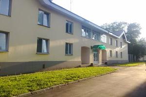 Vagonnik Hotel
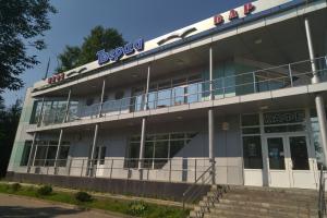 Tvertsa Hotel
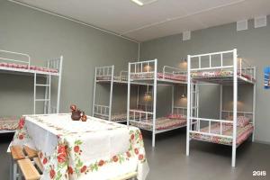 Dom dlya priezzhih Hotel
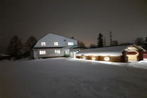 Kompleks otdyha Batino Hotel
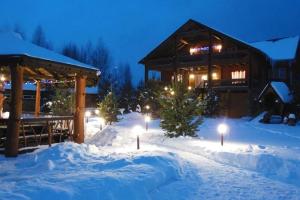 High ratingKompleks otdyha Novoe Bryantsevo Hotel
Hostels
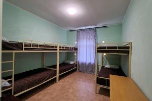 MorozoF Hostel
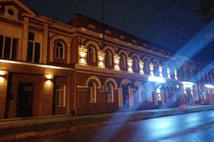 Hostel Staryy gorod