Fairbanks
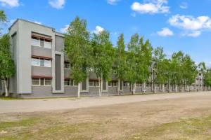
Street view
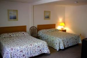

Reviews
Share your experiences, help others make the right choice!
Think about what you would like to know if you were looking for a review about a place to relax. Please describe in detail what you liked and what you didn't. What would you advise to other guests and to the hotel owner. The more fully you tell about the hotel, the easier it will be for other people to make a choice and they will be very grateful to you!
Map
Tourist attractions
Fairbanks Ice Museum (10 min)
Explore exhibits showcasing ice art and the history of ice sculpting in Fairbanks.
Bouchard's International Dog Mushing and Sled Museum (10 min)
Museum featuring exhibits on dog mushing and sledding traditions.
Lend-Lease Monument (13 min)
Monument commemorating the Lend-Lease program's role during World War II.
Alaska Mining Hall of Fame (14 min)
Museum honoring individuals who contributed significantly to Alaska's mining history.
Moose Antler Arch (14 min)
A large arch constructed from moose antlers, symbolizing local wildlife heritage.
Denali Backroads (1.4 km)
Offers guided tours and adventures exploring the Denali region's backcountry.
Alaska Bird Observatory (2.8 km)
Research center focused on monitoring and studying bird populations in Alaska.
Gold Rush Town (2.7 km)
Explore Gold Rush Town to experience Fairbanks' mining history and heritage attractions.
Gold Rush Town (2.8 km)
Gold Rush Town offers interactive exhibits depicting life during Alaska's gold mining era.
Harding Railroad Car (2.8 km)
The Harding Railroad Car, built in 1905, showcases early 20th-century railway travel in Alaska.