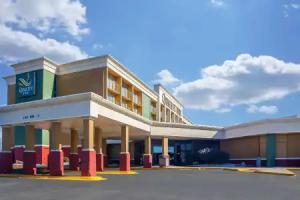
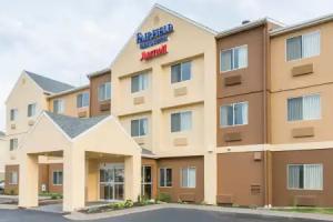
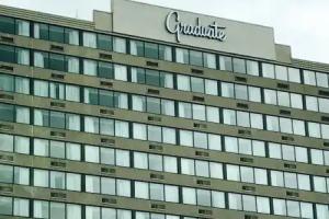
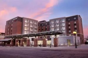
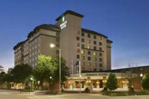
Lincoln
Description
Lincoln /ˈlɪŋkən/ is the capital of the State of Nebraska and the second most populous city in Nebraska. Lincoln is also the county seat of Lancaster County Lincoln is located in the southeastern part of Nebraska and is in the Lincoln metropolitan (statistical) area. Lincoln's population in 2015 was estimated at 277,348.
Lincoln was founded as the village of Lancaster on the salt marshes of what was to become Lancaster County. A short time later, Lancaster was renamed Lincoln and became Nebraska's capital.
Sometimes referred to as the "Star City", many of Lincoln's primary employers fall within the service and manufacturing industries, including a growing high tech sector. The city is the home of the University of Nebraska, has an unemployment rate of 3.1% (June 2016, MSA preliminary) and has the second tallest capitol building in the United States.
History
Further information: Timeline of Lincoln, Nebraska historyPioneer Lincoln
Prior to the expansion westward of settlers, the prairie was covered with buffalo grass. Plains Indians, descendants of indigenous peoples who occupied the area for thousands of years, lived in and hunted along Salt Creek. The Pawnee, which included four tribes, lived in villages along the Platte River. The Great Sioux Nation, including the Ihanktowan-Ihanktowana and the Lakota located to the north and west, used Nebraska as a hunting and skirmish ground, although they did not have any long-term settlements in the state. An occasional buffalo could still be seen in the plat of Lincoln in the 1860s.
Founding
Lincoln was founded in 1856 as the village of Lancaster and became the county seat of the newly created Lancaster County in 1859. The village was sited on the east bank of Salt Creek. The first settlers were attracted to the area due to the abundance of salt. Once J. Sterling Morton developed his salt mines in Kansas, salt in the village was no longer a viable commodity. Captain W. T. Donovan, a former steamer captain, and his family settled on Salt Creek in 1856. In the fall of 1859, the village settlers met to form a county. A caucus was formed and the committee, which included Captain Donovan, selected the village of Lancaster to be the county seat. The county was named Lancaster. After the passage of the 1862 Homestead Act, homesteaders began to inhabit the area. The first plat was dated August 6, 1864.
By the close of 1868, Lancaster had a population of approximately 500 people. The township of Lancaster was renamed Lincoln with the incorporation of the city of Lincoln on April 1, 1869. In 1869, the University of Nebraska was established in Lincoln by the state with a land grant of about 130,000 acres. Construction of University Hall, the first building, began the same year.
State Capital
The capital of the Nebraska Territory had been Omaha since the creation of the territory in 1854; however, most of the territory's population lived south of the Platte River. After much of the territory south of the Platte River considered annexation to Kansas, the territorial legislature voted to locate the capital city south of the river and as far west as possible.
Prior to the vote to remove the capital city from Omaha, a last ditch effort by Omaha Senator J. N. H. Patrick attempted to derail the move by having the future capital city named after recently assassinated President Abraham Lincoln. Many of the people south of the Platte River had been sympathetic to the Confederate cause in the recently concluded Civil War. It was assumed that senators south of the river would not vote to pass the measure if the future capital was named after the former president. In the end, the motion to name the future capital city Lincoln was ineffective and the vote to change the capital's location south of the Platte River was successful with the passage of the Removal Act.
Nebraska was granted statehood on March 1, 1867. The Removal Act called for the formation of a Capital Commission to locate a site for the capital on state owned land. The Commission, composed of Governor David Butler, Secretary of State Thomas Kennard and Auditor John Gillespie, began to tour sites on July 18, 1867 for the new capital city. The village of Lancaster was chosen, in part due to the salt flats and marshes. Lancaster had approximately 30 residents. Disregarding the original plat of the village of Lancaster, Thomas Kennard platted Lincoln on a broader scale. The plat of the village of Lancaster was not dissolved nor abandoned; Lancaster became Lincoln when the Lincoln plat files were finished September 6, 1867. To raise money for the construction of a capital city, a successful auction of lots was held. Newcomers began to arrive and Lincoln's population grew. The Nebraska State Capitol was completed on December 1, 1868; a two story building constructed with native limestone with a central cupola. The Kennard house, built in 1869, is the oldest remaining building in the original plat of Lincoln.
In 1888 a new capitol building was constructed on the site of the first capitol. The new building replaced the former structurally unsound capitol. The second capitol building was a classical design, designed by architect William H. Willcox. Construction began on a third capitol building in 1922. Bertram G. Goodhue was selected in a national competition as its architect. By 1924, the first phase of construction was completed and state offices moved into the new building. In 1925, the Willcox designed capitol building was razed. The Goodhue designed capitol was constructed in four phases, with the completion of the fourth phase in 1932. The completion of the original Goodhue design will be finally realized with the completion of the capitol fountains within the four interior courtyards of the capitol building in 2017.
Growth and expansion
The worldwide economic depression of 1890 saw the reduction of Lincoln's population from 55,000 to 37,000 by 1900. Volga-German immigrants from Russia settled in the North Bottoms neighborhood and as Lincoln expanded with the growth in population, the city began to annex towns nearby. The first town annexed was Bethany Heights in 1922. Bethany Heights was incorporated in 1890. In 1926, the town of University Place was annexed. In 1929, the city annexed the town College View. College View was incorporated in 1892. Union College, a Seventh Day Adventist institution, was founded in College View in 1891. In 1930, the city annexed the town of Havelock. Havelock actively opposed annexation to Lincoln and only relented due to a strike by the Burlington railroad shop workers which halted progress & growth for the city.
The Burlington & Missouri River Railroad's first train arrived in Lincoln on June 26, 1870, soon to be followed by the Midland Pacific in 1871 and the Atchison & Nebraska in 1872. The Union Pacific began service in 1877. The Chicago & North Western and Missouri Pacific began service in 1886. The Chicago, Rock Island & Pacific extended service to Lincoln in 1892. Lincoln became a rail center hub.
As automobile travel became more common in the U.S., the needs for better roads in Nebraska and throughout the U.S. grew. The Omaha-Denver Trans-Continental Route Association in 1911, with support from the Good Roads Movement, established the Omaha-Lincoln-Denver Highway (O-L-D) through Lincoln. The goal was having the most efficient highway to travel on throughout the state of Nebraska, from Omaha to Denver. In 1920, the Omaha-Denver Association merged with the Detroit-Lincoln-Denver Highway Association. As a result, the O-L-D was renamed the Detroit-Lincoln-Denver Highway (D-L-D) with the goal of having a continuous highway from Detroit to Denver. The goal was eventually realized by the mid 1920s; 1,700 mi (2,700 km) of constantly improved highway through six states. The auto route was a tourist magnet and traffic was heavy. Businesses were built and facilities were established in towns along the route in order to keep up with traveler demand. In 1924, the D-L-D was officially designated as Nebraska State Highway 6. In 1926, the highway became part of the Federal Highway System and was renumbered U.S. Route 38. In 1931, U.S. 38 was renumbered as a U.S. 6/U.S. 38 overlap and in 1933, the U.S. 38 route designation was dropped.
In the early years of air travel, Lincoln had three airports and one airfield. Union Airport, was established northeast of Lincoln in 1920. Charles Lindbergh learned to fly at the Lincoln Flying School April 1, 1922. The Lincoln Flying School was founded by E.J. Sias in a building he built at 2145 O Street. The flying school closed in 1947. Some remnants of the old airport can still be seen today in-between N. 56th and N. 70th Streets, north of Fletcher Avenue; mangled within a slowly developing industrial zone. Arrow Airport was established around 1925 as a manufacturing and test facility for Arrow Aircraft and Motors Corporation, primarily the Arrow Sport. The airfield was located near Havelock; or to the west of where the North 48th Street Small Vehicle Transfer Station is located today. Arrow Aircraft & Motors declared bankruptcy in 1939 and Arrow Airport closed roughly several decades later. An existing Arrow Sport can be seen on permanent display, hanging in the Lincoln Airport's main passenger terminal. The city's small municipal airfield in 1930 was dedicated to Charles Lindbergh and named Lindbergh Field for a short period of time as another airfield was named Lindbergh in California. The airfield was north of Salt Lake, in an area known variously over the years as Huskerville, Arnold Heights and Air Park; and was located approximately within the western half of the West Lincoln Township. The air field was a stop for United Airlines in 1927 and a mail stop in 1928. In 1942 the Lincoln Army Airfield was established at the site. During World War II, over 25,000 aviation mechanics were trained with over 40,000 troopers being processed for combat. The Army closed the base in 1945. The Air Force reactivated the base during the Korean War in 1952. In 1966, the base was closed and Lincoln annexed the airfield, including the base's old housing units to the west. The base became the Lincoln Municipal Airport under ownership of the Lincoln Airport Authority. Around the turn of the 21st century, the airport was renamed the Lincoln Airport. The authority shared facilities with the Nebraska National Guard, who continued ownership over some portions of the old Air Force base. During the 1960s, the two main airlines serving the Lincoln Airport were United Airlines and the original Frontier Airlines.
In 1966, Lincoln annexed the township of West Lincoln. West Lincoln voters rejected annexation by Lincoln until the state legislature passed a bill in 1965 allowing cities to annex surrounding areas without a vote. West Lincoln was incorporated in 1887 with a population of 450. In 1960, the population was 507.
As train, automobile, and air travel increased, business flourished, and the city prospered. The population of Lincoln increased 38.2% from 1920 to a population of 75,933 in 1930.
Revitalization and growth
The downtown core retail district from 1959 to 1984 saw profound changes as retail shopping moved from downtown to the suburban Gateway Shopping Mall. In 1956, Bankers Life Insurance Company of Nebraska announced plans to build a $6 million shopping center next to their new campus on the east-side outskirts of Lincoln. Gateway Mall was completed and open for business at 60th and O streets in 1960. By 1984, 75% of Lincoln's revenue from retail sales tax came from within a one-mile radius of the Mall. With the exodus of retail and service businesses, the downtown core began to decline and deteriorate.
The Nebraska legislature in 1969 legislated laws for urban renewal and shortly thereafter Lincoln began a program of revitalization and beautification of the city. Most of the urban renewal projects focused on downtown and the Near South areas. Beautification included new street lighting. Many ideas were considered and not implemented. Successes included Sheldon Memorial Art Gallery, designed by Philip Johnson; new branch libraries, the First National Bank Building and the National Bank of Commerce Building designed by I.M. Pei.
In 1971, an expansion of Gateway Mall was completed. Lincoln's first woman mayor, Helen Boosalis, was elected in 1975. Mayor Boosalis was a strong supporter of the revitalization of Lincoln with the downtown beautification project being completed in 1978. In 1979, the square-block downtown Centrum was opened and connected to buildings with a skywalk. The Centrum was a two-level shopping mall with a garage for 1,038 cars. With the beautification and urban renewal projects, many historic buildings were razed in the city. In 2007 and 2009, the city of Lincoln received beautification grants for improvements on O and West O Streets, west of the Harris Overpass, commemorating the history of the D-L-D.
Vietnamese refugees, from the fall of Saigon in 1975, established a significant ethnic community with businesses along the 27th Street corridor alongside Mexican eateries and African markets. Lincoln was designated as a "Refugee Friendly" city by the U.S. Department of State in 1990. In 2000, Lincoln was the 12th largest resettlement site per capita in the country. As of 2011, Lincoln had the largest Karen (Burmese ethnic minority) population in the United States, behind Omaha. As of the same year, Nebraska was one of the largest resettlement sites for the people of Sudan (most in Lincoln & Omaha). In recent years, Lincoln had the largest Yazidi (Iraqi ethnic minority) population in the U.S.
The decade from 1990 to 2000 saw a population growth never seen before. North 27th Street and Cornhusker Highway were redeveloped with new housing and businesses built. The boom housing market in south Lincoln created new housing developments including high end housing in areas like Cripple Creek, Willamsburg and The Ridge. The shopping center Southpointe Pavilions was completed in competition of Gateway Mall.
In 2001, Gateway Mall was purchased by Westfield America Trust. Westfield renamed the mall Westfield Shoppingtown Gateway; then in 2005, Westfield Gateway. Westfield made a $45 million makeover of the mall in 2005 including an expanded food court, a new west-side entrance and installation of an Italian carousel. In 2012, Westfield America Trust sold Westfield Gateway to Starwood Capital Group. Starwood reverted the mall's name from Westfield Gateway to Gateway Mall. Since 2012, Starwood Capital Group has made incremental expansions and renovations.
In 2015, ALLO Communications announced that it would bring ultra-high speed fiber internet to the city. Speeds up to 1 Gigabit per second were planned for both business and household use by using the city's existing fiber network. Construction on the citywide network was to begin in March 2016 and was estimated to be complete by 2019. Telephone and cable TV service would also be included, making it the third company to compete for such services within Lincoln. In April 2016, Windstream Communications announced that 2,300 customers in Lincoln had 1 Gigabit per second internet with an expected expansion of services to 25,000 customers by 2017, making it the first company to have ultra-fast internet available within the city.
Geography
Detailed map of Lincoln streets and features View from the International Space Station (ISS, 2007); photo centered on northeast Lincoln.Lincoln is located at 40°48′38″N 96°40′49″W / 40.81056°N 96.68028°W / 40.81056; -96.68028 . According to the United States Census Bureau, in 2015, the city has a total area of 92.81 square miles (240.38 km2), of which, 91.45 square miles (236.85 km2) of it is land and 1.35 square miles (3.50 km2) is water.
Lincoln is one of the few large cities of Nebraska not located along either the Platte River or the Missouri River. The city was originally laid out near Salt Creek and among the nearly flat saline wetlands of northern Lancaster County. The city's growth over the years has led to development of the surrounding land, much of which is composed of gently rolling hills. In recent years, Lincoln's northward growth has encroached on the habitat of the endangered Salt Creek tiger beetle.
Metropolitan area
The Lincoln metropolitan area consists of Lancaster County and Seward County, which was added to the metropolitan area in 2003. Lincoln has very little development outside its city limits and has no contiguous suburbs. The largest town that may be considered a suburb of Lincoln is Waverly. This is due primarily to the fact that most land that would otherwise be developed as a suburban town has already been annexed by the city of Lincoln itself.
Neighborhoods
Lincoln's neighborhoods, like in other cities, include both old and new development. Some neighborhoods in Lincoln were formerly small towns that Lincoln later annexed, including University Place annexed in 1926, Belmont, Bethany (Bethany Heights) annexed in 1922, College View annexed in 1929, Havelock annexed in 1930, and West Lincoln annexed in 1966. A number of Historic Districts are located near downtown Lincoln, while newer neighborhoods have appeared primarily in the south and east. As of December 2013, Lincoln had 45 registered neighborhood associations within the city limits.
One core neighborhood that has seen rapid residential growth in recent years is the downtown Lincoln area. In 2010, there were 1,200 downtown Lincoln residents; in 2016, there were 3,000 (an increase of 140%).
Arts and culture
Since the opening of Pinnacle Bank Arena in 2011, Lincoln's emerging music scene has grown to the point where it is sometimes referred to as a "Music City" by some. Primary venues for live music include: Pinnacle Bank Arena, Bourbon Theatre, Duffy's Tavern, and the Zoo Bar. The Pla-Mor Ballroom is a staple of Lincoln's music and dance scene, featuring its house band, the award-winning Sandy Creek Band. Pinewood Bowl hosts a range of performances - from national music performances to local plays during the warm weather months.
The Lied Center is a venue for national tours of Broadway productions, concert music, guest lectures, and regularly features it's resident orchestra Lincoln's Symphony Orchestra. Lincoln has several performing arts venues. Plays are staged by UNL students in the Temple Building; community theater productions are held at the Lincoln Community Playhouse, the Loft at The Mill, and the Haymarket Theater.
For movie viewing, Marcus Theatres owns 32 screens at four locations, and the University of Nebraska's Mary Riepma Ross Media Arts Center shows independent and foreign films. Standalone cinemas in Lincoln include the Joyo Theater and Rococo Theater. The Rococo Theater also hosts benefits and other engagements. The downtown section of O Street is Lincoln's primary bar and nightclub district.
Lincoln is the hometown of Zager and Evans, known for their international No. 1 hit record, "In the Year 2525". It is also the home town of several notable musical groups, such as Remedy Drive, VOTA, the Bathtub Dogs, For Against, Lullaby for the Working Class, Matthew Sweet, Dirtfedd, The Show is the Rainbow and Straight. Lincoln is home to Maroon 5 guitarist James Valentine.
In 2012, the city was listed among the 10 best places to retire in the United States by U.S. News & World Report.
Annual cultural events
Like in many cities, annual events in Lincoln have come and gone throughout time, such as Band Day at UNL and the Star City Holiday Parade. At the same time, however, some events have never changed while new traditions are created. Some current annual cultural events in Lincoln include the Lincoln National Guard Marathon & Half-Marathon in May, Celebrate Lincoln in early June, the Uncle Sam Jam around July 3, and Boo at the Zoo in October. An often local favorite to some is the Haymarket Farmers' Market, running from May to October in the Historic Haymarket, one of several farmers markets throughout the city.
Tourism
Tourist attractions and activities include the Sunken Gardens, basketball games at Pinnacle Bank Arena, the Lincoln Children's Zoo, the dairy store at UNL's East Campus, and Mueller Planetarium on the city campus. The Nebraska State Capitol, which is also the tallest building in Lincoln, offers tours. The Frank H. Woods Telephone Museum exhibits historical telephone technology. The Speedway Motors Museum of American Speed preserves, interprets and displays physical items significant in racing and automotive history.
Parks and recreation
Lincoln has an extensive park system, with over 125 individual parks. The parks are connected by a 133 mi (214 km) system of recreational trails. The MoPac Trail extends through Lincoln. Regional parks include Antelope Park from S. 23rd & "N" Streets to S. 33rd Street & Sheridan Boulevard, Bicentennial Cascade Fountain, Hamann Rose Garden, Lincoln Children's Zoo, Veterans Memorial Garden, and Holmes Park at S. 70th Street & Normal Boulevard. Pioneers Park includes the Pioneers Park Nature Center at S. Coddington Avenue & W. Calvert Streets. Community parks include Ballard Park, Bethany Park, Bowling Lake Park, Densmore Park, Erwin Peterson Park, Fleming Fields, Irvingdale Park, Mahoney Park, Max E. Roper Park, Oak Lake Park, Peter Pan Park, Pine Lake Park, Sawyer Snell Park, Seacrest Park, Tierra Briarhurst, University Place Park and Woods Park. Other notable parks include Iron Horse Park, Lincoln Community Foundation Tower Square, Nine Mile Prairie owned by the University of Nebraska Foundation, Sunken Gardens, Union Plaza, and Wilderness Park. Smaller neighborhood parks are scattered throughout the city. Additionally, there are five public recreation centers, nine outdoor public pools and five public golf courses not including private facilities in Lincoln.
