Perm region
Description
Perm Krai is a federal subject of Russia (a krai) that came into existence on December 1, 2005 as a result of the 2004 referendum on the merger of Perm Oblast and Komi-Permyak Autonomous Okrug. The city of Perm is the administrative center. Population: 2,635,276 (2010 Census).
Geography
Perm Krai is located in the east of the East European Plain and the western slope of the Middle Ural Mountains. 99.8% of its area is in Europe, 0.2% in Asia.
- length from north to south – 645 kilometres (401 mi)
- length from west to east – 417.5 kilometres (259.4 mi)
The krai borders the Komi Republic in the north, Kirov Oblast in the northwest, the Udmurt Republic in the southwest, the Republic of Bashkortostan in the south, and Sverdlovsk Oblast in the east.
The krai borders stretch for over 2,200 kilometres (1,400 mi). The highest point is Mount Tulymsky Kamen at 1,496 metres (4,908 ft).
Rivers
Chusovaya River Vishera River
Rivers of Perm Krai belong to the Kama River Basin, the largest tributary of Volga River. There are more than 29,000 rivers in Perm Krai. The total length of all rivers is more than 90,000 kilometres (56,000 mi).
Only two rivers in Perm Krai have lengths exceeding 500 kilometres (310 mi). They are the Kama River at 1,805 kilometres (1,122 mi) and the Chusovaya River, 592 kilometres (368 mi).
There are about 40 rivers with lengths from 100 to 500 kilometres (62 to 311 mi). The longest of them are:
- Sylva River — 493 km (306 mi)
- Kolva River — 460 km (285 mi)
- Vishera River — 415 km (258 mi)
- Yayva River — 403 km (250 mi)
- Kosva River — 283 km (176 mi)
- Kosa River — 267 km (165 mi)
- Veslyana River — 266 km (165 mi)
- Inva River — 257 km (159 mi)
- Obva River — 247 km (153 mi)
There are also many small rivers, but some of them have historical significance, for example Yegoshikha River, in mouth of which city Perm was founded.
Climate
Perm krai has a continental climate. Winters are long and snowy, with average temperatures in January varying from −18 °C (0 °F) in the northeast part of krai to −15 °C (5 °F) in southwest part. The record lowest recorded temperature was −53 °C (−63 °F) (in the north).
Minerals
Salt dump in Solikamsk Kungur Ice Cave
Perm Krai is rich with minerals, that can be explained its diverse relief in mountainous and flat parts. There are produced: oil, natural gas, gold, diamonds, chromites, peat, limestone, building materials and others.
Oil in its area was first discovered in 1929 near settlement Verhnechusovskie Gorodki. Currently there are known more than 180 oil and gas fields. Among them are developed: 89 oil, 2 gas and 18 both oil and gas fields. Most of them are small and extracted in central and southern districts of krai. Northern fields a less developed because of deep lying of oil under salt layers.
Coal has been mined in Perm Krai for more than 200 years. For a long time it played an important role in the fuel and energy balance in the region. Maximum mining was in 1960 and reached 12 million tones, after it mining decrease and there are no exploration of new fields.
In Perm Krai is located Verkhnekamskoye deposit of potassium salts, one of the largest in the world. Its area is approx. 1,800 km² and the thickness of the salt layers reaches 514 m.
Flora and fauna
Forests cover about 71% of krai's area. Predominant are coniferous forests, percentage of deciduous forests increase from north to south. There are 62 species of mammals, more than 270 species of birds, 39 species of fishes, 6 species of reptile and 9 species of amphibians.
Located in Perm Krai are 3 nature reserves: Basegi, Vishera, Preduralie.
Economy
Nonferrous metallurgy is based on ore processing Verkhnekamskoye potash deposit containing magnesium and rare metals. The factories are located in Berezniki (Titanium Magnesium Plant Corporation VSMPO) and Solikamsk (JSC Solikamsk magnesium plant).
In engineering plays an important role military production. The largest center of engineering is Perm; manufactured aircraft and rocket engines, oil field and mining equipment, Petrol motive-powered saws, communication equipment, vessels, cable and other products. The largest enterprises are Motovilikha Plants and Perm Motors. Timber Complex edge based on the use of the richest forest resources Prikamye. Logging facilities are located mainly in the north region.
Demographics
Kamskaya Hydroelectric power plant, Perm
According to the 2010 Census, the population of Perm Krai is 2,635,276; down from 2,819,421 recorded in the 2002 Census, and further down from 3,099,994 recorded in the 1989 Census.
Ethnic groups, as of the 2010 Census, are: Russians (87.1%), Komi-Permyaks (3.2%), Tatars (4.6%), Bashkirs (1,3%), Ukrainians (0,6%), Udmurts (0,8%), Belarusians (0,3%), Germans (0,3%) and others. Additionally, 119,538 people were registered from administrative databases, and could not declare an ethnicity. It is estimated that the proportion of ethnicities in this group is the same as that of the declared group.
There are about 40,740 Bashkirs is Perm Krai, according to the 2002 Census. Most of them live in Bardymsky District, in basin of Tulva River and belong to tribe gaina.
Tatars live in almost all settlements of Perm Krai. There are several different ethnographical groups of Tatar people. In this territory for long time was active contacts between Tatars and Bashkins, so in some cases it’s difficult to delineate this ethnic groups, especially in such areas as Kuyedinsky District and Tulva River basin.
Death rates in some of the remote and rural areas in Perm Krai are very high, never seen before during times other than major wars or natural calamities. Just five districts out of a total of 47 have a surplus of births over death in Perm Krai. The birth rate in Perm Krai is much higher compared to other European regions. For example, the birth rate for Germany was 8.3 per 1000 in 2007. Perm as a whole is having 50% higher birth rate, and even the district with the lowest birth rate is having 20% higher BR compared to Germany. In 2008, the birth rate in Perm Krai was 8% higher than that of 2007. Close to 35.5 thousand births were recorded with the heaviest increases in City of Perm (+11%) and Komi-Permyak Autonomous Okrug (+18%). Among the districts, Kudymkar City recorded a 46% rise in birth rates for 2008 compared to 2007, while Usolsky recorded a 31% rise and Kyshertsky recorded a 29% rise. In 13 of the districts, there were more births than deaths, among them Ordynsky, Karagaysky, Kudimkar, Chernushynsky, Chaykovsky & Permsky.
Religion
As of a 2012 official survey 43% of the population of Perm Krai adheres to the Russian Orthodox Church, 5% declares to be generically unaffiliated Christian (excluding Catholic and Protestant), 4% are Muslims, 2% are Rodnovers, 1% are Starovers, 1% follows other Orthodox Churches, 8% follows other religion or did not give an answer to the survey. In addition, 24% of the population declares to be "spiritual but not religious" and 14% to be atheist.
Major attractions
Perm State Art Gallery Khokhlovka
Perm Krai is home of several museums:
- Perm State Art Galery
- Perm Museum of Local History
- Museum of Motovilikha Plants
- Architectural-Ethnographic Museum Khokhlovka and others.
Numerous architectural monuments are located in the small town of Usolye, in north of Perm Krai. Particularly important are the Saviour Cathedral, with a separate bell tower, and House of Stroganov.
There are many theaters in Perm, including the Perm Opera and Ballet Theater, the Perm Academic Theater, the Puppet Theater, the Theater for Young Spectators, the Theater "Near Bridge", and others.
There are many temples and convents in Perm Krai. The most significant of them are: Belogorsky Convent located in 85 km from Perm, Sludskaya Church, Fedosievskaya Church, Perm Mosque and others.
Ordinsky is home to the Orda underwater caves. Located near Orda village in Perm region, Ural, Orda Cave is also the biggest underwater gypsum crystal cave in the world.
Towns


All accomodation types
Hotels
 Sauna 24 Hotel
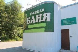 Russkaya banya Hotel
 Domino Hotel
 Na Yablochkova Hotel
 Kommuna Hotel
 Komfort Hotel
 Limon Hotel
 Bolshevichka Hotel
 Apollon Hotel
 Amore 59 Hotel
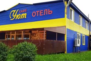 Uyut Hotel
 High ratingKrasavinskiy hutorok Hotel
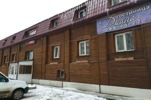 Diana Hotel
Hostels
 Katrin Hostel
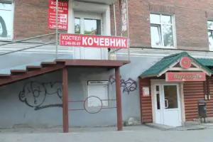 Hostel Kochevnik