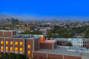
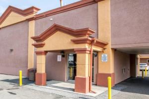
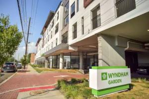
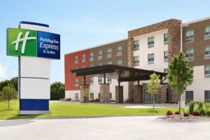
Jersey City
Description
Jersey City is the second most populous city in the U.S. state of New Jersey after Newark. It is the seat of Hudson County as well as the county's largest city. As of 2015, the Census Bureau's Population Estimates Program calculated that Jersey City's population was 264,290, with the largest population increase of any municipality in New Jersey since 2010, an increase of about 6.7% from the 2010 United States Census, when the city's population was at 247,597, ranking the city the 75th largest in the nation.
Part of the New York metropolitan area, Jersey City is bounded on the east by the Hudson River and Upper New York Bay and on the west by the Hackensack River and Newark Bay. A port of entry, with 21 miles (34 km) of waterfront and significant rail connections, the city is an important transportation terminus and distribution and manufacturing center for the Port of New York and New Jersey. Financial and service industries as well as direct rapid transit access to Manhattan in New York City have played a prominent role in the redevelopment of the Jersey City waterfront and the creation of one of the nation's largest downtown central business districts.
After a peak population of 316,715 measured in the 1930 Census, the city's population saw a half-century-long decline to a low of 223,532 in the 1980 Census, but since then the city's population has grown, with the 2010 population reflecting an increase of 7,542 (+3.1%) from the 240,055 counted in the 2000 Census, which had in turn increased by 11,518 (+5.0%) from the 228,537 counted in the 1990 Census.
History
Lenape and New Netherland
The land comprising what is now Jersey City was inhabited by the Lenape, a collection of tribes (later called Delaware Indian). In 1609, Henry Hudson, seeking an alternate route to East Asia, anchored his small vessel Halve Maen (English: Half Moon) at Sandy Hook, Harsimus Cove and Weehawken Cove, and elsewhere along what was later named the North River. After spending nine days surveying the area and meeting its inhabitants, he sailed as far north as Albany. By 1621, the Dutch West India Company was organized to manage this new territory and in June 1623, New Netherland became a Dutch province, with headquarters in New Amsterdam. Michael Reyniersz Pauw received a land grant as patroon on the condition that he would establish a settlement of not fewer than fifty persons within four years. He chose the west bank of the North River (Hudson River) and purchased the land from the Lenape. This grant is dated November 22, 1630 and is the earliest known conveyance for what are now Hoboken and Jersey City. Pauw, however, was an absentee landlord who neglected to populate the area and was obliged to sell his holdings back to the Company in 1633. That year, a house was built at Communipaw for Jan Evertsen Bout, superintendent of the colony, which had been named Pavonia (the Latinized form of Pauw's name, which means peacock). Shortly after, another house was built at Harsimus Cove and became the home of Cornelius Van Vorst, who had succeeded Bout as superintendent, and whose family would become influential in the development of the city. Relations with the Lenape deteriorated, in part because of the colonialist's mismanagement and misunderstanding of the indigenous people, and led to series of raids and reprisals and the virtual destruction of the settlement on the west bank. During Kieft's War, approximately eighty Lenapes were killed by the Dutch in a massacre at Pavonia on the night of February 25, 1643.
Scattered communities of farmsteads characterized the Dutch settlements at Pavonia: Communipaw, Harsimus, Paulus Hook, Hoebuck, Awiehaken, and other lands "behind Kil van Kull". The first village (located inside a palisaded garrison) established on what is now Bergen Square in 1660, and is considered to be the oldest town in what would become the state of New Jersey.
Early America
Among the oldest surviving houses in Jersey City are the Newkirk House (1690), the Van Vorst Farmhouse (1740), and the Van Wagenen House (1742). During the American Revolutionary War, the area was in the hands of the British who controlled New York. In the Battle of Paulus Hook Major Light Horse Harry Lee attacked a British fortification on August 19, 1779. After this war, Alexander Hamilton and other prominent New Yorkers and New Jerseyeans attempted to develop the area that would become historic downtown Jersey City and laid out the city squares and streets that still characterize the neighborhood, giving them names also seen in Lower Manhattan or after war heroes (Grove, Varick, Mercer, Wayne, Monmouth, and Montgomery among them). During the 19th century, former slaves reached Jersey City on one of the four routes of the Underground Railroad that led to the city.
The City of Jersey was incorporated by an act of the New Jersey Legislature on January 28, 1820, from portions of Bergen Township, while the area was still a part of Bergen County. The city was reincorporated on January 23, 1829, and again on February 22, 1838, at which time it became completely independent of North Bergen and was given its present name. On February 22, 1840, it became part of the newly created Hudson County.
Soon after the Civil War, the idea arose of uniting all of the towns of Hudson County east of the Hackensack River into one municipality. A bill was approved by the state legislature on April 2, 1869, with a special election to be held October 5, 1869. An element of the bill provide that only contiguous towns could be consolidated. While a majority of the voters across the county approved the merger, the only municipalities that had approved the consolidation plan and that adjoined Jersey City were Hudson City and Bergen City. The consolidation began on March 17, 1870, taking effect on May 3, 1870. Three years later the present outline of Jersey City was completed when Greenville agreed to merge into the Greater Jersey City.
1853 to 1859; New Jersey Railroad and Transportation Company original Jersey City terminal: Job Male, six year Superintendent of Construction of the NJRR, 1853–1859, built this complete terminal in Jersey City. He was designer and builder of terminal, docks, ferry houses, and piers, and possibly the Maintenance facility between Washington and Green streets built during his term as Superintendent. Reclaiming the natural river front, which included all that section of Hudson Street lying between Essex and Wayne Streets. He planned and built for the company the old circular-roofed depot, which was 500' in length and 100' wide, and which was situated on Montgomery street where the 1858 Pennsylvania Railroad depot was built.
In the late 1880s three passenger railroad terminals opened in Jersey City next to the Hudson River (Pavonia Terminal, Exchange Place and Communipaw). Tens of millions of immigrants passed through these stations as they made their way westward from Ellis Island into the United States. The railroads transformed the geography of the city by building the Erie Cut as well as several large freight rail yards. The railroads became and would remain the largest employers in Jersey City into and during the early 20th century.
20th and 21st centuries
Jersey City was a dock and manufacturing town for much of the 19th and 20th centuries. Much like New York City, Jersey City has always been a destination for new immigrants to the United States. In its heyday before World War II, German, Irish, and Italian immigrants found work at Colgate, Chloro or Dixon Ticonderoga. In 1908, the first permanent, drinking water disinfection system in the U.S. was installed on the water supply for the City by John L. Leal. The Hudson Tubes opened in 1911, allowing passengers to take the train to Manhattan as an alternative to the extensive ferry system. The Black Tom explosion occurred on July 30, 1916, as an act of sabotage on American ammunition supplies by German agents to prevent the materials from being used by the Allies in World War I.
From 1917 to 1947, Jersey City was governed by Mayor Frank Hague. Originally elected as a candidate supporting reform in governance, the Jersey City History Web Site says his name is "synonymous with the early twentieth century urban American blend of political favoritism and social welfare known as bossism." Hague ran the city with an iron fist while, at the same time, molding governors, United States senators, and judges to his whims. Boss Hague was known to be loud and vulgar, but dressed in a stylish manner earning him the nickname "King Hanky-Panky". In his later years in office, Hague would often dismiss his enemies as "reds" or "commies". Hague lived like a millionaire, despite having an annual salary that never exceeded $8,500. He was able to maintain a fourteen-room duplex apartment in Jersey City, a suite at the Plaza Hotel in Manhattan, and a palatial summer home in the seaside community of Deal, and travel to Europe yearly in the royal suites of the best ocean liners.
After Hague's retirement from politics, a series of mayors including John V. Kenny, Thomas J. Whelan and Thomas F. X. Smith attempted to take control of Hague's organization, usually under the mantle of political reform. None were able to duplicate the level of power held by Hague, but the city and the county remained notorious for political corruption for years. By the 1970s, the city experienced a period of urban decline that saw many of its wealthy residents leave for the suburbs, due to rising crime, civil unrest, political corruption, and economic hardship. From 1950 to 1980, Jersey City lost 75,000 residents, and from 1975 to 1982, it lost 5,000 jobs, or 9% of its workforce.
Beginning in the 1980s, development of the waterfront in an area previously occupied by rail yards and factories helped to stir the beginnings of a renaissance for Jersey City. The rapid construction of numerous high-rise buildings increased the population and led to the development of the Exchange Place financial district, also known as 'Wall Street West', one of the largest banking centers in the United States. Large financial institutions such as UBS, Goldman Sachs, Chase Bank, Citibank, and Merrill Lynch occupy prominent buildings on the Jersey City waterfront, some of which are among the tallest buildings in New Jersey. Simultaneous to this building boom, the light-rail network was developed. With 18,000,000 square feet (1,700,000 m2) of office space, it has the nation's 12th largest downtown.
In November 2015, Republican presidential candidate Donald Trump made the claim that "thousands and thousands" of Muslims in Jersey City cheered as they watched the Twin Towers burn after their collapse during the September 11 terrorist attacks, and used the unsubstantiated allegation as justification for his proposal that certain mosques in the United States should be monitored by authorities.
City Ordinance 13.097, passed in October 2013, requires employers with ten or more employees to offer up to five paid sick days a year. The bill impacts all businesses employing workers who work at least 80 hours a calendar year in Jersey City.
Geography
Jersey City is the seat of Hudson County, New Jersey, and the second-largest city in New Jersey. According to the United States Census Bureau, the city had a total area of 21.080 square miles (54.596 km2), including 14.794 square miles (38.316 km2) of land and 6.286 square miles (16.281 km2) of water (29.82%). As of the 1990 Census, it had the smallest land area of the 100 most populous cities in America.
Jersey City is bordered to the east by the Hudson River, to the north by Secaucus, North Bergen, Union City and Hoboken, to the west, across the Hackensack, by Kearny and Newark, and to the south by Bayonne. Given their proximity and accessibility by rapid transit to Manhattan, Jersey City and Hudson County are sometimes referred to as New York City's Sixth Borough.
Neighborhoods
Jersey City (and most of Hudson County) is located on the peninsula known as Bergen Neck, with a waterfront on the east at the Hudson River and New York Bay and on the west at the Hackensack River and Newark Bay. Its north-south axis corresponds with the ridge of Bergen Hill, the emergence of the Hudson Palisades. The city is the site of some of the earliest European settlements in North America, which grew into each other rather expanding from a central point. This growth and the topography greatly influenced the development of the sections of the city and the neighborhoods within them. The city is divided into six wards.
Downtown Jersey CityDowntown Jersey City is the area from the Hudson River westward to the Newark Bay Extension of the New Jersey Turnpike (Interstate 78) and the New Jersey Palisades; it is also bounded by Hoboken to the north and Liberty State Park to the south.
Historic Downtown is an area of mostly low-rise buildings to the west of the waterfront that is highly desirable due to its proximity to local amenities and Manhattan. It includes the neighborhoods of Van Vorst Park and Hamilton Park, which are both square parks surrounded by brownstones. This historic downtown also includes Paulus Hook, the Village and Harsimus Cove neighborhoods. Grove Street, a main thoroughfare in Downtown Jersey City, has seen a lot of development and the surrounding neighborhoods are rich with stores and restaurants that cater to the diverse backgrounds of Jersey City's inhabitants. The Grove Street PATH station is in the process of being renovated and a number of new residential buildings are being built around the stop, including a proposed 50-story building at 90 Columbus. Historic Downtown is home to many cultural attractions including the Jersey City Museum, the Hudson and Manhattan Railroad Powerhouse (planned to become a museum and artist housing) and the Harsimus Stem Embankment along Sixth Street, which a citizens' movement is working to turn into public parkland that would be modeled after the High Line in Manhattan.
Newport and Exchange Place are redeveloped waterfront areas consisting mostly of residential towers, hotels and office buildings. Newport is a planned mixed-use community, built on the old Erie Lackawanna Railway yards, made up of residential rental towers, condominiums, office buildings, a marina, schools, restaurants, hotels, Newport Centre Mall, a waterfront walkway, transportation facilities, and on-site parking for more than 15,000 vehicles. Newport had a hand in the renaissance of Jersey City although, before ground was broken, much of the downtown area had already begun a steady climb (much like Hoboken). In recent years, this area of Jersey City has undergone gentrification that has seen the improvement in neighborhoods. This has also caused a rise of the standard of living throughout the city. Downtown also includes the Newport Centre area, which is also home of the Westin Hotel. Prior to the September 11, 2001, terrorist attacks Jersey City had three office towers over 100 meters. Since then, three more office towers and 10 residential buildings over 100 meters have been completed. In January 2016, the Federal Aviation Administration gave navigational clearance for construction of a 79-story, 900-foot (270 m) residential and commercial tower planned by the Chinese Overseas America Corporation, which would succeed the Goldman Sachs Tower, also in Downtown Jersey City, as the tallest skyscraper in New Jersey.
Bergen-LafayetteBergen-Lafayette, formerly Bergen City, New Jersey, lies between Greenville to the south and McGinley Square to the north, while bordering Liberty State Park and Downtown to the east and the West Side neighborhood to the west. This area is commonly called "The Hill" by the natives of the city. Communipaw Avenue, Bergen Avenue, Martin Luther King Drive, and Ocean Avenue are main thoroughfares. The former Jersey City Medical Center complex, a cluster of Art Deco buildings on a rise in the center of the city, has been converted into residential complexes called The Beacon. Berry Lane Park, which will be the largest municipal park in Jersey City, is currently under construction along Garfield Avenue in the northern section of Bergen-Lafayette.
The HeightsThe Heights or Jersey City Heights is a district in the north end of Jersey City atop the New Jersey Palisades overlooking Hoboken to the east and Croxton in the Meadowlands to the west. Previously the city of Hudson City, The Heights was incorporated into Jersey City in 1869. The southern border of The Heights is generally considered to be north of Bergen Arches and The Divided Highway, while Paterson Plank Road in Washington Park is its main northern boundary. Transfer Station is just over the city line. Its postal area ZIP Code is 07307. The Heights mostly contains two- and three-family houses and low rise apartment buildings, and is similar to North Hudson architectural style and neighborhood character.
Art and culture
Notable landmarks
- See List of Registered Historic Places in Hudson County, New Jersey
- Statue of Liberty National Monument, Ellis Island and Liberty Island
- Liberty Science Center
- The Katyń Memorial by well-known Polish-American artist Andrzej Pitynski on Exchange Place is the first memorial of its kind to be raised on American soil to honor the dead of the Katyń Forest Massacre.
- The Colgate Clock, promoted by Colgate-Palmolive as the largest in the world, sits in Jersey City and faces Lower New York Bay and Lower Manhattan (it is clearly visible from Battery Park in lower Manhattan). The clock, which is 50 feet (15 m) in diameter with a minute hand weighing 2,200 pounds, was erected in 1924 to replace a smaller one that was relocated to a plant in Jeffersonville, Indiana.
- The Landmark Loew's Jersey Theatre, one of the five Loew's Wonder Theatres constructed in the 1920s and the only one located outside of New York City, is located in Journal Square. Currently presenting classic films, live performances, and events while the theatre undergoes restoration by volunteers.
Museums and libraries
The Jersey City Free Public Library has five regional branches, some of which have permanent collections and host exhibitions. At the Main Library, the New Jersey Room contains historical archives and photos. The Greenville Branch is home to the Afro-American Historical and Cultural Society Museum. The Five Corners Branch specializes in works related to music and the fine arts, and is a gallery space. The library system also supports a bookmobile and five neighborhood libraries.
Liberty State Park is home to Central Railroad of New Jersey Terminal, the Interpretive Center, and Liberty Science Center, an interactive science and learning center. The center, which first opened in 1993 as New Jersey's first major state science museum, has science exhibits, the world's largest IMAX Dome theater, numerous educational resources, and the original Hoberman sphere. From the park, ferries travel to both Ellis Island and the Immigration Museum and Liberty Island, site of the Statue of Liberty.
The Jersey City Museum, Mana Contemporary, and the Museum of Russian Art, which specializes in Soviet Nonconformist Art, include permanent collections and special exhibits.
Some stations of the Hudson Bergen Light Rail feature public art exhibitions, including those at Exchange Place, Danforth Avenue and Martin Luther King Drive station.
Hudson County Shakespeare Festival
Since 1992, the Hudson Shakespeare Company has been the resident Shakespeare festival of Hudson County performing a free Shakespeare production for each month of the summer throughout various parks in the city. The group regularly performs at Hamilton Park (9th Street & Jersey Avenue), Van Vorst Park (Jersey Avenue & Montgomery Street), and The Historic Jersey City and Harsimus Cemetery (435 Newark Avenue).
In literature
The American poet Wallace Stevens described the city as a place where "the deer and the dachshund are one."
Transportation
Of all Jersey City commuters, 8.17% walk to work, and 46.62% take public transit. This is the second highest percentage of public transit riders of any city with a population of 100,000+ in the United States, behind only New York City and ahead of Washington, D.C. 40.67% of Jersey City households do not own an automobile, the second-highest of all cities in the United States with 50,000 to 250,000 residents.
Rail
- Hudson-Bergen Light Rail: One of the most popular forms of transportation in the city. Of the 24 HBLR stations that connect its three terminus points, 13 are located in Jersey City.
- PATH: 24-hour rapid transit system with four stations in Jersey City: Exchange Place, Newport, Grove Street, and Journal Square to Hoboken Terminal (HOB), midtown Manhattan (33rd) (along 6th Ave to Herald Square/Pennsylvania Station), World Trade Center (WTC), and Newark Penn Station (NWK).
- Hoboken Terminal-New Jersey Transit Hoboken Division: Main Line (to Suffern, and in partnership with MTA/Metro-North, express service to Port Jervis), Bergen County Line, and Pascack Valley Line, all via Secaucus Junction (where transfer is possible to Northeast Corridor Line); Montclair-Boonton Line and Morris and Essex Lines (both via Newark Broad Street Station); North Jersey Coast Line (limited service as Waterfront Connection via Newark Penn Station to Long Branch and Bay Head); Raritan Valley Line (limited service via Newark Penn Station).
Water
- NY Waterway ferries operate between Newport, Paulus Hook Ferry Terminal, Liberty Harbor, Port Liberté to Manhattan at Battery Park City Ferry Terminal, Pier 11/Wall Street, and West Midtown Ferry Terminal, where free transfer is available to a variety of "loop" buses.
- Statue Cruises provides service to and between Ellis Island and Liberty Island
- Liberty Water Taxi operates ferries between Dock M. of Liberty State Park and the Battery Park City.
Bus
The Journal Square Transportation Center, Exchange Place, and Hoboken Terminal (just over the city line's northeast corner) are major origination/destination points for buses. Service is available to numerous points within Jersey City, Hudson County, and some suburban areas as well as to Newark on the 1, 2, 6, 10, 22, 64, 67, 68, 80, 81, 82, 83, 84, 85, 86, 87, 88, 123, 125, 305, 319 lines. Also serving Jersey City are various lines operated by Academy Bus and A&C Bus. Increased use of jitneys, locally known as dollar vans, have greatly affected travel patterns in Hudson County, leading to decreased bus ridership on traditional bus lines. After studies examining existing systems and changes in public transportation usage patterns it was determined that a Journal Square-Bayonne bus rapid transit system should be investigated. In 2012 the Board of Chosen Freeholders authorized the identification of possible BRT corridors.
As of 2016 two Taiwanese airlines, China Airlines and EVA Air, provide private bus services to and from John F. Kennedy International Airport in New York City for customers based in New Jersey. These bus services stop in Jersey City.
Air
- Newark Liberty International Airport (EWR) is the closest of the metropolitan area's three major airports
- LaGuardia Airport (LGA) is in East Elmhurst, Queens
- John F. Kennedy International Airport (JFK) is on Jamaica Bay in Queens
- Teterboro Airport, in the Hackensack Meadowlands, serves private and corporate planes
- Newport Helistop Heliport at Hudson River at Newport
Road
As of May 2010, the city had a total of 218.57 miles (351.75 km) of roadways, of which 189.88 miles (305.58 km) were maintained by the municipality, 10.34 miles (16.64 km) by Hudson County and 12.23 miles (19.68 km) by the New Jersey Department of Transportation and 6.12 miles (9.85 km) by the New Jersey Turnpike Authority.
- Holland Tunnel: From Boyle Plaza in downtown Jersey City to its eastern terminus at Canal Street, Manhattan (carries / )
- Highways include the New Jersey Turnpike Extension / Interstate 78, the Pulaski Skyway ( U.S. Route 1/9), New Jersey Route 139 (), and New Jersey Route 440 ().
Bike
A part of the East Coast Greenway, a planned unbroken bike route from Maine to the Florida Keys, will travel through the city. In June 2012, part of the route was officially designated in Lincoln Park and over the Lincoln Highway Hackensack River Bridge. Both the Hudson River Waterfront Walkway and Hackensack RiverWalk are bicycle friendly. In April 2012, the city initiated the Morris Canal Greenway Plan to investigate the establishment of a greenway, including a bicycle path, that would follow the route of the Morris Canal to the greatest extent possible. in the same month, the city established bikes lanes along the length Grove Street, originally meant to temporary. In December 2012, the city announced that Grove Street lanes would become permanent and that it would add an additional 54 miles (87 km) of both dedicated and shared bike lanes. The Harbor Ring is an initiative to create a 50-mile bike route along the Lower Hudson River, Upper New York Bay, and Kill van Kull that would incorporate bike paths in the city. In 2013, the city simplified the application and reduced the cost for business and residences to install bike racks as well as making them obligatory for certain new construction projects. Hudson County has initiated exploration of a bike-share program. Jersey City, Hoboken and Weehawken intended to operate the program starting 2014 but delayed the launch due to lack of sponsorship. The revamped program officially launched on September 21, 2015 as Citi Bike with membership working in New York City.
