Vayots Dzor Province
Description
Vayots Dzor ), is a province of Armenia. It lies at the southeastern end of the country, bordering the Nakhichevan exclave of Azerbaijan in the west and the Kalbajar District (de jure part of Azerbaijan, de facto controlled by the unrecognized Artsakh Republic) in the east. It covers an area of 2,308 km2 (891 sq mi). With a population of only 53,230 (2002 census), it is the most sparsely populated province in the country. The capital and largest city of the province is the town of Yeghegnadzor.
The province is home to many ancient landmarks and tourist attractions in Armenia including the Areni-1 cave complex and Areni-1 winery of the Chalcolithic period, the 8th-century Tanahat Monastery, the 10th-century Smbataberd fortress, and the 13th-century Noravank monastery. Vayots Dzor is also home to the spa-town of Jermuk.
The village of Gladzor in Vayots Dzor was home to the 13th and 14th-century University of Gladzor.
Etymology
Part of a series onArmeniaՀայաստան Culture
- Art
- Cinema
- Music
- Media
- Sport
- Vardavar
- Aragatsotn
- Ararat
- Armavir
- Gegharkunik
- Kotayk
- Lori
- Shirak
- Syunik
- Tavush
- Vayots Dzor
- Yerevan (city with special status)
- v
- t
- e
Literally meaning the valley of sorrows, the province is named after the Vayots Dzor canton of historic Syunik; the ninth province of Ancient Armenia. Syunik was ruled by the Siunia dynasty.
Geography
View from the Jermuk Hydrological SanctuarySituated at the southeastern end of modern-day Armenia, Vayots Dzor covers an area of 2,308 km² (7.8% of total area of Armenia). It is one of the most sparsely populated province in the country. It borders the Nakhichevan exclave of Azerbaijan form the west and the Shahumyan Region of the Nagorno-Karabakh Republic from the east. Domestically, it is bordered by the Gegharkunik Province from the north, Ararat Province from the northwest and Syunik Province from the southeast.
Historically, the current territory of the province occupies most of the Vayots Dzor canton of the historic Syunik province of Ancient Armenia.
Vayots Dzor is a mountainous region. It is mainly divided into 3 mountain ranges: Vardenis mountain range at the north, Arpa range at the middle and Vayk range at the south. At a height of 3522 meters, the Vardenis volcano at the north is the highest point of the province, while the Areni valley, at a height of 850 meters, is the lowest point. The 2586 meters-high Vayots Sar volcanic cone is almost located at the centre of the province.
Vayots dzor has many rivers, mountains springs and mineral water. Arpa river has the most significant of them. It flows 92 km in the territory of Vayots Dzor. It originates in Vayots Dzor from the northwest hillside of Syunik plateau at a height of 3260 meters, and flows into the Araks river. It has a number of tributaries that form waterfalls such as the Jermuk Waterfall and the Herher waterfall.
Yeghegis river is the main tributary of Arpa. It flows into a valley that is protected by the government as a wildlife sanctuary.
Most of the rivers in Vayots Dzor are characterized with swift flow, deep fall and inclination. A large project was completed during the Soviet period, to transfer the water of Arpa river to Lake Sevan. Thus, an underground water tunnel was opened in 1981 that starts from the basin of Kechut reservoir to transfer the flow of Arpa river into lake Sevan.
A number of small lakes are also found in the valley of Herher river.
Vayk mountain rangeHistory
Vayots Dzor was first mentioned in the Armenian history by Movses Khorenatsi. However, during archaeological excavations, many sites and objects were found in the region dating back to the Paleolithic Era and the Bronze Age. Carvings on cliffs depicting scenes of hunting and animals were also found. As a result of the archaeological studies, historians assumed that the region has been settled since prehistoric times. The Areni-1 cave complex -including the 6100 year-old Areni-1 winery- discovered in the archaeological excavations conducted between 2007 and 2011, revealed that the region was settled during the 5th millennium BC (Late Chalcolithic Age). The winery consists of fermentation vats, a wine press, storage jars, pottery sherds, and is believed to be the earliest known winery in history.
Archaeologists had also found a 5500-year-old leather shoe.
As early as the 8th century BC, the area of modern-day Vayots Dzor was part of the Kingdom of Urartu. Later, it became part of the Kingdom of Armenia forming the Vayots Dzor canton of the Syunik Province.
Tanahat Monastery, founded in the 8th century, rebuilt during the 13th centuryMany churches, monastic complexes, bridges and caravanserais were built between the 10th and 13th centuries, when Vayots Dzor was part of the Kingdom of Syunik under the rule of the Siunia dynasty.
During the Middle Ages, the Silk Road passed through the area of Vayots Dzor, particularly the road that currently links the town of Martuni with Yeghegnadzor. Vayots Dzor was home to one of the earliest higher educational centres of medieval Armenia, the University of Gladzor; founded around 1280 by Nerses of Mush.
The period between the 15th and 17th centuries is considered to be the darkest period in the history of Vayots Dzor. The region became a frequent battlefield between the invading troops of the Turkic and Iranian tribes. As a result, many monuments and villages were destroyed and the population was displaced.
During the 1st half of the 19th century, following the Russo-Persian War of 1826-28 and the resulting Treaty of Turkmenchay signed in 1828, Vayots Dzor passed from Iranian to Russian rule. In the same year the territory passed to the Russians, it was incorporated into the newly-established Armenian Oblast. In 1840, the Erivan Governorate was founded including Vayots Dzor, while in 1870, the governorate was further divided into uyezds. Consequently, Vayots Dzor became part of the Sharur-Daralagezsky Uyezd of Erivan Governorate.
Between 1918 and 1920, the region was included within the short-lived Republic of Armenia. After the Sovietization of Armenia, Vayots Dzor became one of the regions that resisted the Soviet Communist rule and formed the unrecognized Republic of Mountainous Armenia under the leadership of Garegin Nzhdeh. However, after falling to the Bolsheviks in July 1921, Vayots Dzor became part of the Armenian Soviet Socialist Republic.
During the Soviet period, modern-day Vayots Dzor was divided into the raions of Yeghegnadzor and Azizbekov. After the independence of Armenia, the 2 raions were merged during the 1995 administrative reform to form the Vayots Dzor Province.
Culture
The people of Vayots Dzor are mainly conservative. They celebrate the religious and traditional feasts, including Trndez and Vardavar. A key celebration is the harvest festival, that is celebrated every year in Yeghegnadzor on the second Sunday of October. Locals from all villages take part in the parade on cars decorated with flowers, bringing their own crops, berries typical to their territories. Theatrical shows and concerts are being held during the festival.
Another popular celebration in the province is the wine festival, which is celebrated annually during the month of October, in the village of Areni.
The traditional Armenian lavash and gata are still baked in traditional tandoors at the villages of Vayots Dzor. Local dishes include sour banjar, kyalaglosh, shorva with ghavurma, rabbit kofta, portridge shorva, rosted quail and kid barbecue.
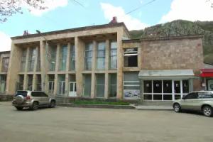
Yeghegnadzor is the cultural centre of Vayots Dzor Province. It has a cultural palace, a public library and an archaeological museum. The town's public park is home to a vishapakar (dragon stone) dating back to the 2nd millennium BC.
Fortresses and archaeological sites
- Areni-1 cave complex and the Winery of the Chalcolithic age,
- Smbataberd fortress of the 10th century,
- Proshaberd fortress of the 13th century,
- Ertij Fort of the 13th century,
- Agarakadzor bridge of the 13th century,
- Orbelian's Caravanserai of 1332.
Churches and monasteries
- Tanahat Monastery of 735,
- Saint Sion Monastery of the 8th century,
- Shativank monastery of the 10th century,
- Khotakerats Monastery of the 10th century,
- Tsakhats Kar Monastery, 10th-11th centuries,
- Noravank monastery, 10th-13th centuries,
- Gndevank monastery, 10th-13th centuries,
- Cathedral of the Holy Mother of God in Yeghegnadzor, 12th century,
- Noravank monastery of 1205,
- Spitakavor Monastery of 1321,
- Areni Church of 1321.
Transportation
The M-2 Motorway that connect Armenia from north to south, passes through the province. On the other hand, the towns of Yeghegnadzor are domestically connected through a number of well-developed roads.
The Jermuk airstrip is located near Jermuk, adjacent to the Kechut Reservoir.