Alif Atoll Ari
Description
Alif Alif Atoll (also known as Northern Ari Atoll or Ari Atholhu Uthuruburi) is an administrative division of the Maldives. It was created on March 1, 1984 combining northern section of Ari Atoll, the small Rasdhukuramathi Atoll, and the isolated island of Thoddoo. Many of the islands in this atoll have been inhabited since ancient times and have archaeological remains from the Maldivian Buddhist period.
The separation of Ari Atoll (formerly Alifu Atoll) into a Northern and a Southern section has formed the two most recent administrative divisions of the Maldives, namely Alifu Alifu Atoll and Alifu Dhaalu Atoll.
Geography
The North Ari Atoll administrative division consists of the northern part of the geographic or natural atoll Ari Atoll (described as Northern Ari Atoll in this context to differentiate from the official name of the administrative division), Rasdhukuramathi Atoll and Thoddoo Island. The atolls consists of Inhabited Islands and Uninhabited Island, a definition which includes resort islands, airport islands and industrial islands.
Inhabited islands
Name Population Coordinates Geographic Atoll/Island Remarks Bodufolhudhoo 586 4°11′7″N 72°46′23″E / 4.18528°N 72.77306°E / 4.18528; 72.77306 Northern Ari Atoll Feridhoo 413 4°3′3″N 72°43′31″E / 4.05083°N 72.72528°E / 4.05083; 72.72528 Northern Ari Atoll Himandhoo 667 3°55′15″N 72°44′38″E / 3.92083°N 72.74389°E / 3.92083; 72.74389 Northern Ari Atoll Maalhos 408 3°59′13″N 72°43′11″E / 3.98694°N 72.71972°E / 3.98694; 72.71972 Northern Ari Atoll Mathiveri 623 4°11′30″N 72°44′46″E / 4.19167°N 72.74611°E / 4.19167; 72.74611 Northern Ari Atoll Rasdhoo 949 4°15′46″N 72°59′31″E / 4.26278°N 72.99194°E / 4.26278; 72.99194 Rasdhukuramathi Atoll Capital of North Ari Atoll administrative division, known as Ross Atoll in the Admiralty Charts Thoddoo 2,023 4°26′20″N 72°57′31″E / 4.43889°N 72.95861°E / 4.43889; 72.95861 Thoddoo Island Ukulhas 921 4°12′53″N 72°51′50″E / 4.21472°N 72.86389°E / 4.21472; 72.86389 Northern Ari AtollMaalhos: Maalhos is geographically the westernmost island of the Atoll and the second-most westerly inhabited island of the Maldives after Maamakunudhoo). Vajrayana Buddhist remains have been found on this island.
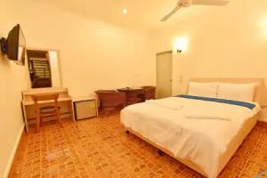
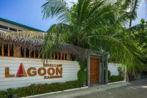
Rasdhoo: Rasdhoo is the capital island of the North Ari Atoll administrative division. It has ferry connections with Malé as well as the other inhabited islands of the atoll. The island has several guesthouses catering to tourists visiting inhabited islands rather than resort islands.
Resort islands
Resort islands are classified as Uninhabited Islands which have been converted to become resorts. The following are the resort islands, with the official name of the resort.
Name Resort Name Coordinates Geographic Atoll Remarks Bathalaa Bathala Island Resort 4°4′13″N 72°56′43″E / 4.07028°N 72.94528°E / 4.07028; 72.94528 Northern Ari Atoll Ellaidhoo Ellaidhoo Maldives 4°0′22″N 72°56′56″E / 4.00611°N 72.94889°E / 4.00611; 72.94889 Northern Ari Atoll Fesdhoo W Maldives 4°0′24″N 72°48′39″E / 4.00667°N 72.81083°E / 4.00667; 72.81083 Northern Ari Atoll Gaathafushi Gaathufushi Private Island 4°1′24″N 72°48′38″E / 4.02333°N 72.81056°E / 4.02333; 72.81056 Northern Ari Atoll Owned by W Maldives Gangehi Gangehi Island Resort 4°13′12″N 72°45′18″E / 4.22000°N 72.75500°E / 4.22000; 72.75500 Northern Ari Atoll Halaveli Constance Halaveli 4°2′17″N 72°55′9″E / 4.03806°N 72.91917°E / 4.03806; 72.91917 Northern Ari Atoll Kan'dholhudhoo Kandolhu Maldives 4°0′9″N 72°52′53″E / 4.00250°N 72.88139°E / 4.00250; 72.88139 Northern Ari Atoll Kudafolhudhoo Nika Island Resort 4°10′52″N 72°46′1″E / 4.18111°N 72.76694°E / 4.18111; 72.76694 Northern Ari Atoll Kuramathi Kuramathi Maldives 4°15′33″N 72°58′45″E / 4.25917°N 72.97917°E / 4.25917; 72.97917 Rasdhukuramathi Atoll Maayafushi Voi Maayafushi Resort 4°4′25″N 72°53′15″E / 4.07361°N 72.88750°E / 4.07361; 72.88750 Northern Ari Atoll Velidhoo Velidhoo Island Resort 4°11′41″N 72°49′6″E / 4.19472°N 72.81833°E / 4.19472; 72.81833 Northern Ari Atoll Veligandu Veligandu Island Resort 4°17′56″N 73°0′41″E / 4.29889°N 73.01139°E / 4.29889; 73.01139 Northern Ari AtollVeligandu: Veligandu covers 22 acres (8.9 ha) and it is 600 metres long. It is a holiday resort with 91 rooms and an excellent snorkelling reef. A large number of workers at the resort come from Sri Lanka and India. The island is linked to Male by seaplane services.