Khmelnytskyi Region
Description
Khmelnytskyi Oblast is an oblast (province) of western Ukraine. The administrative center of the oblast is the city of Khmelnytskyi.
The current estimated population is around 1,401,140 (as of 2004).
Geography
Khmelnytskyi Oblast has a total area of 20,600 km2 (7,953.70 sq mi) (3.4% of the total area of Ukraine) is located between 48°27' and 50°37' north latitude and between 26°09' and 27°56' east longitude. It is 220 km (136.70 mi) long when measured from north to south, and is 120 km (74.56 mi) in length when measured from east to west. The oblast borders the Rivne Oblast to the northwest, the Zhytomyr Oblast to the northeast, the Vinnytsia Oblast to the east, the Chernivtsi Oblast to the south, and the Ternopil Oblast to the west.
Elevations
The Podillia highland (270–370 meters above sea-level) occupies the central area of the Khmelnytskyi Oblast. The northwestern areas of the oblast are part of the Volyn highland (highest point — 329 m above sea-level), while to the north, the oblast claims a part of the historic region of Polissia (highest point — 200–250 m above sea-level). The southwestern territory of the Khmelnytskyi Oblast is crossed by the Tovtry range (Ukrainian: Товтровий кряж, translit. Tovtryi kryazh), which includes Mount Velyka Buhaikha (Ukrainian: Велика Бугаїха), the highest point of oblast at 409 m above sea-level. The extreme south of the oblast has a surface with the canyon-like river valleys. The Dneister Reservoir located there is the lowest point of the oblast (121 m above sea-level) .
Rivers and Lakes
There are 120 rivers with a length of 10 km (6.21 mi) or more in the Khmelnytskyi Oblast. The largest of these are the Dniester River (which flows for 160 km (99.42 mi) within the oblast), as well as its tributaries: Smotrych, Ushytsia, and the Zbruch — and the Southern Buh River (which flows for 120 km (74.56 mi) within the oblast), as well as its tributaries: Buzhok, Ikva, and Vovk. The rivers of the Dnieper River's basin — Horyn, Khmora, and Sluch Rivers also run through the oblast. The oblast's lakes are located mostly in basin of the Horyn River. The largest reservoir in the oblast is the Dniester Reservoir.
There are 1858 ponds and/or reservoirs in the oblast. The largest of these include Shchedrivske (with a surface area of 12.58 km²), Novostavske (with a surface area of 11.68 km²), and Kuzmynske (with a surface area of 7.65 km²).
History
Khmelnytskyi Oblast was created on September 22, 1937 as the Kamianets-Podilskyi Oblast (Ukrainian: Кам’янець-Подільськa область, translit., Kamyanets-Podil'ska oblast’). In March 1941 the administrative center of the oblast was moved from Kamianets-Podilskyi to the city of Proskuriv (now Khmelnytskyi). In 1954, Proskuriv was renamed Khmelnytskyi, and soon afterward, the oblast was renamed to Khmelnytskyi Oblast.
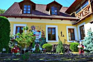
Attractions
- Kamyanets National historical-architectural preserve
- Medjybizh National historical-cultural preserve
- Samchyky State historical-cultural preserve
Nomenclature
Most of Ukraine's oblasts are named after their capital cities, officially referred to as "oblast centers" (Ukrainian: обласний центр, translit. oblasnyi tsentr). The name of each oblast is a relative adjective, formed by adding a feminine suffix to the name of respective center city: Khmelnytskyi is the center of the Khmelnyts’ka oblast’ (Khmelnytskyi Oblast).