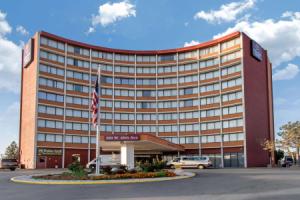
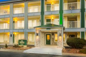
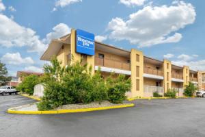
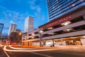
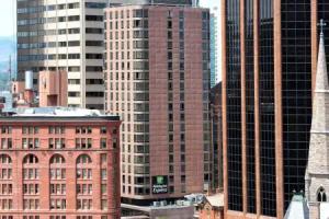
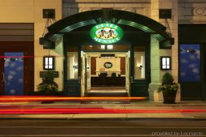
Denver
Description
Denver , officially the City and County of Denver, is the capital and most populous municipality of the U.S. state of Colorado. Denver is located in the South Platte River Valley on the western edge of the High Plains just east of the Front Range of the Rocky Mountains. The Denver downtown district is located immediately east of the confluence of Cherry Creek with the South Platte River, approximately 12 mi (19 km) east of the foothills of the Rocky Mountains. Denver is nicknamed the Mile-High City because its official elevation is exactly one mile (5,280 ft or 1,610 m) above sea level, making it one of the highest major cities in the United States. The 105th meridian west of Greenwich, the longitudinal reference for the Mountain Time Zone, passes directly through Denver Union Station.
Denver is ranked as a Beta- world city by the Globalization and World Cities Research Network. With a 2015 estimated population of 682,545, Denver ranks as the 19th-most populous U.S. city, and with a 2.8% increase in 2015, the city is also the fastest growing major city in the United States. The 10-county Denver-Aurora-Lakewood, CO Metropolitan Statistical Area had an estimated 2015 population of 2,814,330 and ranked as the 19th most populous U.S. metropolitan statistical area. The 12-city Denver-Aurora, CO Combined Statistical Area had an estimated 2015 population of 3,418,876, which ranks as the 16th most populous U.S. metropolitan area. Denver is the most populous city of the 18-county Front Range Urban Corridor, an oblong urban region stretching across two states with an estimated 2015 population of 4,757,713. Denver is the most populous city within a 500-mile (800 km) radius in the Mountain West and the second-most populous city in the Southwestern United States after Phoenix, Arizona. In 2016, Denver was named the best place to live in the USA by U.S. News & World Report.
History
Denver City was founded in November 1858 as a mining town during the Pike's Peak Gold Rush in western Kansas Territory. That summer, a group of gold prospectors from Lawrence, Kansas, had arrived and established Montana City on the banks of the South Platte River. This was the first settlement in what was later to become the city of Denver. The site faded quickly, however, and by the summer of 1859 it was abandoned in favor of Auraria (named after the gold mining town of Auraria, Georgia), and St. Charles City.
On November 22, 1858, General William Larimer, a land speculator from eastern Kansas Territory, placed cottonwood logs to stake a claim on the bluff overlooking the confluence of the South Platte River and Cherry Creek, across the creek from the existing mining settlement of Auraria, and on the site of the existing townsite of St. Charles. Larimer named the town site Denver City to curry favor with Kansas Territorial Governor James W. Denver. Larimer hoped that the town's name would help make it the county seat of Arapaho County, but unknown to him Governor Denver had already resigned from office. The location was accessible to existing trails and was across the South Platte River from the site of seasonal encampments of the Cheyenne and Arapaho. The site of these first towns is now the site of Confluence Park near downtown Denver. Larimer, along with associates in the St. Charles City Land Company, sold parcels in the town to merchants and miners, with the intention of creating a major city that would cater to new emigrants. Denver City was a frontier town, with an economy based on servicing local miners with gambling, saloons, livestock and goods trading. In the early years, land parcels were often traded for grubstakes or gambled away by miners in Auraria. In May 1859, Denver City residents donated 53 lots to the Leavenworth & Pike's Peak Express in order to secure the region's first overland wagon route. Offering daily service for "passengers, mail, freight, and gold," the Express reached Denver on a trail that trimmed westward travel time from twelve days to six. In 1863, Western Union furthered Denver's dominance of the region by choosing the city for its regional terminus.
The Colorado Territory was created on February 28, 1861, Arapahoe County was formed on November 1, 1861, and Denver City was incorporated on November 7, 1861. Denver City served as the Arapahoe County Seat from 1861 until consolidation in 1902. In 1867, Denver City became the Territorial Capital. With its new-found importance, Denver City shortened its name to Denver. On August 1, 1876, Colorado was admitted to the Union.
Although by the close of the 1860s, Denver residents could look with pride at their success establishing a vibrant supply and service center, the decision to route the nation's first transcontinental railroad through Cheyenne, rather than Denver, threatened the prosperity of the young town. A daunting 100 miles away, citizens mobilized to build a railroad to connect Denver to the transcontinental railroad. Spearheaded by visionary leaders including Territorial Governor John Evans, David Moffat, and Walter Cheesman, fundraising began. Within three days, $300,000 had been raised, and citizens were optimistic. Fundraising stalled before enough was raised, forcing these visionary leaders to take control of the debt-ridden railroad. Despite challenges, on June 24, 1870, citizens cheered as the Denver Pacific completed the link to the transcontinental railroad, ushering in a new age of prosperity for Denver.
Finally linked to the rest of the nation by rail, Denver prospered as a service and supply center. The young city grew during these years, attracting millionaires with their mansions, as well as the poverty and crime of a rapidly growing city. Denver citizens were proud when the rich chose Denver and were thrilled that Horace Tabor, the Leadville mining millionaire, built an impressive business block at 16th and Larimer as well as the elegant Tabor Grand Opera House. Luxurious hotels, including the much-loved Brown Palace Hotel, soon followed, as well as splendid homes for millionaires like the Croke, Patterson, Campbell Mansion at 11th and Pennsylvania and the now-demolished Moffat Mansion at 8th and Grant. Intent on transforming Denver into one of the world's great cities, leaders wooed industry and enticed laborers to work in these factories. Soon, in addition to the elite and a large middle class, Denver had a growing population of German, Italian, and Chinese laborers, soon followed by African-Americans and Spanish-surname workers. Unprepared for this influx, the Silver Crash of 1893 unsettled political, social, and economic balances, laying the foundation for ethnic bigotry, such as the Red Scare and the rise of the Ku Klux Klan, as well as corruption and crime.
Between 1880 and 1895 the city experienced a huge rise in corruption, as crime bosses, such as Soapy Smith, worked side by side with elected officials and the police to control elections, gambling, and the bunko gangs. The city also experienced a depression in 1893 after the crash of silver prices. In 1887, the precursor to the international charity United Way was formed in Denver by local religious leaders who raised funds and coordinated various charities to help Denver's poor. By 1890, Denver had grown to be the second-largest city west of Omaha, Nebraska. In 1900, whites represented 96.8% of Denver's population.
Between the 1880s and 1930s, Denver's floriculture industry developed and thrived. This period became known locally as the Carnation Gold Rush.
In 1901, the Colorado General Assembly voted to split Arapahoe County into three parts: a new consolidated City and County of Denver, a new Adams County, and the remainder of the Arapahoe County to be renamed South Arapahoe County. A ruling by the Colorado Supreme Court, subsequent legislation, and a referendum delayed the creation of the City and County of Denver until November 15, 1902.
Denver has hosted the Democratic National Convention twice, during the years of 1908, and again in 2008, taking the opportunity to promote the city's status on the national, political, and socioeconomic stage.
Early in the 20th century, Denver, like many other cities, was home to a pioneering Brass Era car company. The Colburn Automobile Company made cars copied from the contemporary Renault.
From 1953 to 1989, the Rocky Flats Plant, a DOE nuclear weapon facility formerly located about 15 miles from Denver, produced fissile plutonium "pits" for nuclear warheads. A major fire at the facility in 1957, as well as leakage from nuclear waste stored at the site between 1958 and 1968, resulted in the contamination of some parts of Denver, to varying degrees, with plutonium-239, a harmful radioactive substance with a half-life of 24,200 years. A study by the Jefferson County health director, Dr. Carl Johnson, in 1981 linked the contamination to an increase in birth defects and cancer incidence in central Denver and nearer Rocky Flats. Later studies confirmed many of his findings. Plutonium contamination was still present outside the former plant site as of August 2010, and presents risks to building the envisioned Jefferson Parkway, which would complete Denver's automotive beltway.
Denver was selected in 1970 to host the 1976 Winter Olympics to coincide with Colorado's centennial celebration, but in November 1972 Colorado voters struck down ballot initiatives allocating public funds to pay for the high costs of the games, which were subsequently moved to Innsbruck, Austria. The notoriety of becoming the only city ever to decline to host an Olympiad after being selected has made subsequent bids difficult. The movement against hosting the games was based largely on environmental issues and was led by State Representative Richard Lamm, who was subsequently elected to three terms (1975–87) as Colorado governor. Denver explored a potential bid for the 2022 Winter Olympics, but no bid will be submitted. In 2010, Denver adopted a comprehensive update of its zoning code. The new zoning was developed to guide development as envisioned in adopted plans such as Blueprint Denver, Transit Oriented Development Strategic Plan, Greenprint Denver, and the Strategic Transportation Plan.
Denver has also been known historically as the Queen City of the Plains and the Queen City of the West, because of its important role in the agricultural industry of the high-plains region in eastern Colorado and along the foothills of the Colorado Front Range. Several US Navy ships have been named USS Denver in honor of the city.
Geography
Denver is located in the center of the Front Range Urban Corridor, between the Rocky Mountains to the west and the High Plains to the east. Denver's topography consists of plains in the city center with hilly areas to the north, west and south. According to the United States Census Bureau the city has a total area of 155 square miles (401 km2), of which 153 square miles (396 km2) is land and 1.6 square miles (4.1 km2) (1.1%) is water. The City and County of Denver is surrounded by only three other counties: Adams County to the north and east, Arapahoe County to the south and east, and Jefferson County to the west.
Although Denver's nickname is the "Mile-High City" because its official elevation is one mile above sea level, defined by the elevation of the spot of a benchmark on the steps of the State Capitol building, the elevation of the entire city ranges from 5,130 to 5,690 feet (1,560 to 1,730 m). According to Geographic Names Information System (GNIS) and the National Elevation Dataset, the city's elevation is 5,278 feet (1,609 m), which is reflected on various websites such as that of the National Weather Service.
Neighborhoods
As of January 2013, the City and County of Denver has defined 78 official neighborhoods that the city and community groups use for planning and administration. Although the city's delineation of the neighborhood boundaries is somewhat arbitrary, it corresponds roughly to the definitions used by residents. These "neighborhoods" should not be confused with cities or suburbs, which may be separate entities within the metro area.
The character of the neighborhoods varies significantly from one to another and includes everything from large skyscrapers to houses from the late 19th century to modern, suburban style developments. Generally, the neighborhoods closest to the city center are denser, older and contain more brick building material. Many neighborhoods away from the city center were developed after World War II, and are built with more modern materials and style. Some of the neighborhoods even farther from the city center, or recently redeveloped parcels anywhere in the city have either very suburban characteristics or are new urbanist developments that attempt to recreate the feel of older neighborhoods. Most neighborhoods contain parks or other features that are the focal point for the neighborhood.
Denver does not have larger area designations, unlike the City of Chicago, which has larger areas that house the neighborhoods (IE: Northwest Side). Denver residents use the terms "north" "south" "east" and "west".
Denver also has a number of neighborhoods not reflected in the administrative boundaries. These neighborhoods may reflect the way people in an area identify themselves or they might reflect how others, such as real estate developers, have defined those areas. Well-known non-administrative neighborhoods include the historic and trendy LoDo (short for "Lower Downtown"), part of the city's Union Station neighborhood; Uptown, straddling North Capitol Hill and City Park West; Curtis Park, part of the Five Points neighborhood; Alamo Placita, the northern part of the Speer neighborhood; Park Hill, a successful example of intentional racial integration; and Golden Triangle, in the Civic Center.
Adjacent counties, municipalities and CDPs
North: Adams County, Berkley, Northglenn, Commerce City West: Jefferson County, Wheat Ridge, Lakeside, Mountain View, Edgewater, Lakewood, Dakota Ridge DenverEnclave: Arapahoe County, Glendale, Holly Hills Adams County
East: Aurora
Arapahoe County South: Arapahoe County, Bow Mar, Littleton, Sheridan, Englewood, Cherry Hills Village, Greenwood Village, Aurora
Culture and contemporary life
Apollo Hall opened quickly after the city's founding in 1859 and staged many plays for eager settlers. In the 1880s Horace Tabor built Denver's first Opera House. After the start of the 20th century, city leaders embarked on a city beautification program that created many of the city's parks, parkways, museums, and the Municipal Auditorium, which was home to the 1908 Democratic National Convention and is now known as the Ellie Caulkins Opera House. Denver and the metropolitan areas around it continued to support culture. In 1988, voters in the Denver Metropolitan Area approved the Scientific and Cultural Facilities Tax (commonly known as SCFD), a 1 cent sales tax that contributes money to various cultural and scientific facilities and organizations throughout the Metro area. The tax was renewed by voters in 1994 and 2004 and allows the SCFD to operate until 2018.
Denver is home to many nationally recognized museums, including a new wing for the Denver Art Museum by world-renowned architect Daniel Libeskind, the second largest Performing Arts Center in the nation after Lincoln Center in New York City and bustling neighborhoods such as LoDo, filled with art galleries, restaurants, bars and clubs. That is part of the reason why Denver was recently recognized for the third year in a row as the best city for singles. Denver's neighborhoods also continue their influx of diverse people and businesses while the city's cultural institutions grow and prosper. The city acquired the estate of abstract expressionist painter Clyfford Still in 2004 and built a museum to exhibit his works near the Denver Art Museum. The Denver Museum of Nature and Science currently holds an aquamarine specimen valued at over one million dollars, as well as specimens of the state mineral, rhodochrosite. Every September the Denver Mart, located at 451 E. 58th Avenue hosts a gem and mineral show. The state history museum, History Colorado Center, opened in April 2012. It features hands-on and interactive exhibits, artifacts and programs about Colorado history. It was named in 2013 by True West Magazine as one of the top-ten "must see" history museums in the country. History Colorado's Byers-Evans House Museum and the Molly Brown House are nearby.
Denver has numerous art districts around the city, including Denver's Art District on Santa Fe and the River North Art District (RiNo).
While Denver may not be as recognized for historical musical prominence as some other American cities, it still manages to have a very active pop, jazz, jam, folk, and classical music scene, which has nurtured several artists and genres to regional, national, and even international attention. Of particular note is Denver's importance in the folk scene of the 1960s and 1970s. Well-known folk artists such as Bob Dylan, Judy Collins and John Denver lived in Denver at various points during this time, and performed at local clubs. Also, three members of the widely popular group Earth, Wind, and Fire are from Denver. More recent Denver-based artists include The Lumineers, Air Dubai, The Fray, Flobots, Cephalic Carnage, Axe Murder Boyz, Deuce Mob, and Five Iron Frenzy.
Because of its proximity to the mountains and generally sunny weather, Denver has gained a reputation as being a very active, outdoor-oriented city. Many Denver residents spend the weekends in the mountains; skiing in the winter and hiking, climbing, kayaking, and camping in the summer.
Denver and surrounding cities are home to a large number of local and national breweries. Many restaurants in the region have on-site breweries, and some of the larger brewers offer tours, including Coors and New Belgium Brewing Company. The city also welcomes visitors from around the world when it hosts the annual Great American Beer Festival each fall.
Denver used to be a major trading center for beef and livestock when ranchers would drive (or later transport) cattle to the Denver Union Stockyards for sale. As a celebration of that history, for more than a century Denver has hosted the annual National Western Stock Show, attracting as many as 10,000 animals and 700,000 attendees. The show is held every January at the National Western Complex northeast of downtown.
Denver has one of the country's largest populations of Mexican Americans and hosts four large Mexican American celebrations: Cinco de Mayo (with over 500,000 attendees), in May, El Grito de la Independencia, in September, the annual Lowrider show, and the Dia De Los Muertos art shows/events in North Denver's Highland neighborhood, and the Lincoln Park neighborhood in the original section of West Denver.
Denver is also famous for its dedication to New Mexican cuisine and the chile. It's best known for its green and red chile sauce, Colorado burrito, Southwest (Denver) omelette, breakfast burrito, chiles rellenos, and tamales. Denver is also well known for other types of food such as Rocky Mountain oysters, rainbow trout, and the Denver sandwich.
The Dragon Boat Festival in July, Moon Festival in September and Chinese New Year are annual events in Denver for the Chinese and Asian residents. Chinese hot pot (huo guo) and Korean BBQ restaurants have been growing in popularity. The Denver area has 2 Chinese newspapers, the Chinese American Post and the Colorado Chinese News.
Denver is the setting for The Bill Engvall Show, and the 18th season of MTV's The Real World. It was also the setting for the prime time drama Dynasty from 1981 to 1989 (although the show was mostly filmed in Los Angeles). From 1998 to 2002 the city's Alameda East Veterinary Hospital was home to the Animal Planet series Emergency Vets, which spun off three one-off documentary specials and the current Animal Planet series E-Vet Interns. The city is also the setting for the Disney Channel Original TV Show, Good Luck Charlie.
Parks and recreation
As of 2006, Denver had over 200 parks, from small mini-parks all over the city to the giant 314 acres (1.27 km2) City Park. Denver also has 29 recreation centers providing places and programming for resident's recreation and relaxation.
Many of Denver's parks were acquired from state lands in the late 19th and early 20th centuries. This coincided with the City Beautiful movement, and Denver mayor Robert Speer (1904–12 and 1916–18) set out to expand and beautify the city's parks. Reinhard Schuetze was the city's first landscape architect, and he brought his German-educated landscaping genius to Washington Park, Cheesman Park, and City Park among others. Speer used Schuetze as well as other landscape architects such as Frederick Law Olmsted, Jr. and Saco Rienk DeBoer to design not only parks such as Civic Center Park, but many city parkways and tree-lawns. All of this greenery was fed with South Platte River water diverted through the city ditch.
In addition to the parks within Denver itself, the city acquired land for mountain parks starting in the 1911s. Over the years, Denver has acquired, built and maintained approximately 14,000 acres (57 km2) of mountain parks, including Red Rocks Park, which is known for its scenery and musical history revolving around the unique Red Rocks Amphitheatre. Denver also owns the mountain on which the Winter Park Resort ski area is operated in Grand County, 67 miles (110 km) west of Denver. City parks are important places for both Denverites and visitors, inciting controversy with every change. Denver continues to grow its park system with the development of many new parks along the Platte River through the city, and with Central Park and Bluff Lake Nature Center in the Stapleton neighborhood redevelopment. All of these parks are important gathering places for residents and allow what was once a dry plain to be lush, active, and green. Denver is also home to a large network of public community gardens, most of which are managed by Denver Urban Gardens, a non-profit organization.
Since 1974, Denver and the surrounding jurisdictions have rehabilitated the urban South Platte River and its tributaries for recreational use by hikers and cyclists. The main stem of the South Platte River Greenway runs along the South Platte from Chatfield Reservoir 35 miles (56 km) into Adams County in the north. The Greenway project is recognized as one of the best urban reclamation projects in the U.S., winning, for example, the Silver Medal Rudy Bruner Award for Urban Excellence in 2001.
In its 2013 ParkScore ranking, The Trust for Public Land, a national land conservation organization, reported that Denver had the 17th best park system among the 50 most populous U.S. cities.
Transportation
City streets
Most of Denver has a straightforward street grid oriented to the four cardinal directions. Blocks are usually identified in hundreds from the median streets, identified as "00", which are Broadway (the east–west median, running north–south) and Ellsworth Avenue (the north–south median, running east–west). Colfax Avenue, a major east–west artery through Denver, is 15 blocks (1500) north of the median. Avenues north of Ellsworth are numbered (with the exception of Colfax Avenue and several others, such as Martin Luther King, Jr. Blvd and Montview Blvd.), while avenues south of Ellsworth are named.
There is also an older downtown grid system that was designed to be parallel to the confluence of the South Platte River and Cherry Creek. Most of the streets downtown and in LoDo run northeast–southwest and northwest–southeast. This system has an unplanned benefit for snow removal; if the streets were in a normal N–S/E–W grid, only the N–S streets would receive sunlight. With the grid oriented to the diagonal directions, the NW–SE streets receive sunlight to melt snow in the morning and the NE–SW streets receive it in the afternoon. This idea was from Henry Brown the founder of the Brown Palace Hotel. There is now a plaque across the street from the Brown Palace Hotel which honors this idea. The NW–SE streets are numbered, while the NE–SW streets are named. The named streets start at the intersection of Colfax Avenue and Broadway with the block-long Cheyenne Place. The numbered streets start underneath the Colfax and I-25 viaducts. There are 27 named and 44 numbered streets on this grid. There are also a few vestiges of the old grid system in the normal grid, such as Park Avenue, Morrison Road, and Speer Boulevard. Larimer Street, named after William Larimer, Jr., the founder of Denver, which is located in the heart of LoDo, is the oldest street in Denver.
All roads in the downtown grid system are streets (e.g. 16th Street, Stout Street). Roads outside that system that travel east/west are given the suffix "avenue" and those that head north and south are given the "street" suffix (e.g. Colfax Avenue, Lincoln Street). Boulevards are higher capacity streets and travel any direction (more commonly north and south). Smaller roads are sometimes referred to as places, drives (though not all drives are smaller capacity roads, some are major thoroughfares) or courts. Most streets outside the area between Broadway and Colorado Boulevard are organized alphabetically from the city's center.
Many Denver streets have bicycle lanes, and there are over 850 miles of paved, off-road, bike paths in Denver parks and along bodies of water, like Cherry Creek and the South Platte. This allows for a significant portion of Denver's population to be bicycle commuters and has led to Denver being known as a bicycle friendly city. In addition to the many bike paths, Denver launched B-Cycle – a city-wide bicycle sharing program – in late April 2010. The B-Cycle network was the largest in the United States at the time of its launch, boasting 400 bicycles.
The Denver Boot, a car-disabling device was first used in Denver.
Cycling
The League of American Bicyclists has rated Colorado as the sixth most bicycle-friendly state in the nation for the year 2014. This is due in large part to Front Range cities like Boulder, Fort Collins and Denver placing an emphasis on legislation, programs and infrastructure developments that promote cycling as a mode of transportation. Walk score has rated Denver as the third most bicycle-friendly large city in the United States. Many Denver streets have bicycle lanes, and there are over 850 miles of paved, off-road, bike paths in Denver parks and along bodies of water, like Cherry Creek and the South Platte. This allows for a significant portion of Denver's population to be bicycle commuters and has led to Denver being known as a bicycle friendly city. According to data from the 2011 American Community Survey, Denver ranks 6th among US cities with populations over 400,000 in terms of the percentage of workers who commute by bicycle at 2.2% of commuters. In addition to the many bike paths, Denver launched B-Cycle – a city-wide bicycle sharing program – in late April 2010. The B-Cycle network was the largest in the United States at the time of its launch, boasting 400 bicycles. Through the acquisition of new grants, the program has continued to expand each year, adding dozens of new stations, hundreds of bikes, and by beginning service during the winter months.
Walkability
A 2011 study by Walk Score ranked Denver sixteenth most walkable of fifty largest U.S. cities.
Freeways and highways
Denver is primarily served by the interstate freeways I-25 and I-70. The intersection of the two interstates is referred to locally as "the mousetrap", because when viewed from the air, the junction (and subsequent vehicles) resemble mice in a large trap.
- Interstate 25 runs north–south from New Mexico through Denver to Wyoming
- Interstate 225 traverses neighboring Aurora. I-225 was designed to link Aurora with I-25 in the southeastern corner of Denver, and I-70 to the north of Aurora, with construction starting May 1964 and ending May 21, 1976.
- Interstate 70 runs east–west from Utah to Maryland.
- Interstate 270 runs concurrently with US 36 from an interchange with Interstate 70 in northeast Denver to an interchange with Interstate 25 north of Denver. The freeway continues as US 36 from the interchange with Interstate 25.
- Interstate 76 begins from I-70 just west of the city in Arvada. It intersects I-25 north of the city and runs northeast to Nebraska where it ends at I-80.
- US 6 follows the alignment of 6th Avenue west of I-25, and connects downtown Denver to the west-central suburbs of Golden and Lakewood. It continues west through Utah and Nevada to Bishop, California. To the east, it continues as far as Provincetown, on Cape Cod in Massachusetts.
- US 36 connects Denver to Boulder and Rocky Mountain National Park near Estes Park. It runs east into Ohio, after crossing four other states.
- State Highway 470 (C-470, SH 470) is the southwestern portion of the Denver metro area's beltway. Originally planned as Interstate 470 in the 1960s, the beltway project was attacked on environmental impact grounds and the interstate beltway was never built. The portion of "Interstate 470" that was built as a state highway is the present-day SH 470, which is a freeway for its entire length.
Denver also has a nearly complete beltway known as "the 470's". These are SH 470 (also known as C-470), a freeway in the southwest Metro area, and two toll highways, E-470 (from southeast to northeast) and Northwest Parkway (from terminus of E-470 to US 36). SH 470 was originally intended to be I-470 and built with federal highway funds, but the funding was redirected to complete conversion of downtown Denver's 16th Street to a pedestrian mall. As a result, construction was delayed until 1980 after state and local legislation was passed. I-470 was also once called "The Silver Stake Highway", from Gov. Lamm's declared intention to drive a silver stake through it and kill it.
A highway expansion and transit project for the southern I-25 corridor, dubbed T-REX (Transportation Expansion Project), was completed on November 17, 2006. The project installed wider and additional highway lanes, and improved highway access and drainage. The project also includes a light rail line that traverses from downtown to the south end of the metro area at Lincoln Avenue. The project spanned almost 19 miles (31 km) along the highway with an additional line traveling parallel to part of I-225, stopping just short of Parker Road.
Metro Denver highway conditions can be accessed on the Colorado Department of Transportation website Traffic Conditions.
Mass transportation
Mass transportation throughout the Denver metropolitan area is managed and coordinated by the Regional Transportation District (RTD). RTD currently operates more than 1,000 buses serving over 10,000 bus stops in 38 municipal jurisdictions in eight counties around the Denver and Boulder metropolitan areas. Additionally, RTD operates seven rail lines, the A, C, D, E, F, W, and H with a total of 57.9 miles (93.2 km) of track, serving 44 stations. All lines are light rail except the A, a commuter rail line. FasTracks is a light rail/bus/rail expansion project approved by voters in 2004 which will serve neighboring suburbs and communities. The W line, or West line, opened in April 2013 serving Golden/Federal Center.
CDOT runs a bus system named Bustang that offers weekday service between Union Station in Denver, Glenwood Springs, Colorado Springs, and Fort Collins.
Greyhound Lines, the intercity bus operator, has a major hub in Denver, with routes to New York City, Portland, Reno, Las Vegas, and their headquarters, Dallas. Subsidiary Autobuses Americanos provides service to El Paso. Allied bus operators Black Hills Trailways, and Burlington Trailways provide service to Billings, Omaha, Indianapolis, and Alamosa.
Amtrak, the national passenger rail system, provides service to Denver, operating its California Zephyr daily in both directions between Chicago and Emeryville, California, across the bay from San Francisco. Amtrak Thruway service operated by private bus companies links the Denver station with Rocky Mountain points.
At Albuquerque, New Mexico, Denver Thruway connections are made daily with the Amtrak Southwest Chief. Additionally, the Ski Train operated on the former Denver & Rio Grande Western Railroad, which took passengers between Denver and the Winter Park Ski Resort, but it is no longer in service. The Ski Train made its final run to Winter Park on March 29, 2009.
Denver's early years as a major train hub of the west are still very visible today. Trains stop in Denver at historic Union Station, where travelers can access RTD's 16th Street Free MallRide or use light rail to tour the city. Union Station will also serve as the main juncture for rail travel in the metro area, at the completion of FasTracks.
Airports
Denver International Airport (IATA: DEN, ICAO: KDEN), commonly known as DIA, serves as the primary airport for a large region surrounding Denver. DIA is located 18.6 miles (30 km) east-northeast of the Colorado State Capitol. DIA is the tenth busiest airport in the world and ranks fourth in the United States, with 51,245,334 passengers passing through it in 2008. It covers more than 53 square miles (137.3 km2), making it the largest airport by land area in the United States and larger than the island of Manhattan. Denver serves as a major hub for United Airlines, is the headquarters for Frontier Airlines, and is the fastest-growing focus city for Southwest Airlines.
Three general aviation airports serve the Denver area. Rocky Mountain Metropolitan Airport (KBJC) is 13.7 miles (22 km) north-northwest, Centennial Airport (KAPA) is 13.7 miles (22 km) south-southeast, and Front Range Airport (KFTG) is located 23.7 miles (38 km) east of the state capitol.
In the past, Denver has been home to several other airports that are no longer operational. Stapleton International Airport was closed in 1995 when it was replaced by DIA. Lowry Air Force Base was a military flight training facility that ceased flight operations in 1966, with the base finally being closed in 1994. It is currently being used for residential purposes. Buckley Air Force Base, a former Air National Guard base, is currently the only military facility in the Denver-Metro area.

