Gegharkunik Province
Description
Gegharkunik is a province (marz) of Armenia. Its capital and largest city is Gavar.
Gegharkunik Province is located at the eastern part of Armenia, bordering Azerbaijan. It includes the exclave of Artsvashen, which has been under Azerbaijani occupation since the First Nagorno-Karabakh War. With an area of 5,348 km2 (2,065 sq mi), Gegharkunik is the largest province in Armenia. However, approximately 24% or 1,278 km2 (493 sq mi) of its territory is covered by Lake Sevan, the largest lake in the South Caucasus and a major tourist attraction of the region.
The Yerevan-Sevan-Dilijan republican highway runs through the province.
Etymology and symbols
The early Armenian history Movses Khorenatsi connected the name of Gegharkunik with Gegham, a 5th-generation descendant of the legendary patriarch and founder of the Armenian nation Hayk. Gegham was the father of Sisak (founder of the Siunia dynasty) and Harma (grandfather of Ara the Beautiful). The Gegham Mountains and the Lake of Gegham (currently known as Lake Sevan) were also named after Gegham.
The region of Gegharkunik has been connected to Uelikuni/Uelikuhi, attested in Urartian sources as one of the local "kingdoms" conquered by Urartu in the eighth century BCE. The word "Uel" is believed to be an early (proto-Armenian) version of "Gegh" (proto-Indo European u corresponds with g in Armenian, l corresponds with the Armenian gh).
Armenian gull is the symbol of the province. It is depicted on the Gegharkunik coat of arms adopted on 4 May 2011, flying over the Lake Sevan and its peninsula, surrounded by the mountains of Sevan. The wheat ears on both sides of the coat of arms represent the agricultural characteristic of the province, while the opened book at the bottom represents the intellectual and cultural heritage of the region.
Geography
Gegharkunik Province occupies the east of the central part of modern-day Armenia. With an area of 5,349 km2 (18% of total area of Armenia), it is ranked first among the provinces of Armenia in terms of the total area.
Gegharkunik Province is situated at the east of modern-day Armenia, surrounding the Lake Sevan. Within Armenia, it borders Tavush Province to the north, Kotayk and Ararat provinces to the west and Vayots Dzor Province to the south. The Dashkasan, Gadabay and Kalbajar districts of Azerbaijan form the eastern border of the province. From 1993 to 2020, the province shared a border with the unrecognized Republic of Artsakh, when the Kalbajar District of Azerbaijan was administered as the Shahumyan Province of Artsakh. The Armenian exclave of Artsvashen in Gegharkunik Province is currently occupied and controlled by Azerbaijan.
Gegharkunik has a mountainous landscape. Its territory is dominated by the Gegham Mountains in the west, the Vardenis Mountains in the south, the Sevan Mountains in the east, the Miapor Mountains in the northeast and the Kenats Mountains in the north of the province. The height of the mountains ranges between 2500 and 3500 meters. Gegharkunik is separated from Vayots Dzor by the 82 kilometer-long Vardenis Mountains, where the highest point is Mount Vardenis at 3,522 meters. The highest point of the province is Mount Azhdahak of the Gegham Mountains with a height of 3597 meters in the western part of the range.
Lake Sevan occupies the central part of the province, lying at a height of 1900 meters above sea level and covering an area of 1260 km2 (around 23.5% of the area of Gegharkunik). The lake is the largest body of fresh water in Armenia and the entire South Caucasus. With a volume of around 32.92 billion m³ of water, Sevan is of a major environmental importance for the entire region. Getik, Gavaraget and Masrik are the main rivers of the province.
The climate of Gegharkunik is cold and snowy in winter, while the summer is characterized with warm and humid climate. The annual precipitation level ranges between 500 and 600 mm at below 2000 meters, while it may reach up to 1000 mm in the mountainous areas.
History
Historically, the current territory of the province mainly occupies the Gegharkunik and Sotk cantons of the Syunik province of Ancient Armenia, along with parts of Mazaz and Varazhnunik cantons of Ayrarat province.
From 1930 until 1995, modern-day Gegharkunik was divided into 5 raions within the Armenian SSR: Sevan raion, Kamo raion, Krasnoselsk raion, Martuni raion and Vardenis raion. With the territorial administration reform of 1995, the 5 raions were merged to form the Gegharkunik Province.
After the 2020 Nagorno-Karabakh war, the length of the province's border with Azerbaijan increased. Starting on 12 May 2021, Azerbaijani troops advanced into Gegharkunik province and established positions near the villages of Kut and Verin Shorzha, precipitating a border crisis between Armenia and Azerbaijan. On 25 May 2021, an Armenian soldier was killed by Azerbaijani fire in Gegharkunik, and two days later on 27 May, six Armenian soldiers were captured by Azerbaijani forces in Gegharkunik while carrying out engineering work near the border with Azerbaijan.
Culture
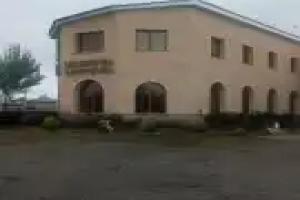
There are cultural palaces and many public libraries in the urban settlements of the province. A geological museum operates in Sevan on the basis of the Sevan Botanical Garden. Gavar is home to a history museum as well as drama theatre.
The cuisine of Gavar is closely related with the oriental cuisine elements, characterized with various spices, vegetables, fish, and fruits combination. One of the famous sweets of the town is the Kyavar baklava which is a many-layered pastry with tissue-thin sheets of phyllo dough, filled with nuts and sugar and finished with a dousing of hot honey.
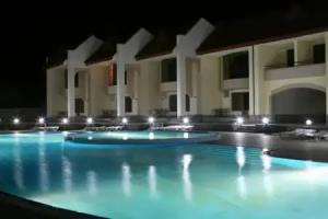
The summer presidential residence of Armenia is located at the Sevan Peninsula.
Fortresses and archaeological sites
- Mount Azhdahak Petroglyphs: A great number of prehistoric petroglyphs have been found in the surroundings of Mount Azhdahak. Most images depict men in scenes of hunting and fighting, as well as astronomical bodies and phenomena: the Sun, the Moon, constellations, the stellar sky, lightning, and many others.
- Lchashen Cyclopean Fortress: the site is home to an ancient settlement, a burial place and a cyclopean fortress dating back to the 4th millennium-7th century BC.
- Sevsar Ancient Astronomical Observatory: at the western slopes of Mount Sevsar, dating back to the 3rd-1st millennia BC. Recent studies suggest the birthplace of the naming of the constellations and the creation of the zodiac is in the Armenian plateau.
- Berdkunk Fortress of the 1st millennium BC
- Teyseba archaeological site of the Urartian period, 8th century BC
- Odzaberd fortress, 8th century BC
- Noratus cemetery of the 10th century
Churches and monasteries
- Shoghagavank Monastery of the 5th century
- Saint Thaddeus Church of Ddmashen, 7th century
- Hatsarat Monastery of the 7th century
- Sevanavank monastic complex of the 9th century
- Hayravank Monastery of the 9th century
- Makenyats Vank monastic complex of the 9th century
- Kotavank monastery of the Holy Mother of God, 9th century
- Surp Hovhannes Church of Tsaghkashen, 9th century
- Shoghagavank monastic complex of the 9th century
- Vanevan Monastery, opened in 903
Transportation
The province is connected with other parts of Armenia through the M-4, M-10 and M-14 Motorways. The M-11 Motorway that passes through Martuni and Vardenis connects the province with the town of Karvachar of the Nagorno-Karabakh Republic. The Vardenis-Martakert highway, the second highway connecting Armenia with Nagorno-Karabakh, was opened in September 2017. Part of the highway came under the control of Azerbaijan as a result of the 2020 Nagorno-Karabakh war and currently cannot be used by Armenians.
Sevan has a train station that connects the town with Yerevan through railway. The provincial centre Gavar has had an airstrip since the Soviet years, located to the north of the town.