Western Norway
Description
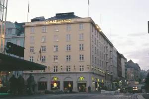
Western Norway is the region along the Atlantic coast of southern Norway. It consists of the counties Rogaland, Hordaland, Sogn og Fjordane, and Møre og Romsdal. The region has a population of approximately 1.3 million people. The largest city is Bergen and the second-largest is Stavanger. Agder, Vest-Telemark, Hallingdal, Valdres and northern parts of Gudbrandsdal have at times been included in Western Norway.
The area shares a common history with Denmark, the Faroe Islands and Iceland and to a lesser extent the Netherlands and Britain. For example, the Icelandic horse is a close relative of the Fjord horse and both the Faroese and Icelandic languages have similarities to the West Norwegian dialects.
Western Norway has also had much emigration to the United States, Canada, Iceland, the Faroe Islands and the United Kingdom. This applies particularly to the US states of Minnesota, North Dakota, Wisconsin, Montana, and South Dakota. The Icelandic and Faroese people, and many people in the British Isles, are descendants of Norsemen and Vikings who emigrated from Western Norway during the Viking Age. On the other hand, thousands of Western Norwegians are descendants of Dutch and German traders who arrived in the 16th and the 17th centuries, especially in Bergen.
Western Norway has the lowest unemployment rates, lowest crime rates, smallest public sector, fewest people on welfare and the most innovative economy in the country. It is generally regarded as Norway's most functional region.
History
Early history
Norway's history begins on the west coast, particularly in Rogaland. Excavations and rock art tells us that it was in Rogaland that the first humans settled in Norway, when the ice retreated after the last ice age ca. 10,000 years ago. There are many artifacts from the Stone Age in Rogaland. The preliminary oldest traces of humans are found in a settlement on Galta, Rennesøy, near the ferry terminal Mortavika and Vista on Randaberg. In the beginning there has been sure short visits by people from the south who hunted along the coast. It is thought that people came from Doggerland, the North Sea land area between Denmark and England, which disappeared when the ice retreated and sea levels rose. The people who lived there must now find a new land. Some retreated south again, while a few passed the Norwegian Trench (which was considerably smaller than now) in its hunt for deer and the new country.
Viking Age
The region includes most of the scope of the old Gulating, which was founded around the year 900. The Gulating Act divided the country into the Western counties, which consisted of the former småkongedømmene that existed in the area before the unification of the 800's and then was converted to jarle judge. These were Sunnmørafylke (Sunnmøre), Firda County (Fjordane), Sygna County (Sogn), Hordafylke (Hordaland), Rygjafylke (Rogaland) and Egdafylke (Agder).
Before the millennium, iron was introduced and used in agriculture, and there was a shortage of land to cultivate. In the same period, the kings’ power increased, and large tax claims caused many to seek freedom and fortune abroad. Many emigrated, and looting became an alternative source of income. Effective boats and weapons made the Vikings feared among contemporary Christian Europeans. But the images of Vikings as bloodthirsty plunderers are not always representative. The Vikings were involved in a wealthy merchant trade, not only in Europe but also including the Byzantine Empire and the Baghdad Caliphate.
Historically Vikings are often introduced with the Viking attack on Lindisfarne in 793, when they really made their mark in European history. The era ends with the Battle of Stamford Bridge in 1066. Vikings' seaworthiness and wanderlust resulted in new areas being developed. Norwegian settlers moved into the North Sea westward to Iceland, the Faroe Islands, Greenland, Shetland, Orkney, Isle of Mann and the Hebrides. Settlements were established in the southeast corner of Ireland including in Dublin, Waterford and Wexford. Norwegians settled along the northwest area of England, principally in the area of modern-day Cumbria. The Norwegian Vikings also discovered Vinland, present-day America, long before Christopher Columbus.
Christianization
Christianity (Catholicism) became the dominant religion in Norway in the 11th century, but the religion was probably known among Norwegians already in the 7th century.
While Eastern Norway was introduced to Christianity by missionaries and monks from Germany and Friesland, Western Norway was mainly introduced to the religion by English, Scottish, Irish people and Vikings who had converted to Christianity. Norse paganism existed in some areas in Western Norway until they were totally replaced by Christianity in the 13th century. The coastal areas were the first to introduce the new faith, and then the inland areas. Churches were planted everywhere.
Emigration to Iceland
The main source of information about the settlement period in Iceland is the Book of Settlements (Landnámabák), written in the 12th century, which gives a detailed account of the first settlers. According to this book, Western Norwegian sailors accidentally discovered the country. A few voyages of exploration were made soon after that and then the settlement started. Ingólfur Arnarson was said to be the first settler. He was a chieftain from Norway, arriving in Iceland with his family and dependents in 874. He built his farm in Reykjavík, the site of the present capital. During the next 60 years or so, Viking settlers from Scandinavia and also from Norse colonies in the British Isles—Ireland, Scotland and the Scottish Isles—settled in the country. There was therefore a Celtic element among the first inhabitants. The settlement of Iceland may also be viewed in the context of the general Viking expansion of the period, plausibly linked to population pressure in Western Norway and increasing scarcity of farming land.
It has thus left few traces in the archaeological record, nor has it contributed more than a handful of words to the Icelandic language, which was a Scandinavian dialect, more or less identical with the Viking Age Norse spoken in Western Norway, the Faroes, Shetland, Orkney, etc. Today it is estimated that 60% of the Icelandic population are descendants of people from Western Norway.
Emigration to America
More than 800,000 Norwegians have emigrated to the United States. The first organized group of emigrants left Stavanger on the sloop the Restoration on 4 July 1825. In 1837 the Ægir left Bergen as the first ship with emigrants from Hordaland. For a century emigration was a central aspect of Norwegian history.
The Emigration Center of Western Norway is a memorial to those who left and to their descendants. The emigrant archives now include 96,000 names of emigrants from the two counties of Hordaland and Sogn og Fjordane up to 1924. This has been possible thanks to the work of many years by Jahn Sjursen, who has also collected books and other publications, pictures and objects related to Norwegian emigrants in the United States. He officially donated his collections to the Emigration Center at the opening in 1997. The Center continues to receive publications and objects for its collection. Via the internet we are linked to the national digital records of emigrants from Norway to the United States that have been developed by the University of Bergen and the Bergen Public Archives. The Center's Emigrant Church was originally the Brampton Lutheran Church in Sargent County, North Dakota, built by Norwegian emigrants at the turn of the 19th century. The Brampton congregation was formed 1 July 1908. and 22 June 1996, the congregation donated their fully furnished church to the Emigration Center. It was taken down, transported to Sletta and reconstructed there by volunteers from Radøy. The church was reconsecrated by the Bishop of Bjørgvin, Ole Danholt Hagesæther, 6 July 1997.
Geography
Western Norway is the third largest region in Norway by area. It covering an area of about 22,592 square miles (58,512 square km).
The United Kingdom and the Faroe Islands lie to the west across the North Sea, while Denmark lies south of its southern tip across the North Sea. It is 675 km (419 mi) from the Faroe Islands to Western Norway while Unst in the Shetland Islands is about 300 km away. Western Norway has a 26 592 kilometers long coastline.
The southern part of the region is called Jæren. This is one of the major agricultural areas in Norway. Farms in other areas of Western Norway are often small. The total area of agricultural in Western Norway is 2 650 square kilometers, which is 5.3% of the total area in the region.
Western Norway is highly mountainous; in less than 10 kilometers from the Sognefjord, there are peaks that are over 2000 meters in height. The highest point is Store Skagastølstind (also known as Storen), which is 2,405 meters high. It is situated on the border between the municipality of Luster and Årdal and is part of the Hurrungane range. The summit is a popular destination for mountaineers but is fairly difficult. First ascent by William Cecil Slingsby on 21 July 1876. There are a number of different routes, the most popular being Heftye's renne (Heftye's couloir). Another popular route of ascent is via Andrew's renne (Andrew's couloir), first ascent A. W. Andrews and party in 1899. Store Skagastølstind and the mountaineering of the late 19th century in Norway is traditionally linked to the historical hotel Turtagrø.
There are many fjords in Western Norway, Hardangerfjorden, Boknafjorden and Sognefjorden is the longest. The Sognefjord (Sognefjorden) is the largest fjord in Norway, and the second longest in the world, after Scoresby Sund on Greenland. Located in Sogn og Fjordane it stretches 205 km (127 mi) inland to the small village of Skjolden.
Providing the most spectacular fjord and mountain scenery in Norway, the region has been a tourist mecca for centuries. Except for the Jæren plain located at the extreme southern end of the region, Vestlandet is mountainous, with the Jotunheim Mountains and the Hardanger Plateau being the highest areas. The Jostedals Glacier, the largest glacier in Europe, is located in the north-central part of the region, while Hardanger Icecap (Hardangerjøkulen) and the Folgefonna Glacier are smaller ice fields in the south. Norway's longest fjord, Sogn Fjord (128 miles [206 km]), located in the central part of the region, nearly divides Vestlandet in two; farther south Hardanger Fjord knives inland for 70 miles (110 km). Many waterfalls flow into the fjords, with the Syv Systre, Toka Gorge, and Vørings Falls (Vøringsfossen) among the most beautiful and best known. The rugged coastline is protected by thousands of offshore islands in a nearly continuous line. Occasionally, the northern parts of Møre og Romsdal are considered to be part of Trøndelag.
Statistics
Map references: Europe
Area:
total: 58,582 km2
Area – comparative: slightly larger than Croatia, but slightly smaller than West Virginia.
Coastline: 26,592 km
Maritime claims:
contiguous zone: 10 nmi (18.5 km; 11.5 mi)
continental shelf: 200 nmi (370.4 km; 230.2 mi)
exclusive economic zone: 200 nmi (370.4 km; 230.2 mi)
territorial sea: 12 nmi (22.2 km; 13.8 mi)
Physical geography
Rivers running westward acquired tremendous erosive power. Following fracture lines marking weaknesses in the Earth's crust, they dug out gorges and canyons that knifed deep into the jagged coast. To the east the land sloped more gently, and broader valleys were formed. During repeated periods of glaciation in the Great Ice Age of the Quaternary Period (i.e., about the last 2.6 million years), the scouring action of glaciers tonguing down the V-shaped valleys that were then part of the landscape created the magnificent U-shaped drowned fjords that now grace the western coast of Norway. Enormous masses of soil, gravel, and stone were also carried by glacial action as far south as present-day Denmark and northern Germany. The bedrock, exposed in about 40 percent of the area, was scoured and polished by the movements of these materials.
From the southernmost point a swelling complex of ranges, collectively called Langfjellene, runs northward to divide eastern Norway, or Østlandet, from western Norway. The narrow coastal zone of Vestlandet has many islands, and steep-walled, narrow fjords cut deep into the interior mountain region. The major exception is the wide Jæren Plain, south of Stavanger.
Glaciation and other forces wore down the surface and created thick sandstone, conglomerate, and limestone deposits known as sparagmite. Numerous extensive areas called peneplains, whose relief has been largely eroded away, also were formed. Remains of these include the Hardanger Plateau—3,000 feet (900 m) above sea level—Europe's largest mountain plateau, covering about 4,600 square miles (12,000 km2)
Terrain
Glaciated; mostly high plateaus and rugged mountains broken by fertile valleys; small, scattered plains; coastline deeply indented by fjords. Frozen ground all-year can also be found in the higher mountain areas. Numerous glaciers are still found in Western Norway.
Elevation extremes:
lowest point: North Sea 0 m
highest point: Store Skagastølstind 2,405 m
Geology
The deglaciation patterns of the Bergen and Nordfjord–Sunnmøre areas in western Norway are described and correlated. In the Bergen area the coast was first deglaciated at 12,600 B.P., with a succeeding re-advance into the North Sea around 12,200 B.P. Later, during the Allerød, the inland ice retreated at least 50 km, but nearly reached the sea again during the Younger Dryas re-advance, ending at 10,000 B.P. Sunnmøre was ice-free during an interstadial 28,000–38,000 B.P. Later the inland ice reached the sea. The final deglaciation is poorly dated in Sunnmøre, while further south in Nordfjord, it started slightly before 12,300 B.P., followed by a major retreat. No large re-advance of the inland ice occurred during the Younger Dryas. However, in the Sunnmøre–Nordfjord area many local glaciers formed outside the inland ice during the Younger Dryas. Limnic sediments outside one such cirque glacier have been cored and dated, proving that the glacier did not exist at 12,300–11,000 B.P., and that it was formed and disappeared in the time interval 11,000–10,000 B.P. (Younger Dryas). The erosion rate of the cirque glacier was 0.9 mm/year.
Flora and fauna
Western Norway has the same flora and fauna as the rest of Norway, but there are some major differences. While almost all red deer in Norway are found here, there are few moose. Reindeer are a common sight on the Hardangervidda and in other large mountain areas. The whole of the Hardangervidda is above the tree line. Its alpine climate means that many species of Arctic animals and plants are found here, further south than anywhere else in Europe. Its wild reindeer herds are among the largest in the world, with some 15,000 animals recorded in 1996 and about 8,000 in 2008. They migrate across the plateau during the year, moving from their winter grazing lands on the east side of the Hardangervidda, where they graze on lichen, to their breeding grounds in the more fertile west of the plateau.
30,000 years ago glaciers covered vast areas of the Northern Hemisphere. As so much water was trapped on land, in the form of glacial ice, the sea lay 120 metres below its present level. This meant that the North Sea was dry land, a treeless tundra, with long, winding rivers, endless stretches of boggy land and wide, sandy heaths. Only as far south as the Mediterranean and the Black Sea were there any forests.
As the climate slowly improved and the Scandinavian peninsula rose from the grip of the ice, plants and animals started to invade the new territory. As soon as there was dry land the first plants took root and with them came animals, birds and insects. The first of these were the Arctic animals such as wild reindeer, Arctic fox and wolverine (glutton), who followed the edge of the glacier up to the mountains. The trees came later, accompanied by a rich flora and fauna including bears, elk, marten, fox, hare, European beaver and otter.
This influx reached its climax around 3000 BC when the climate improved considerably, giving rise to the postglacial period of warmth. The average temperature rose 3 degrees. This may not sound very much, but in the mountains the tree line rises about 100 metres up the mountainside for each degree M so the consequences were dramatic. Most of the mountains of Western Norway which today occupy about three quarters of the land mass M became covered with dense forests of pine and birch. The glaciers had thawed and vanished, and extensive oak forests, not unlike those we see today in Central Europe, spread over the low-lying land. Life was hard for the animals and plants in the high mountains, as they were pressed up towards the highest peaks, which rose like islands from a sea of forest.
Along the west coast the winter is mild and snowfalls rare. Here are a number of the plants which cannot tolerate frost, for example the star hyacinth (scilla verna) and the purple heather (erica purpurea), which are otherwise only found in England, Ireland and further south. A little further inland we come upon the species which can withstand short periods of frost and snow in winter. These are found both a little further north, and in the fjords. Typical examples are the foxglove (digitalis purpurea) and the holly (ilex aquifolium), which in Norway grow only in the southwest.
Culture
Cuisine
Western Norway is famous for much of the cuisine in Norway. In its traditional form is based largely on the raw materials readily available in Norway and its mountains, wilderness and coast. It differs in many respects from its continental counterparts with a stronger focus on game and fish.
Modern Norwegian cuisine, although still strongly influenced by its traditional background, now bears the marks of globalization: Pastas, pizzas and the like are as common as meatballs and cod as staple foods, and urban restaurants sport the same selection you would expect to find in any western European city.
Lamb's meat and mutton is very popular in autumn, mainly used in fårikål (mutton stew with cabbage). Pinnekjøtt, cured and sometimes smoked mutton ribs that is steamed for several hours, is traditionally served as Christmas dinner in the western parts of Norway. Another Western specialty is smalahove, a smoked lamb's head.
Music
Music based on traditional Norwegian form usually includes minor or modal scales (sometimes mixed with major scales), making a sober and haunting sound. Pure major key dance music forms also exist. Prior to the 18th century, there is scant written record of what kind of music was played in Norway, but there is a large aural tradition. In 1380, Norway had come under Danish rule, and thus had no royal house or nobility of its own; as a result, for 450 years, Norway did not participate as much in the musical development which occurred in royal (or "cultured") circles throughout the rest of Europe. Religious and traditional (folk) music were dominant throughout this era in rural areas, though again scant records exist to document their nature. In the last half of the 20th century, Norway, like many other countries in the world, underwent a roots revival that saw indigenous music being revived.
The violinist Ole Bull (1810–1880) from Bergen was the first major Norwegian musician. He became world-famous starting in about 1834, and was known as the Nordic Paganini.
From about 1831, traditional Norwegian music began to influence the classical scene, especially through Ole Bull, who befriended the famous traditional Hardanger fiddle player Myllarguten and through the friendship gained better understanding of traditional music. Bull himself started playing the Hardanger fiddle, and was the first to present folk tunes to the public in urban areas. He also saw to that Myllarguten played with him in concert, presenting a rural traditional musician to an urban audience for the very first time, in February 1849, at the very height of Norwegian romantic nationalism. This later inspired Edvard Grieg to look for folk musical sources. But urban audiences were slow to gain an appreciation and understanding of traditional (rural) music.
Vamp is a band from Haugesund, which was started in 1991. The band's musical profile is a mix of Norwegian folk music, Celtic music and rock.
Leif Ove Andsnes, a pianist from Karmøy is one of the most famous pianist in the world.
Architecture
In the early Middle Ages, stave churches were constructed throughout Norway. Many of them remain to this day and represent Norway's most important contribution to architectural history. A fine example is The Stave Church at Urnes which is now on UNESCO's World Heritage List. Another notable example of wooden architecture is the Bryggen Wharf in Bergen, consisting of a row of narrow wooden structures along the quayside. At the beginning of the 20th century, the city of Ålesund was rebuilt in the Art Nouveau style. The 1930s, when functionalism dominated, became a strong period for Norwegian architecture, but it is only in recent decades that Norwegian architects have truly achieved international renown.
Art
Kitty Kielland, the sister to A. Kielland and Nikolai Astrup are famous painters from Western Norway. Brudeferden i Hardanger is the best known art from Western Norway. This is painted by the famous Norwegian painters Adolph Tidemand and Hans Gude.
Transport
Aviation
Of the 26 airports in Western Norway, 15 are public, and 11 are operated by the state-owned Avinor. Two airports have more than one million passengers annually. 41,089,675 passengers passed through Norwegian airports in 2007, of which 13,397,458 were international.
The regional airport service was introduced in the 1960s, with 30 airports being served by short take-off and landing aircraft. These are located mainly in Sogn og Fjordane, in areas with long distances to large cities and with too little traffic to support commercial flights. The airports, which typically have a 800 metres (2,600 ft) runway, are run by Avinor, while the airplanes are operated based on subsidized public service obligation contracts with the Norwegian Ministry of Transport and Communications. By far the largest contractor is Widerøe with their fleet of de Havilland Canada Dash 8 aircraft, but also Danish Air Transport, Lufttransport and Kato Air have won bids.
Rail transport
The main long-haul network consists of lines from Bergen eastwards to Voss and over the mountains to Oslo and a line connecting Stavanger to Oslo via Kristiansand. There is also a line from Åndalsnes in Romsdal to Oslo. In Bergen there is a funicular and a light rail line. There are also plans for a light rail system further south in the region of Nord-Jæren.
Road transport
The most important national routes are part of the European route scheme, and the most prominent are the E39 going north-south through the entire region. National and county roads are managed by the Norwegian Public Roads Administration.
The E39 road passes through the cities, connecting from Trondheim to Aalborg. The E16 road to Oslo passes through the Lærdalstunnelen, the longest road tunnel in the world.
Water transport
Fast ferries operate many places where fjords and islands make it quicker to follow the waterways than the roads; some small islands are served by water buses. Public transport by ship transported eight million passengers 273 million passenger kilometers in 2007 in whole the country. The Coastal Express (known as Hurtigruten) operates daily cruiseferries from Bergen to Kirkenes, calling at 35 ports. International cruiseferries operate from Bergen and Stavanger to the United Kingdom and Denmark.
The petroleum and natural gas production on the Norwegian continental shelf uses pipelines to transport produce to processing plants on mainland Norway and other European countries; total length is 9,481 kilometres (5,891 mi). The government-owned Gassco operates all natural gas pipelines; in 2006, 88 billion cubic meters were transported, or 15% of European consumption
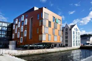
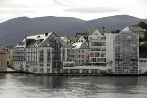
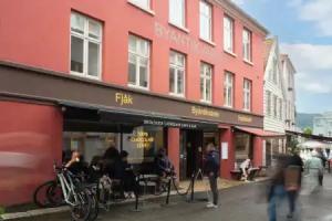
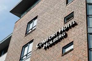
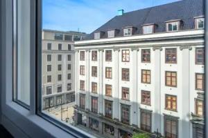
Cities
Western Norway has 22 cities/towns. Ranked by population:
- Bergen
- Stavanger
- Sandnes
- Ålesund
- Haugesund
- Molde
- Kristiansund
- Stord
- Egersund
- Førde
- Bryne
- Florø
- Åkrehamn
- Kopervik
- Jørpeland
- Odda
- Ulsteinvik
- Sauda
- Fosnavåg
- Skudeneshavn
- Måløy
- Åndalsnes