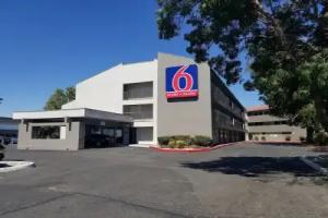
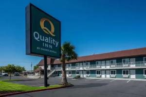
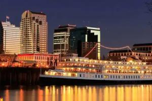
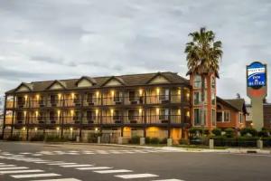
Sacramento

Description

Sacramento is the capital city of the U.S. state of California and the seat of Sacramento County. It is at the confluence of the Sacramento River and the American River in the northern portion of California's expansive Central Valley. Its estimated 2014 population of 485,199 made it the sixth-largest city in California, and the 35th largest city in the United States. Sacramento is the cultural and economic core of the Sacramento metropolitan area, which includes seven counties with a 2010 population of 2,414,783. Its metropolitan area is the fourth largest in California after the Greater Los Angeles area, the San Francisco Bay Area, and the San Diego metropolitan area, and is the 27th largest in the United States. In 2002, the Civil Rights Project at Harvard University conducted for TIME magazine named Sacramento "America's Most Diverse City".

Sacramento became a city through the efforts of the Swiss immigrant John Sutter, Sr., his son John Augustus Sutter, Jr., and James W. Marshall. Sacramento grew quickly thanks to the protection of Sutter's Fort, which was established by Sutter in 1839. During the California Gold Rush, Sacramento was a major distribution point, a commercial and agricultural center, and a terminus for wagon trains, stagecoaches, riverboats, the telegraph, the Pony Express, and the First Transcontinental Railroad.

The city was named after the Sacramento River, which forms its western border. The river was named by Spanish cavalry officer Gabriel Moraga for the Santísimo Sacramento (Blessed Sacrament), referring to the Catholic Eucharist.

California State University, Sacramento, more commonly known as Sacramento State or Sac State, is the largest university in the city and one of 23 campuses in the California State University system. University of the Pacific's Sacramento Campus is a private university with one of its three campuses in Sacramento. In addition, the University of California, Davis, is in nearby Davis, 15 miles (24 km) west of the capital. The UC Davis Medical Center, a world-renowned research hospital, is located in the city of Sacramento.

History

Indigenous culture

Nisenan (Southern Maidu) and Plains Miwok Native Americans had lived in the area for perhaps thousands of years. Unlike the settlers who would eventually make Sacramento their home, these Native Americans left little evidence of their existence. Traditionally, their diet was dominated by acorns taken from the plentiful oak trees in the region, and by fruits, bulbs, seeds, and roots gathered throughout the year.

Spanish exploration

In 1808, the Spanish explorer Gabriel Moraga discovered and named the Sacramento Valley and the Sacramento River. A Spanish writer with the Moraga expedition wrote: "Canopies of oaks and cottonwoods, many festooned with grapevines, overhung both sides of the blue current. Birds chattered in the trees and big fish darted through the pellucid depths. The air was like champagne, and (the Spaniards) drank deep of it, drank in the beauty around them. "Es como el sagrado sacramento! (It's like the Blessed Sacrament.)" The valley and the river were then christened after the "Most Holy Sacrament of the Body and Blood of Christ", referring to the Catholic sacrament of the Eucharist.

Mexican Period: Sutter's Fort and New Helvetia

John Sutter first arrived on August 13, 1839 at the divergence of the American and Sacramento Rivers with a Mexican land grant of 50,000 acres. The next year, he and his party established Sutter's Fort, a massive adobe structure with walls eighteen feet high and three feet thick.

Representing Mexico, Sutter called his colony New Helvetia, a Swiss inspired name, and was the political authority and dispenser of justice in the new settlement. Soon, the colony began to grow as more and more pioneers headed west. Within just a few short years, John Sutter had become a grand success, owning a ten-acre orchard and a herd of thirteen thousand cattle. Fort Sutter became a regular stop for the increasing number of immigrants coming through the valley. In 1847, Sutter hired James Marshall to build a sawmill so that he could continue to expand his empire.

From pioneers to gold fever

Sutter received 2,000 fruit trees in 1847, which started the agriculture industry in the Sacramento Valley. In 1848, when gold was discovered by James W. Marshall at Sutter's Mill in Coloma (located some 50 miles (80.5 km), northeast of the fort), a large number of gold-seekers came to the area, increasing the population. John Sutter, Jr. then planned the City of Sacramento 2 miles south of New Helvetia, in association with Sam Brannan against the wishes of his father, naming the city after the Sacramento River for commercial reasons. He hired topographical engineer William H. Warner to draft the official layout of the city, which included 26 lettered and 31 numbered streets (today's grid from C St. to Broadway and from Front St. to Alhambra Blvd.). However, a bitterness grew between the elder Sutter and his son as Sacramento became an overnight commercial success (Sutter's Fort, Mill and the town of Sutterville, all founded by John Sutter, Sr., would eventually fail).

The citizens of Sacramento adopted a city charter in 1849, which was recognized by the state legislature in 1850. Sacramento is the oldest incorporated city in California, incorporated on February 27, 1850. During the early 1850s the Sacramento valley was devastated by floods, fires and cholera epidemics. Despite this, because of its position just downstream from the Mother Lode in the Sierra Nevada, the new city grew, quickly reaching a population of 10,000.

Remnants of downtown Sacramento's Chinatown

Throughout the early 1840s and 1850s, China was at war with Great Britain and France in the First and Second Opium Wars. The wars, along with endemic poverty in China, helped drive many Chinese immigrants to America. Many first came to San Francisco, which was then the largest city in California, which was known as "Dai Fow" (The Big City) and some came eventually to Sacramento (then the second-largest city in California), which is known as "Yee Fow" (Second City). Many of these immigrants came in hopes for a better life as well as the possibility of finding gold in the foothills east of Sacramento.

Sacramento's Chinatown was located on "I" Street from Second to Sixth Streets. At the time this area of "I" Street was considered a health hazard as, lying within a levee zone it was lower than other parts of the city which were situated on higher land. Throughout Sacramento's Chinatown history there were fires, acts of discrimination, and prejudicial legislation such as the Chinese Exclusion Act that was not repealed until 1943. The mysterious fires were thought to be set off by those who did not take a liking to the Chinese working class. Ordinances on what was viable building material were set into place to try to get the Chinese to move out. Newspapers such as The Sacramento Union, at the time, wrote stories that portrayed the Chinese in an unfavorable light to inspire ethnic discrimination and drive the Chinese away. As the years passed, a railroad was created over parts of the Chinatown and further politics and laws would make it even harder for Chinese workers to sustain a living in Sacramento. While the east side of the country fought for higher wages and fewer working hours, many cities in the western United States wanted the Chinese out because of the belief that they were stealing jobs from the white working class.

The Chinese remained resilient despite these efforts. They built their buildings out of bricks just as the building guidelines established. They helped build part of the railroads that span the city as well as making a great contribution to the transcontinental railroad that spans the United States. They also helped build the levees within Sacramento and the surrounding cities. As a result, they are a well-recognized part of Sacramento's history and heritage.

While most of Sacramento's Chinatown has now been razed, a small Chinatown mall remains, as well as a museum dedicated to the history of Sacramento's Chinatown and the contributions Chinese Americans have made to the city. Amtrak sits along what was part of Sacramento's Chinatown "I" Street.

Capital city

The California State Legislature, with the support of Governor John Bigler, moved to Sacramento in 1854. The capital of California under Spanish (and, subsequently, Mexican) rule had been Monterey, where in 1849 the first Constitutional Convention and state elections were held. The convention decided that San Jose would be the new state's capital. After 1850, when California's statehood was ratified, the legislature met in San Jose until 1851, Vallejo in 1852, and Benicia in 1853, before moving to Sacramento. In the 1879 Constitutional Convention, Sacramento was named to be the permanent state capital.

Begun in 1860 to be reminiscent of the United States Capitol in Washington, D.C., the Classical Revival style California State Capitol was completed in 1874. In 1861, the legislative session was moved to the Merchants Exchange Building in San Francisco for one session because of massive flooding in Sacramento. The legislative chambers were first occupied in 1869 while construction continued. From 1862 to 1868, part of the Leland Stanford Mansion was used for the governor's offices during Stanford's tenure as the Governor; and the legislature met in the Sacramento County Courthouse.

With its new status and strategic location, Sacramento quickly prospered and became the western end of the Pony Express. Later it became a terminus of the First Transcontinental Railroad, which began construction in Sacramento in 1863 and was financed by "The Big Four"—Mark Hopkins, Charles Crocker, Collis P. Huntington, and Leland Stanford.

In 1850 and again in 1861, Sacramento citizens were faced with a completely flooded town. After the devastating 1850 flood, Sacramento experienced a cholera epidemic and a flu epidemic, which crippled the town for several years. In 1861, Governor Leland Stanford, who was inaugurated in early January 1861, had to attend his inauguration in a rowboat, which was not too far from his house in town on N street. The flood waters were so bad, the legend says, that when he returned to his house, he had to enter into it through the second floor window. From 1862 until the mid-1870s Sacramento raised the level of its downtown by building reinforced brick walls on its downtown streets, and filling the resulting street walls with dirt. Thus the previous first floors of buildings became the basements, with open space between the street and the building, previously the sidewalk, now at the basement level. Most property owners used screw jacks to raise their buildings to the new grade. The sidewalks were covered, initially by wooden sidewalks, then brick barrel vaults, and eventually replaced by concrete sidewalks. Over the years, many of these underground spaces have been filled or destroyed by subsequent development. However, it is still possible to view portions of the "Sacramento Underground".

The same rivers that earlier brought death and destruction began to provide increasing levels of transportation and commerce. Both the American and especially Sacramento rivers would be key elements in the economic success of the city. In fact, Sacramento effectively controlled commerce on these rivers, and public works projects were funded though taxes levied on goods unloaded from boats and loaded onto rail cars in the historic Sacramento Rail Yards. Now both rivers are used extensively for recreation. The American River is a 5-mph (8-km/h) waterway for all power boats (including jet-ski and similar craft) (Source Sacramento County Parks & Recreation) and has become an international attraction for rafters and kayaking.

The Sacramento River sees many boaters, who can make day trips to nearby sloughs or continue along the Delta to the Bay Area and San Francisco. The Delta King, a paddlewheel steamboat which for eighteen months lay on the bottom of the San Francisco Bay, was refurbished and now boasts a hotel, a restaurant, and two different theaters for nightlife along the Old Sacramento riverfront.

Modern era

The city's current charter was adopted by voters in 1920. As a charter city, Sacramento is exempt from many laws and regulations passed by the state legislature. The city has expanded continuously over the years. The 1964 merger of the City of North Sacramento with Sacramento substantially increased its population, and large annexations of the Natomas area eventually led to significant population growth throughout the 1970s, 1980s, and 1990s.

Sacramento County (along with a portion of adjacent Placer County) is served by a customer-owned electric utility, the Sacramento Municipal Utility District (SMUD). Sacramento voters approved the creation of SMUD in 1923. In April 1946, after 12 years of litigation, a judge ordered Pacific Gas & Electric to transfer title of Sacramento's electric distribution system to SMUD. Today SMUD is the sixth-largest public electric utility in the U.S., and is a leader for innovative programs and services, including the development of clean fuel resources, such as solar power. The year following the creation of SMUD, 1924, brought several events in Sacramento: Standard Oil executive Verne McGeorge established McGeorge School of Law, American department store Weinstock & Lubin opened a new store at 12th and K street, the US$2 million Senator Hotel was open, Sacramento's drinking water became filtered and treated drinking water, and Sacramento boxer Georgie Lee fought Francisco Guilledo, a Filipino professional boxer known as Pancho Villa, at L Street Auditorium on March 21.

Wikimedia Commons has media related to Japanese American internment processing in Sacramento.

Early in World War II, the Sacramento Assembly Center (also known as the Walerga Assembly Center) was established to house Japanese Americans forcibly "evacuated" from the West Coast under Executive Order 9066. The camp was one of fifteen temporary detention facilities where over 110,000 Japanese Americans, two-thirds of them U.S. citizens, were held while construction on the more permanent War Relocation Authority camps was completed. The assembly center was built on the site of a former migrant labor camp, and inmates began arriving from Sacramento and San Joaquin Counties on May 6, 1942. It closed after only 52 days, on June 26, and the population of 4,739 was transferred to the Tule Lake concentration camp. The site was then turned over to the Army Signal Corps and dedicated as Camp Kohler. After the war and the end of the incarceration program, returning Japanese Americans were often unable to find housing and so 234 families temporarily lived at the former assembly center. Camp Kohler was destroyed by a fire in December 1947, and the assembly center site is now part of the Foothill Farms-North Highlands subdivision.

The Sacramento-Yolo Port District was created in 1947, and ground was broken on the Port of Sacramento in 1949. On June 29, 1963, with 5,000 spectators waiting to welcome her, the Motor Vessel Taipei Victory arrived. The port was open for business. The Nationalist Chinese flagship, freshly painted for the historic event, was loaded with 5,000 tons of bagged rice for Mitsui Trading Co. bound for Okinawa and 1,000 tons of logs for Japan. She was the first ocean-going vessel in Sacramento since the steamship Harpoon in 1934. The Port of Sacramento has been plagued with operating losses in recent years and faces bankruptcy. This severe loss in business is due to the heavy competition from the Port of Stockton, which has a larger facility and a deeper channel. As of 2006, the city of West Sacramento took responsibility for the Port of Sacramento. During the Vietnam War era, the Port of Sacramento was the major terminus in the supply route for all military parts, hardware and other cargo going into Southeast Asia.

In 1967, Ronald Reagan became the last Governor of California to live permanently in the city. A new executive mansion, constructed by private funds in a Sacramento suburb for Reagan, remained vacant for nearly forty years and was recently sold by the state.

The 1980s and 1990s saw the closure of several local military bases: McClellan Air Force Base, Mather Air Force Base, and Sacramento Army Depot. In 1980, there was another flood. The flood's damage affected the "boat section" of Interstate 5. The culmination of a series of storms as well as a faulty valve are believed to have caused this damage.

In the early 1990s, Mayor Joe Serna attempted to lure the Los Angeles Raiders football team to Sacramento, selling $50 million in bonds as earnest money. When the deal fell through, the bond proceeds were used to construct several large projects, including expanding the Sacramento Convention Center Complex and refurbishing of the Memorial Auditorium. Serna renamed a city park for migrant worker rights activist Cesar Chavez. Through his effort, Sacramento became the first major city in the country to have a paid municipal holiday honoring Chavez.

In spite of military base closures and the decline of agricultural food processing, Sacramento has continued to experience population growth in recent years. Primary sources of population growth are an influx of residents from the nearby San Francisco Bay Area, as well as immigration from Asia and Latin America. From 1990 to 2000, the city's population grew by 14.7%. The Census Bureau estimates that from 2000 to 2007, the county's population increased by nearly 164,000 residents.

In the late 1990s and early 2000s (decade), Mayor Heather Fargo made several abortive attempts to provide taxpayer financing of a new sports arena for the Maloof brothers, owners of the Sacramento Kings NBA Basketball franchise. In November 2006, Sacramento voters soundly defeated a proposed sales tax hike to finance the plan. The defeat was due in part to competing plans for the new arena and its location.

In 2002, Time magazine featured an article recognizing Sacramento as the most diverse and integrated city in America.

Despite a devolution of state bureaucracy, the state government remains by far Sacramento's largest employer. The City of Sacramento expends considerable effort to keep state agencies from moving outside the city limits. In addition, many federal agencies have offices in Sacramento.

The California Supreme Court normally sits in nearby San Francisco.

Geography and climate

Geography

According to the United States Census Bureau, the city covers an area of 100.1 square miles (259 km2), 97.81% of it land, and 2.19% of it water.

Depth to groundwater is typically about 30 feet (9 m). Much of the land to the west of the city (in Yolo County) is permanently reserved for a vast flood control basin (the Yolo Bypass), due to the city's historical vulnerability to floods. As a result, the greater metropolitan area sprawls only four miles (6 km) west of downtown (as West Sacramento, California) but 30 miles (48 km) northeast and east, into the Sierra Nevada foothills, and 10 miles (16 km) to the south into valley farmland.

The city is located at the confluence of the Sacramento River and the American River, and has a deep-water port connected to the San Francisco Bay by a channel through the Sacramento–San Joaquin River Delta. It is the shipping and rail center for the Sacramento Valley. Food processing is among the major industries in the area.

Culture and arts

Old Sacramento

The oldest part of the town besides Sutter's Fort is Old Sacramento, which consists of cobbled streets and many historic buildings, several from the 1850s and 1860s. Buildings have been preserved, restored or reconstructed, and the district is now a substantial tourist attraction, with rides on steam-hauled historic trains and paddle steamers.

The historic buildings include the Lady Adams Building, built by the passengers and ship's carpenters of the ship Lady Adams. Having survived the Great Conflagration of November 1852, it is the oldest surviving building in Sacramento other than Sutter's Fort.

Another surviving landmark is the B.F. Hastings building, built in 1853. Early home of the California Supreme Court and the location of the office of Theodore Judah, it also was the western terminus of the Pony Express.

The "Big Four Building", built in 1852, was home to the offices of Collis Huntington, Mark Hopkins, Leland Stanford, and Charles Crocker. The Central Pacific Railroad and Southern Pacific Railroad were founded there. The original building was destroyed in 1963 for the construction of Interstate 5, but was re-created using original elements in 1965. It is now a National Historic Landmark. Also of historic interest is the Eagle Theatre (Sacramento, California), a reconstruction of California's first permanent theatre in its original location.

Theater arts

There are several major theatre venues for Sacramento. The Sacramento Convention Center Complex governs both the Community Center Theatre and Memorial Auditorium. The Wells Fargo Pavilion is the most recent addition in 2003. It is built atop the old Music Circus tent foundations. Next to that is the McClatchy Main stage, originally built as a television studio, which was renovated at the same time the pavilion was built. It is the smaller of the venues and provides seating for only 300. The Sacramento Ballet, Sacramento Philharmonic Orchestra and the Sacramento Opera perform at the Community Center Theater.

Professional theatre is represented in Sacramento by a number of companies. California Musical Theatre and its Summer stock theatre, Music Circus, lure many directors, performers, and artists from New York and Los Angeles to work alongside a large local staff for their productions at the Wells Fargo Pavilion.

During the fall, winter and spring seasons Broadway Sacramento brings bus and truck tours to the Community Center Theater. At the B Street Theatre, smaller and more intimate professional productions are performed as well as a children's theatre that will soon be opening a larger theatre complex in the heart of midtown in 2014. Rounding out the professional companies is Capital Stage, which performed aboard the Delta King until the end of the 2010–2011 season and soon took up residence at its own venue along the J-Street corridor.

The Sacramento area has one of the largest collection of community theatres in California. Some of these include the Thistle Dew Dessert Theatre and Playwrights Workshop, Davis Musical Theatre Co., El Dorado Musical Theatre, Runaway Stage Productions, River City Theatre Company, Flying Monkey Productions, The Actor's Theatre, KOLT Run Productions, Kookaburra Productions, Big Idea Theatre, Celebration Arts, Lambda Player, Light Opera Theatre of Sacramento, Synergy Stage and the historic Eagle Theatre. The Sacramento Shakespeare Festival provides entertainment under the stars every summer in William Land Park. Many of these theatres compete annually for the Elly Awards overseen by The Sacramento Area Regional Theatre Alliance or SARTA.

Visual arts

The Sacramento Metropolitan Arts Commission is an organization which was established as the Sacramento arts council in 1977 to provide several arts programs for the city. These include Art in Public Places, Arts Education, Grants and Cultural Programs, Poet Laureate Program, Arts Stabilization Programs and Other Resources and opportunities.

Sacramento Second Saturday Art Walk is a program of local art galleries that stay open into the late evenings every second Saturday of each month, providing a unique experience for the local population as well as tourists to view original art and meet the artists themselves.

Museums

Sacramento has several major museums. The Crocker Art Museum is the oldest public art museum west of the Mississippi River. On July 26, 2007, the Museum broke ground for an expansion that more than tripled the Museum's floor space. The modern architecture is very different from the Museum's original Victorian style building. Construction was completed in 2010.

Also of interest is the Governor's Mansion State Historic Park, a large Victorian Mansion which was home to 13 of California's Governors. The Leland Stanford Mansion State Historic Park, which was completely restored in 2006, serves as the State's official address for diplomatic and business receptions. Guided public tours are available. The California Museum for History, Women, and the Arts, home of the California Hall of Fame, is a cultural destination dedicated to telling the rich history of California and its unique influence on the world of ideas, innovation, art and culture. The Museum educates tens of thousands of school children through inspiring programs, sharing with world visitors California's rich art, history and cultural legacy through dynamic exhibits, and serving as a public forum and international meeting place. The California State Railroad Museum in Old Sacramento has historical exhibits and live steam locomotives that patrons may ride. The California Automobile Museum, located just south of Old Sacramento, is filled with automotive history and vehicles from 1880 to 2006 and is the oldest non-profit automotive museum in the West. The mission of it is to preserve, promote, and teach automotive culture and its influence on our lives—past, present and future. In addition, the Sacramento History Museum, in the heart of Old Sacramento, focuses on the history of Sacramento from the region's pre-Gold Rush history through the present day.

There is a Museum Day held in Sacramento every year, when 26 museums in the greater Sacramento area offer free admission. The 2009 Sacramento Museum Day brought out more than 80,000 people, the largest number the event has gathered. Sacramento Museum Day is held every year on the first Saturday of February.

Music

Tower Records was started and based in Sacramento until its closing.

Classical music is widely available. The Sacramento Philharmonic Orchestra, the Sacramento Baroque Soloists, the Sacramento Choral Society & Orchestra, the Sacramento Youth Symphony, the Sacramento Master Singers, the Sacramento Children's Chorus, and the Camellia Symphony each present a full season of concerts.

Each year, the city hosts the Sammies, the Sacramento Music Awards. Sacramento also has a reputation as a center for Dixieland jazz, because of the Sacramento Jazz Jubilee which is held every Memorial Day weekend. Events and performances are held in multiple locations throughout the city. Each year thousands of jazz fans from all over the world visit for this one weekend.

A growing number of hardcore and metal bands hail from the Sacramento area, including Deftones, Papa Roach, Will Haven, Trash Talk, Dance Gavin Dance, A Lot Like Birds, and Far. Alternative rock bands CAKE, !!!, and Pilgrim hail from Sacramento as do rock bands Tesla, Oleander and Steel Breeze plus some other famous musicians like record producer and recording artist Charlie Peacock, Bob Stubbs of Social Distortion and Craig Chaquico of Jefferson Starship.

Scottish pop band Middle of the Road sung kindly of Sacramento in their 1972 European hit song "Sacramento". Experimental groups such as Hella, Death Grips, and Tera Melos also come out of Sacramento.

Food

In 2012, Sacramento started the marketing campaign as "America's Farm-to-Fork Capital" due to Sacramento's many restaurants that source their food locally from the numerous surrounding farms. In 2012, The Kitchen was nominated for Outstanding Restaurant by the James Beard Foundation. Sacramento is also known for its beverage culture, with keystone events that include Cal Expo's Grape and Gourmet, Sacramento Beer Week, and Sacramento Cocktail Week. Sacramento is home to well-known cookbook authors, Biba Caggiano of Biba's Restaurant and Mai Pham of Lemongrass and Star Ginger.

Parks and recreation

Sacramento boasts an extensive park system consisting of over 5,000 acres (2,023 ha) of parkland and recreation centers. The city features a collection of smaller parks in the Downtown districts, including Crocker Park, Pioneer Landing and Southside Park. Popular parks outside the central core include American River Parkway which spans 23 miles along the American River, and William Land Park.

In its 2013 ParkScore ranking, The Trust for Public Land reported that Sacramento was tied with San Francisco and Boston for having the 3rd best park system among the 50 most populous U.S. cities. ParkScore ranks city park systems by a formula that analyzes the city's median park size, park acres as percent of city area, the percent of residents within a half-mile of a park, spending of park services per resident, and the number of playgrounds per 10,000 residents.

Sacramento is a hotbed for high school rugby. Jesuit High is the recent defending national champion (winning five times in total). Their arch-rival school Christian Brothers came in second nationwide. Burbank, Del Campo and Vacaville have also placed well in the national competition over the years. The Sacramento Valley High School Rugby Conference hosts the largest and arguably deepest preseason youth and high school rugby tournament in America.

Sacramento hosts some recreational facilities and events. The Jedediah Smith Memorial Trail that runs between Old Sacramento and Folsom Lake grants access to the American River Parkway, a natural area that includes more than 5,000 acres (20 km2) of undeveloped land. It attracts cyclists and equestrians from across the state. The California State Fair is held in Sacramento each year at the end of the summer, ending on Labor Day. In 2010, the State Fair moved to July. More than one million people attended this fair in 2001.

Among other recreational options in Sacramento is Discovery Park, a 275-acre (1.1 km2) park studded with stands of mature trees and grasslands. This park is situated where the American River flows into the Sacramento River.

In amateur sports, Sacramento claims many prominent Olympians such as Mark Spitz, Debbie Meyer (6 time gold medalist in for US swimming), Mike Burton, Summer Sanders (Gold medalist in swimming, and trained in childhood by Debbie Meyer at Rio Del Oro Racquet Club), Jeff Float (all swimming), and Billy Mills (track). Coach Sherm Chavoor founded his world famous Arden Hills Swim Club just east of the city and trained Burton, Spitz and others.

Transportation

Roads and highways

The Sacramento region is served by several highways and freeways. Interstate 80 (I-80) is the major east-west route, connecting Sacramento with San Francisco in the west, and Reno in the east. Business 80 (the Capital City Freeway) splits from I-80 in West Sacramento, runs through Sacramento, and then rejoins its parent in the northwest portion of the city. U.S. Highway 50 also begins its eastern journey in West Sacramento, co-signed with Business 80, but then splits off and heads toward South Lake Tahoe as the El Dorado Freeway.

Interstate 5 (I-5) runs though Sacramento, heads north up to Redding, and then heads south near the western edge of the California Central Valley towards Los Angeles. California State Highway 99 runs through Sacramento, heading closer to the eastern edge of the Central Valley, connecting to Marysville and Yuba City in the north, and Fresno and Bakersfield in the south. California State Highway 160 approaches the city after running along the Sacramento River from Contra Costa County in the south, and then becomes a major city street in Downtown Sacramento before turning into the North Sacramento Freeway, going over the American River to Business 80.

Some Sacramento neighborhoods, such as Downtown Sacramento and Midtown Sacramento are very bicycle friendly as are many other communities in the region. As a result of litigation, Sacramento has undertaken to make all city facilities and sidewalks wheelchair accessible. In an effort to preserve its urban neighborhoods, Sacramento has constructed traffic-calming measures in many areas.

Amtrak service

Amtrak provides passenger rail service to the city of Sacramento. The Sacramento Valley Rail Station is on the corner of 5th and I streets near the historic Old Town Sacramento and underwent extensive renovations in 2007. The station serves as a Regional Transit light rail terminus.

Amtrak California operates the Capitol Corridor, a multiple-frequency service providing service from the capital city to its northeastern suburbs and the San Francisco Bay Area.

Sacramento is the northern terminus of the Amtrak California San Joaquins route which provide direct multiple-frequency passenger rail service to California's Central Valley as far as Bakersfield; Thruway Motorcoach connections are available from the trains at Bakersfield to Southern California and Southern Nevada.

Sacramento is a stop along Amtrak's Coast Starlight route which provides scenic service to Seattle via Klamath Falls and Portland to the north and to Los Angeles via San Luis Obispo and Santa Barbara to the south.

Amtrak's California Zephyr serves Sacramento daily and provides service to the east serving Reno, Salt Lake, Denver, Omaha, Chicago and intermediate cities.

The Sacramento Valley Rail Station provides numerous Thruway Motorcoach routes. One route serves the cities of Marysville, Oroville, Chico, Corning, Red Bluff and Redding with additional service to Yreka and even Medford, Oregon. A second serves the cities of Roseville, Rocklin, Auburn, Colfax, Truckee, Reno and Sparks. The third and final thruway motorcoach route serves Placerville, Lake Tahoe, Stateline Casinos, and Carson City, Nevada. Each of these routes provides multiple frequencies each day.

Sacramento has the second busiest Amtrak station in California and the seventh busiest in the country.

Walkability

A 2011 study by Walk Score ranked Sacramento 24th most walkable of fifty largest U.S. cities.

Airport

Sacramento International Airport

Sacramento International Airport (IATA: SMF, ICAO: KSMF, FAA LID: SMF) is a public airport 10 miles (16 km) northwest of downtown Sacramento, in Sacramento County, California. It is run by Sacramento County. Southwest Airlines currently accounts for half the airline passengers. Other airlines include Delta, United, American Airlines and Alaska. In 2015, the airport handled 9,608,948 passengers, an increase of 7.1% from 8,972,956 passengers in 2014.

Sacramento International Airport handles flights to and from various US destinations (including Hawaii) as well as Mexico, Canada and connecting flights to Europe, Asia, and South America.

The airport is best known for its red rabbit installation by Lawrence Argent entitled "Leap".

Other transportation options

The city and its suburbs are served by Sacramento Regional Transit District, which ranks as the fourteenth busiest in the United States. Sac RT is a bus and light-rail system, with 274 buses and light-rail providing service for 58,200 daily passengers. Light-rail lines have recently been expanded east as far as the city of Folsom. Sacramento's light rail system goes to the Sacramento Valley Rail Station, Meadowview RD. in south Sacramento and north to Watt/I-80 where I-80 and Business 80 meet. Yolobus provides bus service to West Sacramento and Yolo County.

Greyhound Lines provides intercity bus service to Portland, Reno, Los Angeles, and San Francisco from its new station along Richards Boulevard. Intercity bus service to San Francisco and Sparks, Nevada is offered by Megabus.

Bicycling is an increasingly popular transportation mode in Sacramento, which enjoys a mild climate and flat terrain. Bicycling is especially common in the older neighborhoods of Sacramento's center, such as Alkali Flat, Midtown, McKinley Park, Land Park, and East Sacramento. Many employees who work downtown commute by bicycle from suburban communities on a dedicated bicycle path on the American River Parkway. Sacramento was designated as a Silver Level Bicycle Friendly Community by the League of American Bicyclists in September 2006. The advocacy organization Sacramento Area Bicycle Advocates co-sponsors the Sacramento Area Council of Governments' May is Bike Month campaign.

There is commuter bus service from Yolo County on Yolobus, from Solano County on FAST, on two bus lines from Yuba County's Yuba Sutter Transit, from Amador Transit's Sacramento Line, on Placer County Transit's Auburn to Light Rail Line, and from San Joaquin County on several SMART bus lines.

Street view

Hotels

2 guests
Adults2+
Children under 170+
Age7+
Age7+
Age7+
Age7+
Age7+
Age7+
Age7+
Age7+
Age7+
Age7+
Search hotel

Reviews

Share your experiences, help others make the right choice!
Think about what you would like to know if you were looking for a review about a place to relax. Please describe in detail what you liked and what you didn't. What would you advise to other guests and to the hotel owner. The more fully you tell about the hotel, the easier it will be for other people to make a choice and they will be very grateful to you!

Map

X