Thuringia
Description
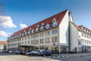
The Free State of Thuringia is a federal state of Germany, located in the central part of the country. It has an area of 16,171 square kilometres (6,244 sq mi) and 2.29 million inhabitants, making it the sixth smallest by area and the fifth smallest by population of Germany's sixteen states. Most of Thuringia is within the watershed of the Saale, a left tributary of the Elbe. Its capital is Erfurt.
Thuringia has been known by the nickname of "the green heart of Germany" (das grüne Herz Deutschlands) from the late 19th century, due to the dense forest covering the land.
Thuringia is known in Germany for nature and winter sports. It is home to the Rennsteig, Germany's most famous hiking trail, and the winter resort of Oberhof. Germany has won more Winter Olympics gold medals than any other country in the last 20 years, and half of Germany's all-time total of 136 Winter Olympic gold medals (through the Sochi games in 2014) have been won by Thuringian athletes.
Johann Sebastian Bach spent the first part of his life (1685–1717) and important further stages of his career in Thuringia. In the classical period, Goethe and Schiller lived at Weimar. Both worked also in the famous University of Jena nearby, which now hosts the most important centre of science in Thuringia. Other Universities of this federal state are the Ilmenau University of Technology, the University of Erfurt, and the Bauhaus University of Weimar.
Etymology and symbols
Arms of the landgraves of Thuringia (1265)The name Thuringia or Thüringen derives from the Germanic tribe Thuringii, who emerged during the Migration Period. Their origin isn't completely known. An older theory claimed that they were successors of the Hermunduri, but later research rejected the idea. Other historians argue that the Thuringians were allies of the Huns, came to central Europe together with them, and lived before in what is Galicia today. Publius Flavius Vegetius Renatus first mentioned the Thuringii around 400; during that period, the Thuringii were famous for their excellent horses.
The Thuringian Realm existed until 531 and later, the Landgraviate of Thuringia was the largest state in the Region, persisting between 1131 and 1247. Afterwards there was no state named Thuringia, nevertheless the term commonly described the region between the Harz mountains in the north, the Weiße Elster river in the east, the Franconian Forest in the south and the Werra river in the west. After the Treaty of Leipzig, Thuringia had its own dynasty again, the Ernestine Wettins. Their various lands formed the Free State of Thuringia, founded in 1920, together with some other small principalities. The Prussian territories around Erfurt, Mühlhausen and Nordhausen joined Thuringia in 1945.
The coat of arms of Thuringia shows the lion of the Ludowingian Landgraves of 12th-century origin. Furthermore, there are eight stars around it, representing the eight former states, which formed Thuringia. The flag of Thuringia is a white-red bicolor, derived from the white and red stripes of the Ludowingian lion. The coat of arms and flag of Hesse are quite similar to the Thuringian ones, because they are also derived from the Ludowingian symbols.
Symbols of Thuringia in popular culture are the Bratwurst and the Forest, because a large amount of the territory is forested.
History
Named after the Thuringii tribe who occupied it around AD 300, Thuringia came under Frankish domination in the 6th century.
Thuringia became a landgraviate in 1130 AD. After the extinction of the reigning Ludowingian line of counts and landgraves in 1247 and the War of the Thuringian Succession (1247–1264), the western half became independent under the name of "Hesse", never to become a part of Thuringia again. Most of the remaining Thuringia came under the rule of the Wettin dynasty of the nearby Margraviate of Meissen, the nucleus of the later Electorate and Kingdom of Saxony. With the division of the house of Wettin in 1485, Thuringia went to the senior Ernestine branch of the family, which subsequently subdivided the area into a number of smaller states, according to the Saxon tradition of dividing inheritance amongst male heirs. These were the "Saxon duchies", consisting, among others, of the states of Saxe-Weimar, Saxe-Eisenach, Saxe-Jena, Saxe-Meiningen, Saxe-Altenburg, Saxe-Coburg, and Saxe-Gotha; Thuringia became merely a geographical concept.
Thuringia generally accepted the Protestant Reformation, and Roman Catholicism was suppressed as early as 1520; priests who remained loyal to it were driven away and churches and monasteries were largely destroyed, especially during the German Peasants' War of 1525. In Mühlhausen and elsewhere, the Anabaptists found many adherents. Thomas Müntzer, a leader of some non-peaceful groups of this sect, was active in this city. Within the borders of modern Thuringia the Roman Catholic faith only survived in the Eichsfeld district, which was ruled by the Archbishop of Mainz, and to a small degree in Erfurt and its immediate vicinity.
Some reordering of the Thuringian states occurred during the German Mediatisation from 1795 to 1814, and the territory was included within the Napoleonic Confederation of the Rhine organized in 1806. The 1815 Congress of Vienna confirmed these changes and the Thuringian states' inclusion in the German Confederation; the Kingdom of Prussia also acquired some Thuringian territory and administered it within the Province of Saxony. The Thuringian duchies which became part of the German Empire in 1871 during the Prussian-led unification of Germany were Saxe-Weimar-Eisenach, Saxe-Meiningen, Saxe-Altenburg, Saxe-Coburg-Gotha, Schwarzburg-Sondershausen, Schwarzburg-Rudolstadt and the two principalities of Reuss Elder Line and Reuss Younger Line. In 1920, after World War I, these small states merged into one state, called Thuringia; only Saxe-Coburg voted to join Bavaria instead. Weimar became the new capital of Thuringia. The coat of arms of this new state was simpler than they had been previously.
In 1930 Thuringia was one of the free states where the Nazis gained real political power. Wilhelm Frick was appointed Minister of the Interior for the state of Thuringia after the Nazi Party won six delegates to the Thuringia Diet. In this position he removed from the Thuringia police force anyone he suspected of being a republican and replaced them with men who were favourable towards the Nazi Party. He also ensured that whenever an important position came up within Thuringia, he used his power to ensure that a Nazi was given that post.
After being controlled briefly by the US, from July 1945, the state of Thuringia came under the Soviet occupation zone, and was expanded to include parts of Prussian Saxony, such as the areas around Erfurt, Mühlhausen, and Nordhausen. Erfurt became the new capital of Thuringia. Ostheim, an exclave of Landkreis Eisenach, was ceded to Bavaria.
In 1952, the German Democratic Republic dissolved its states, and created districts (Bezirke) instead. The three districts that shared the territory of Thuringia were centered in Erfurt, Gera and Suhl. Also present Altenburg kreis was part of Leipzig bezirk.
The State of Thuringia was restored with slightly altered borders during Germany's reunification in 1990.
Geography
Topography
From the northwest going clockwise, Thuringia borders on the German states of Lower Saxony, Saxony-Anhalt, Saxony, Bavaria and Hesse.
The landscapes of Thuringia are quite diverse. The far north is occupied by the Harz mountains, followed by the Goldene Aue, a fertile floodplain around Nordhausen with the Helme as most important river. The north-west includes the Eichsfeld, a hilly and sometimes forested region, where the Leine river emanates. The central and northern part of Thuringia is defined by the 3000 km² wide Thuringian Basin, a very fertile and flat area around the Unstrut river and completely surrounded by the following hill chains (clockwise from the north-west): Dün, Hainleite, Windleite, Kyffhäuser, Hohe Schrecke, Schmücke, Finne, Ettersberg, Steigerwald, Thuringian Forest, Hörselberge and Hainich. Within the Basin the smaller hill chains Fahner Höhe and Heilinger Höhen. South of the Thuringian Basin is the Land's largest mountain range, marked by the Thuringian Forest in the north-west, the Thuringian Highland in the middle and the Franconian Forest in the south-east. Most of this range is forested and the Großer Beerberg (983 m) is Thuringia's highest mountain. To the south-west, the Forest is followed up by Werra river valley, dividing it from the Rhön Mountains in the west and the Grabfeld plain in the south. Eastern Thuringia, commonly described as the area east of Saale and Loquitz valley, is marked by a hilly landscape, rising slowly from the flat north to the mountainous south. The Saale in the west and the Weiße Elster in the east are the two big rivers running from south to north and forming densely settled valleys in this area. Between them lies the flat and forested Holzland in the north, the flat and fertile Orlasenke in the middle and the Vogtland, a hilly but in most parts non-forested region in the south. The far eastern region (east of Weiße Elster) is the Osterland or Altenburger Land along Pleiße river, a flat, fertile and densely settled agricultural area.
The most important river in Thuringia is the Saale (a tributary of the Elbe) with its tributaries Unstrut, Ilm and Weiße Elster, draining the most parts of Thuringia and the Werra (the headwater of the Weser), draining the south-west and west of the Land. Furthermore, some small parts on the southern border are drained by tributaries of the Main (a tributary of the Rhine). There are no large natural lakes in Thuringia, but it does have some of Germany's biggest dams including the Bleiloch Dam and the Hohenwarte Dam at Saale river same as the Leibis-Lichte Dam and the Goldisthal Pumped Storage Station within the Highland. Thuringia is Germany's only state without connection to navigable waterways.
The geographic center of the Federal Republic is located in Thuringia, within the municipality of Vogtei next to Mühlhausen. Thuringia's center is located only eight kilometres south of the capital's Cathedral within the municipality of Rockhausen.
Nature and environment
Due to many centuries of intensive settlement, most of the area is shaped by human influence. The original natural vegetation of Thuringia is forest with beech as its predominant species, as can still be found in the Hainich mountains today. In the uplands, a mixture of beech and spruce would be natural. However, most of the plains have been cleared and are in intensive agricultural use while most of the forests are planted with spruce and pine. Since 1990, Thuringia's forests have been managed aiming for a more natural and tough vegetation more resilient to climate change as well as diseases and vermin. In comparison to the forest, agriculture is still quite conventional and dominated by large structures and monocultures. Problems here are caused especially by increasingly prolonged dry periods during the summer months.
Environmental damage in Thuringia has been reduced to a large extent after 1990. The condition of forests, rivers and air was improved by modernizing factories, houses (decline of coal heating) and cars, and contaminated areas such as the former Uranium surface mines around Ronneburg have been remediated. Today's environmental problems are the salination of the Werra river, caused by discharges of K+S salt mines around Unterbreizbach and overfertilisation in agriculture, damaging the soil and small rivers.
Environment and nature protection has been of growing importance and attention since 1990. Large areas, especially within the forested mountains, are protected as natural reserves, including Thuringia's first national park within the Hainich mountains, founded in 1997, the Rhön Biosphere Reserve, the Thuringian Forest Nature Park and the South Harz Nature Park.
Infrastructure
Transport
As Germany's most central Land, Thuringia is an important hub of transit traffic. The transportation infrastructure was in very poor condition after the GDR period. Since 1990, many billions of Euros have been invested to improve the condition of roads and railways within Thuringia.
During the 1930s, the first two motorways were built across the Land, the A4 motorway as an important east-west connection in central Germany and the main link between Berlin and south-west Germany, and the A9 motorway as the main north-south route in eastern Germany, connecting Berlin with Munich. The A4 runs from Frankfurt in Hesse via Eisenach, Gotha, Erfurt, Weimar, Jena and Gera to Dresden in Saxony, connecting Thuringia's most important cities. At Hermsdorf junction it is connected with the A9. Both highways were widened from four to six lanes (three each way) after 1990, including some extensive re-routing in the Eisenach and Jena areas. Furthermore, three new motorways were built during the 1990s and 2000s. The A71 crosses the Land in southwest-northeast direction, connecting Würzburg in Bavaria via Meiningen, Suhl, Ilmenau, Arnstadt, Erfurt and Sömmerda with Sangerhausen and Halle in Saxony-Anhalt. The crossing of the Thuringian Forest by the A71 has been one of Germany's most expensive motorway segments with various tunnels (including Germany's longest road tunnel, the Rennsteig Tunnel) and large bridges. The A73 starts at the A71 south of Erfurt in Suhl and runs south towards Nuremberg in Bavaria. The A38 is another west-east connection in the north of Thuringia running from Göttingen in Lower Saxony via Heiligenstadt and Nordhausen to Leipzig in Saxony. Furthermore, there is a dense network of federal highways complementing the motorway network. The upgrading of federal highways is prioritised in the federal trunk road programme 2015 (Bundesverkehrswegeplan 2015). Envisaged projects include upgrades of the B247 from Gotha to Leinefelde to improve Mühlhausen's connection to the national road network, the B19 from Eisenach to Meiningen to improve access to Bad Salzungen and Schmalkalden, and the B88 and B281 for strengthening the Saalfeld/Rudolstadt region.
The first railways in Thuringia had been built in the 1840s and the network of main lines was finished around 1880. By 1920, many branch lines had been built, giving Thuringia one of the densest rail networks in the world before World War II with about 2,500 km of track. Between 1950 and 2000 most of the branch lines were abandoned, reducing Thuringia's network by half compared to 1940. On the other hand, most of the main lines were refurbished after 1990, resulting in improved speed of travel. The most important railway lines at present are the Thuringian Railway, connecting Halle and Leipzig via Weimar, Erfurt, Gotha and Eisenach with Frankfurt and Kassel and the Saal Railway from Halle/Leipzig via Jena and Saalfeld to Nuremberg. The former has an hourly ICE/IC service from Dresden to Frankfurt while the latter is served hourly by ICE trains from Berlin to Munich. In 2017, a new high speed line will be opened, diverting long-distance services from these mid-19th century lines. Both ICE routes will then use the Erfurt–Leipzig/Halle high-speed railway, and the Berlin-Munich route will continue via the Nuremberg–Erfurt high-speed railway. Only the segment west of Erfurt of the Frankfurt-Dresden line will continue to be used by ICE trains after 2017, with an increased line speed of 200 km/h (currently 160 km/h). Erfurt's central station, which was completely rebuilt for this purpose in the 2000s (decade), will be the new connection between both ICE lines. The most important regional railway lines in Thuringia are the Neudietendorf–Ritschenhausen railway from Erfurt to Würzburg and Meiningen, the Weimar–Gera railway from Erfurt to Chemnitz, the Sangerhausen–Erfurt railway from Erfurt to Magdeburg, the Gotha–Leinefelde railway from Erfurt to Göttingen, the Halle–Kassel railway from Halle via Nordhausen to Kassel and the Leipzig–Hof railway from Leipzig via Altenburg to Zwickau and Hof. Most regional and local lines have hourly service, but some run only every other hour.
There are a few small airports in Thuringia but the only one with public aviation is Erfurt–Weimar Airport. It is used for charter flights to the Mediterranean and other holiday destinations. The most important airports for scheduled flights are Frankfurt Airport, Berlin Brandenburg Airport and Munich Airport, all located in adjacent states. Leipzig–Altenburg Airport was served by Ryanair from 2003 to 2011.
Thuringia is Germany's only Land without a connection to waterways because its rivers are too small to be navigable.
Energy and water supply
The traditional energy supply of Thuringia is lignite, mined in the bordering Leipzig region. Since 2000, the importance of environmentally unfriendly lignite combustion has declined in favour of renewable energies, which reached an amount of 40% (in 2013), and more clean gas combustion, often carried out as Cogeneration in the municipal power stations. The most important forms of renewable energies are Wind power and Biomass, followed by Solar energy and Hydroelectricity. Furthermore, Thuringia hosts two big pumped storage stations: the Goldisthal Pumped Storage Station and the Hohenwarte Dam.
The water supply is granted by the big dams, like the Leibis-Lichte Dam, within the Thuringian Forest and the Thuringian Highland, making a drinking water exporter of Thuringia.
Health
Health care provision in Thuringia improved after 1990, as did the level of general health. Life expectancy rose, nevertheless it is still a bit lower than the German average. This is caused by a relatively unhealthy lifestyle of the Thuringians, especially in high consumption of meat, fat and alcohol, which led to significant higher rates of obesity compared to the German average.
Health care in Thuringia is currently undergoing a concentration process. Many smaller hospitals in the rural towns are closing, whereas the bigger ones in centres like Jena and Erfurt get enlarged. Overall, there is an oversupply of hospital beds, caused by rationalisation processes in the German health care system, so that many smaller hospitals generate losses. On the other hand, there is a lack of family doctors, especially in rural regions with increased need of health care provision because of overageing.