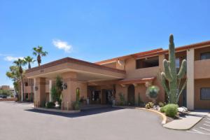
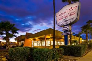
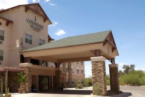
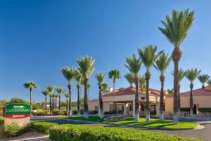
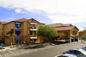
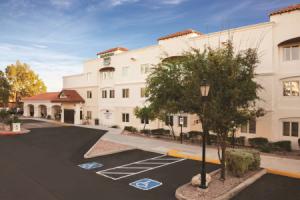
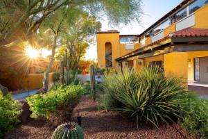
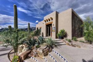
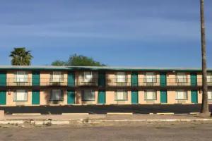
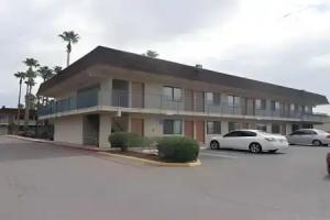
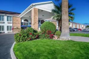
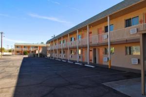
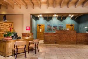
Tucson
Description
Tucson is a city and the county seat of Pima County, Arizona, United States, and home to the University of Arizona. The 2010 United States Census put the population at 520,116, while the 2015 estimated population of the entire Tucson metropolitan statistical area (MSA) was 980,263. The Tucson MSA forms part of the larger Tucson-Nogales combined statistical area (CSA), with a total population of 1,010,025 as of the 2010 Census. Tucson is the second-largest populated city in Arizona behind Phoenix, both of which anchor the Arizona Sun Corridor. The city is located 108 miles (174 km) southeast of Phoenix and 60 mi (97 km) north of the U.S.-Mexico border. Tucson is the 33rd largest city and the 59th largest metropolitan area in the United States. Roughly 150 Tucson companies are involved in the design and manufacture of optics and optoelectronics systems, earning Tucson the nickname Optics Valley.
Major incorporated suburbs of Tucson include Oro Valley and Marana northwest of the city, Sahuarita south of the city, and South Tucson in an enclave south of downtown. Communities in the vicinity of Tucson (some within or overlapping the city limits) include Casas Adobes, Catalina Foothills, Flowing Wells, Midvale Park, Tanque Verde, Tortolita, and Vail. Towns outside the Tucson metro area include Benson to the southeast, Catalina and Oracle to the north, and Green Valley to the south.
The Spanish name of the city, Tucsón [tukˈson], is derived from the O'odham Cuk Ṣon [tʃʊk ʂɔːn], meaning "(at the) base of the black [hill]", a reference to a basalt-covered hill now known as Sentinel Peak, also known as "A" Mountain. Tucson is sometimes referred to as "The Old Pueblo".
History
Tucson was probably first visited by Paleo-Indians, known to have been in southern Arizona about 12,000 years ago. Recent archaeological excavations near the Santa Cruz River have located a village site dating from 2100 BC. The floodplain of the Santa Cruz River was extensively farmed during the Early Agricultural period, circa 1200 BC to AD 150. These people constructed irrigation canals and grew corn, beans, and other crops while gathering wild plants and hunting. The Early Ceramic period occupation of Tucson saw the first extensive use of pottery vessels for cooking and storage. The groups designated as the Hohokam lived in the area from AD 600 to 1450 and are known for their vast irrigation canal systems and their red-on-brown pottery.
Jesuit missionary Eusebio Francisco Kino visited the Santa Cruz River valley in 1692, and founded the Mission San Xavier del Bac in 1700 about 7 mi (11 km) upstream from the site of the settlement of Tucson. A separate Convento settlement was founded downstream along the Santa Cruz River, near the base of what is now "A" mountain. Hugo O'Conor, the founding father of the city of Tucson, Arizona authorized the construction of a military fort in that location, Presidio San Agustín del Tucsón, on August 20, 1775 (near the present downtown Pima County Courthouse). During the Spanish period of the presidio, attacks such as the Second Battle of Tucson were repeatedly mounted by Apaches. Eventually the town came to be called "Tucson" and became a part of Sonora after Mexico gained independence from Spain in 1821.
Tucson was captured by Philip St. George Cooke with the Mormon Battalion during the Mexican–American War, but soon returned to Mexican control as Cooke continued his mission westward establishing Cooke's Wagon Road to California. Tucson was not included in the Mexican Cession and Cooke's road through Tucson became one of the important routes into California during the California Gold Rush.
Arizona, south of the Gila River, was legally bought from Mexico in the Gadsden Purchase on June 8, 1854. Tucson became a part of the United States of America, although the American military did not formally take over control until March 1856. In 1857 Tucson became a stage station on the San Antonio-San Diego Mail Line and in 1858 became 3rd division headquarters of the Butterfield Overland Mail until the line shut down in March 1861. The Overland Mail Corporation attempted to continue running, however following the Bascom Affair, devastating Apache attacks on the stations and coaches ended operations in August 1861.
From August 1861 to mid-1862, Tucson was the western capital of the Confederate Arizona Territory, the eastern capital being Mesilla. In 1862 the California Column drove the Confederate forces out of Arizona. Tucson and all of what is now Arizona were part of New Mexico Territory until 1863, when they became part of the new Arizona Territory. From 1867 to 1877, Tucson was the capital of the Arizona Territory. Tucson was incorporated in 1877, making it the oldest incorporated city in Arizona.
From 1877 to 1878, the area suffered a rash of stagecoach robberies. Most notable, however, were the two holdups committed by masked road-agent William Whitney Brazelton. Brazelton held up two stages in the summer of 1878 near Point of Mountain Station approximately 17 mi (27 km) northwest of Tucson. John Clum, of Tombstone, Arizona fame was one of the passengers. Brazelton was eventually tracked down and killed on Monday August 19, 1878, in a mesquite bosque along the Santa Cruz River 3 miles (5 km) south of Tucson by Pima County Sheriff Charles A. Shibell and his citizen's posse. Brazelton had been suspected of highway robbery not only in the Tucson area, but also in the Prescott region and Silver City, New Mexico area as well. Brazelton's crimes prompted John J. Valentine, Sr. of Wells, Fargo & Co. to send special agent and future Pima County sheriff Bob Paul to investigate. Fort Lowell, then east of Tucson, was established to help protect settlers from Apache attacks. In 1882, Frank Stilwell was implicated in the murder of Morgan Earp by Cowboy Pete Spence's wife, Marietta, at the coroner's inquest on Morgan Earp's shooting. The coroner's jury concluded that Spence, Stilwell, Frederick Bode, and Florentino "Indian Charlie" Cruz were the prime suspects in the assassination of Morgan Earp. :250 Deputy U.S. Marshal Wyatt Earp gathered a few trusted friends and accompanied Virgil Earp and his family as they traveled to Benson for a train ride to California. They found Stilwell lying in wait for Virgil in the Tucson station and killed him on the tracks. After killing Stilwell, Wyatt deputized others and rode on a vendetta, killing three more cowboys over the next few days before leaving the state.
In 1885, the University of Arizona, was founded as a land-grant college on over-grazed ranch land between Tucson and Fort Lowell. In 1890, Asians made up 4.2% of the city's population.
By 1900, 7,531 people lived in the city. The population increased gradually to 13,913 in 1910. At about this time, the U.S. Veterans Administration had begun construction on the present Veterans Hospital. Many veterans who had been gassed in World War I and were in need of respiratory therapy began coming to Tucson after the war, due to the clean dry air. Over the following years the city continued to grow, with the population increasing to 20,292 in 1920 and 36,818 in 1940. In 2006 the population of Pima County, in which Tucson is located, passed one million while the City of Tucson's population was 535,000.
In 1912, when Arizona statehood became reality, the total number of different flags that had flown over Tucson now numbered five: American, Spanish, Mexican, Confederate, and the State of Arizona.
During the territorial and early statehood periods, Tucson was Arizona's largest city and commercial center, while Phoenix was the seat of state government (beginning in 1889) and agriculture. The establishment of Tucson Municipal Airport increased its prominence. Between 1910 and 1920, Phoenix surpassed Tucson in population, and has continued to outpace Tucson in growth. In recent years, both Tucson and Phoenix have experienced some of the highest growth rates in the United States.
Geography
According to the United States Census Bureau, as of 2010, the City of Tucson has a land area of 226.71 square miles (587.2 km2).
The city's elevation is 2,643 ft (806 m) above sea level (as measured at the Tucson International Airport). Tucson is situated on an alluvial plain in the Sonoran desert, surrounded by five minor ranges of mountains: the Santa Catalina Mountains and the Tortolita Mountains to the north, the Santa Rita Mountains to the south, the Rincon Mountains to the east, and the Tucson Mountains to the west. The high point of the Santa Catalina Mountains is 9,157 ft (2,791 m) Mount Lemmon, the southernmost ski destination in the continental U.S., while the Tucson Mountains include 4,687 ft (1,429 m) Wasson Peak. The highest point in the area is Mount Wrightson, found in the Santa Rita Mountains at 9,453 ft (2,881 m) above sea level.
Tucson is located 118 mi (190 km) southeast of Phoenix and 60 mi (97 km) north of the United States - Mexico border. The 2010 United States Census puts the city's population at 520,116 with a metropolitan area population at 980,263. In 2009, Tucson ranked as the 32nd largest city and 52nd largest metropolitan area in the United States. A major city in the Arizona Sun Corridor, Tucson is the largest city in southern Arizona, the second largest in the state after Phoenix. It is also the largest city in the area of the Gadsden Purchase. As of 2015, The Greater Tucson Metro area has exceeded a population of 1 million.
The city is located on the Santa Cruz River, formerly a perennial river but now a dry river bed for much of the year that floods during significant seasonal rains.
Interstate 10, which runs southeast to northwest through town, connects Tucson to Phoenix to the northwest on the way to its western terminus in Santa Monica, California, and to Las Cruces, New Mexico and El Paso, Texas toward its eastern terminus in Jacksonville, Florida. I-19 runs south from Tucson toward Nogales and the U.S.-Mexico border. I-19 is the only Interstate highway that uses "kilometer posts" instead of "mileposts", although the speed limits are marked in miles per hour instead of kilometers per hour.
Neighborhoods
Downtown and Central TucsonSimilar to many other cities in the Western U.S., Tucson was developed on a grid plan starting in the late 19th century, with the city center at Stone Avenue and Broadway Boulevard. While this intersection was initially near the geographic center of Tucson, that center has shifted as the city has expanded far to the east, development to the west being effectively blocked by the Tucson Mountains. An expansive city covering substantial area, Tucson has many distinct neighborhoods.
Tucson's earliest neighborhoods, some of which are now covered by the Tucson Convention Center, or TCC, include:
- El Presidio, Tucson's oldest neighborhood
- Barrio Histórico, also known as Barrio Libre
- Armory Park, directly south of downtown
- Barrio Anita, named for an early settler and located between Granada Avenue and Interstate 10
- Barrio Tiburón, now known as the Fourth Avenue arts district − designated in territorial times as a red-light district
- Barrio El Jardín, named for an early recreational site, Levin's Gardens
- Barrio El Hoyo, named for a lake that was part of the gardens. Before the TCC was built, El Hoyo (Spanish for pit or hole) referred to this part of the city, which was inhabited mainly by Mexican-American citizens and Mexican immigrants.
- Barrio Santa Rosa, dating from the 1890s, now listed as a historic district on the National Register of Historic Places
Other historical neighborhoods near downtown include:
- Feldman's, named for an early resident photographer (with the streets "Helen" and "Mabel" named for his daughters)
- Menlo Park, situated west of downtown, adjacent to "A Mountain" more correctly called Sentinel Peak
- Iron Horse, east of Fourth Avenue and north of the railroad tracks, named for its proximity
- West University, located between the University of Arizona and downtown
- Dunbar Spring, west of West University
- Pie Allen, located west and south of the university near Tucson High School and named for John Brackett "Pie" Allen, a local entrepreneur and early mayor of Tucson
- Sam Hughes, located east of the University of Arizona, named after a Tucson pioneer
At the end of the first decade of the 21st century, downtown Tucson underwent a revitalization effort by city planners and the business community. The primary project was Rio Nuevo, a large retail and community center that has been stalled in planning for more than ten years. Downtown is generally regarded as the area bordered by 17th Street to the south, I-10 to the west, and 6th Street to the north, and Toole Avenue and the Union Pacific (formerly Southern Pacific) railroad tracks, site of the historic train depot and "Locomotive #1673", built in 1900. Downtown is divided into the Presidio District, the Barrio Viejo, and the Congress Street Arts and Entertainment District. Some authorities include the 4th Avenue shopping district, which is set just northeast of the rest of downtown and connected by an underpass beneath the UPRR tracks.
Attractions downtown include the Hotel Congress designed in 1919, the Art Deco Fox Theatre designed in 1929, the Rialto Theatre opened in 1920, and St. Augustine Cathedral completed in 1896. Included on the National Register of Historic Places is the old Pima County Courthouse, designed by Roy Place in 1928. The El Charro Café, Tucson's oldest restaurant, also operates its main location downtown.
As one of the oldest parts of town, Central Tucson is anchored by the Broadway Village shopping center designed by local architect Josias Joesler at the intersection of Broadway Boulevard and Country Club Road. The 4th Avenue Shopping District between downtown and the university and the Lost Barrio just East of downtown, also have many unique and popular stores. Local retail business in Central Tucson is densely concentrated along Fourth Avenue and the Main Gate Square on University Boulevard near the UA campus. The El Con Mall is also located in the eastern part of midtown.
The University of Arizona, chartered in 1885, is located in midtown and includes Arizona Stadium and McKale Center (named for J.F. "Pop" McKale). Historic Tucson High School (designed by Roy Place in 1924) featured in the 1987 film Can't Buy Me Love, the Arizona Inn (built in 1930), and the Tucson Botanical Gardens are also located in Central Tucson.
Tucson's largest park, Reid Park, is located in midtown and includes Reid Park Zoo and Hi Corbett Field. Speedway Boulevard, a major east-west arterial road in central Tucson, was named the "ugliest street in America" by Life magazine in the early 1970s, quoting Tucson Mayor James Corbett. Despite this, Speedway Boulevard was awarded "Street of the Year" by Arizona Highways in the late 1990s. According to David Leighton, historical writer for the Arizona Daily Star newspaper, Speedway Boulevard derives its name from an old horse racetrack, known as "The Harlem River Speedway," more commonly called "The Speedway," in New York City. The street was called "The Speedway," from 1904 to about 1906 before the word "The" was taken out.
Central Tucson is bicycle-friendly. To the east of the University of Arizona, Third Street is bike-only except for local traffic and passes by the historic homes of the Sam Hughes neighborhood. To the west, E. University Boulevard leads to the Fourth Avenue Shopping District. To the North, N. Mountain Avenue has a full bike-only lane for half of the 3.5 miles (5.6 km) to the Rillito River Park bike and walk multi-use path. To the south, N. Highland Avenue leads to the Barraza-Aviation Parkway bicycle path.
Southern TucsonSouth Tucson is actually the name of an independent, incorporated town of 1 sq mi (2.6 km2), completely surrounded by the city of Tucson, sitting just south of downtown. South Tucson has a colorful, dynamic history. It was first incorporated in 1936, and later reincorporated in 1940. The population consists of about 83% Mexican-American and 10% Native American residents. South Tucson is widely known for its many Mexican restaurants and the architectural styles which include bright outdoor murals, many of which have been painted over due to city policy.
The South side of the city of Tucson is generally considered to be the area of approximately 25 sq mi (65 km2) north of Los Reales Road, south of 22nd Street, east of I-19, west of Davis Monthan Air Force Base and southwest of Aviation Parkway. The Tucson International Airport and Tucson Electric Park are located here.
Western TucsonA combination of urban and suburban development, the West Side is generally defined as the area west of I-10. Western Tucson encompasses the banks of the Santa Cruz River and the foothills of the Tucson Mountains, and includes the International Wildlife Museum, Sentinel Peak, and the Marriott Starr Pass Resort & Spa, located in the wealthy enclave known as Starr Pass. Moving past the Tucson Mountains, travelers find themselves in the area commonly referred to as "west of" Tucson or "Old West Tucson". A large undulating plain extending south into the Altar Valley, rural residential development predominates, but here you will also find major attractions including Saguaro National Park West, the Arizona-Sonora Desert Museum, and the Old Tucson Studios movie set/theme park.
On Sentinel Peak (also known as "'A' Mountain"), just west of downtown, there is a giant "A" in honor of the University of Arizona. Starting in about 1916, a yearly tradition developed for freshmen to whitewash the "A", which was visible for miles. However, at the beginning of the Iraq War, anti-war activists painted it black. This was followed by a paint scuffle where the "A" was painted various colors until the city council intervened. It is now red, white and blue except when it is white or another color decided by a biennial election. Because of the three-color paint scheme often used, the shape of the A can be vague and indistinguishable from the rest of the peak. The top of Sentinel Peak, which is accessible by road, offers an outstanding scenic view of the city looking eastward. A parking lot located near the summit of Sentinel Peak was formerly a popular place to watch sunsets or view the city lights at night.
Northern TucsonNorth Tucson includes the urban neighborhoods of Amphitheater and Flowing Wells. Usually considered the area north of Fort Lowell Road, North Tucson includes some of Tucson's primary commercial zones (Tucson Mall and the Oracle Road Corridor). Many of the city's most upscale boutiques, restaurants, and art galleries are also located on the north side, including St. Philip's Plaza. The Plaza is directly adjacent to the historic St. Philip's in the Hills Episcopal Church (built in 1936).
Also on the north side is the suburban community of Catalina Foothills, located in the foothills of the Santa Catalina Mountains just north of the city limits. This community includes among the area's most expensive homes, sometimes multimillion-dollar estates. The Foothills area is generally defined as north of River Road, east of Oracle Road, and west of Sabino Creek. Some of the Tucson area's major resorts are located in the Catalina Foothills, including the Hacienda Del Sol, Westin La Paloma Resort, Loews Ventana Canyon Resort and Canyon Ranch Resort. La Encantada, an upscale outdoor shopping mall, is also in the Foothills.
The DeGrazia Gallery of the Sun is located near the intersection of Swan Road and Skyline Drive. Built by artist Ted DeGrazia starting in 1951, the 10-acre (40,000 m2) property is listed on the National Register of Historic Places and features an eclectic chapel, an art gallery, and a free museum.
The expansive area northwest of the city limits is diverse, ranging from the rural communities of Catalina and parts of the town of Marana, the small suburb of Picture Rocks, the affluent town of Oro Valley in the western foothills of the Santa Catalina Mountains, and residential areas in the northeastern foothills of the Tucson Mountains. Continental Ranch (Marana), Dove Mountain (Marana), and Rancho Vistoso (Oro Valley) are all masterplanned communities located in the Northwest, where thousands of residents live.
The community of Casas Adobes is also on the Northwest Side, with the distinction of being Tucson's first suburb, established in the late 1940s. Casas Adobes is centered on the historic Casas Adobes Plaza (built in 1948). Casas Adobes is also home to Tohono Chul Park (a nature preserve) near the intersection of North Oracle Road and West Ina Road. The attempted assassination of Representative Gabrielle Giffords, and the murders of chief judge for the U.S. District Court for Arizona, John Roll and five other people on January 8, 2011, occurred at the La Toscana Village in Casas Adobes. The Foothills Mall is also located on the northwest side in Casas Adobes.
Many of the Tucson area's golf courses and resorts are located in this area, including the Hilton El Conquistador Golf & Tennis Resort in Oro Valley, the Omni Tucson National Resort & Spa, and Westward Look Resort. The Ritz Carlton at Dove Mountain, the second Ritz Carlton Resort in Arizona, which also includes a golf course, opened in the foothills of the Tortolita Mountains in northeast Marana in 2009. Catalina State Park and Tortolita Mountain Park are also located in the Northwest area.
Eastern TucsonEast Tucson is relatively new compared to other parts of the city, developed between the 1950s and the 1970s, with developments such as Desert Palms Park. It is generally classified as the area of the city east of Swan Road, with above-average real estate values relative to the rest of the city. The area includes urban and suburban development near the Rincon Mountains. East Tucson includes Saguaro National Park East. Tucson's "Restaurant Row" is also located on the east side, along with a significant corporate and financial presence. Restaurant Row is sandwiched by three of Tucson's storied Neighborhoods: Harold Bell Wright Estates, named after the famous author's ranch which occupied some of that area prior to the depression; the Tucson Country Club (the third to bear the name Tucson Country Club), and the Dorado Country Club. Tucson's largest office building is 5151 East Broadway in east Tucson, completed in 1975. The first phases of Williams Centre, a mixed-use, master-planned development on Broadway near Craycroft Road, were opened in 1987. Park Place, a recently renovated shopping center, is also located along Broadway (west of Wilmot Road).
Near the intersection of Craycroft and Ft. Lowell Roads are the remnants of the Historic Fort Lowell. This area has become one of Tucson's iconic neighborhoods. In 1891, the Fort was abandoned and much of the interior was stripped of their useful components and it quickly fell into ruin. In 1900, three of the officer buildings were purchased for use as a sanitarium. The sanitarium was then sold to Harvey Adkins in 1928. The Bolsius family Pete, Nan and Charles Bolsius purchased and renovated surviving adobe buildings of the Fort – transforming them into spectacular artistic southwestern architectural examples. Their woodwork, plaster treatment and sense of proportion drew on their Dutch heritage and New Mexican experience. Other artists and academics throughout the middle of the 20th century, including: Win Ellis, Jack Maul, Madame Cheruy, Giorgio Belloli, Charels Bode, Veronica Hughart, Edward and Rosamond Spicer, Hazel Larson Archer and Ruth Brown, renovated adobes, built homes and lived in the area. The artist colony attracted writers and poets including beat generation Alan Harrington and Jack Kerouac whose visit is documented in his iconic book On the Road. This rural pocket in the middle of the city is listed on the National Register of Historic Places. Each year in February the neighborhood celebrates its history in the City Landmark it owns and restored the San Pedro Chapel.
Situated between the Santa Catalina Mountains and the Rincon Mountains near Redington Pass northeast of the city limits is the affluent community of Tanque Verde. The Arizona National Golf Club, Forty-Niners Country Club, and the historic Tanque Verde Guest Ranch are also in northeast Tucson.
Southeast Tucson continues to experience rapid residential development. The area includes Davis-Monthan Air Force Base. The area is considered to be south of Golf Links Road. It is the home of Santa Rita High School, Chuck Ford Park (Lakeside Park), Lakeside Lake, Lincoln Park (upper and lower), The Lakecrest Neighborhoods, and Pima Community College East Campus. The Atterbury Wash with its access to excellent bird watching is also located in the Southeast Tucson area. The suburban community of Rita Ranch houses many of the military families from Davis-Monthan, and is near the southeastern-most expansion of the current city limits. Close by Rita Ranch and also within the city limits lies Civano, a planned development meant to showcase ecologically sound building practices and lifestyles.
Mount LemmonMount Lemmon, the highest peak of the Santa Catalina Mountains, reaches an elevation of 9,157 feet (2,791 m) above sea level. The mountain is named after 19th century botanist Sara Lemmon. She was the first documented European woman to ascend to the peak, accompanied by her husband and by local rancher Emmerson Oliver Stratton. The Lemmons botanized extensively along the way, including collecting the plant Tagetes lemmonii which is now called the Mount Lemmon marigold.
Catalina Highway stretches 25 miles (40 km) and the entire mountain range is one of Tucson's most popular vacation spots for cycling, hiking, rock climbing, camping, birding, and wintertime snowboarding and skiing. Near the top of Mt. Lemmon is the town of Summerhaven. In Summerhaven, visitors will find log houses and cabins, a general store, and various shops, as well as numerous hiking trails. Near Summerhaven is the road to Ski Valley which hosts a ski lift, several runs, a giftshop, and nearby restaurant.
Mt. Lemmon Sky Center, which is located at a Steward Observatory site known as 'Sky Island', sits 9,152 feet (2,790 m) in altitude on the summit of Mt. Lemmon. As one of the Southwestern United States's 27 unique Sky Islands, this science learning facility is open to the public.
Arts and culture
Annual cultural events and fairs
Tucson Gem and Mineral ShowThe Tucson Gem & Mineral Show is one of the largest gem and mineral shows in the world and has been held for over 50 years. The Show is only one part of the gem, mineral, fossil, and bead gathering held all around Tucson in over 45 different sites. The various shows run from late-January to mid-February with the official Show lasting two weeks in February.
Tucson Festival of BooksSince 2009, the Tucson Festival of Books has been held annually over a two-day period in March at the University of Arizona. By 2010 it had become the fourth largest book festival in the United States, with 450 authors and 80,000 attendees. In addition to readings and lectures, it features a science fair, varied entertainment, food, and exhibitors ranging from local retailers and publishers to regional and national nonprofit organizations. In 2011, the Festival began presenting a Founder's Award; recipients include Elmore Leonard and R.L. Stine.
Tucson Folk FestivalFor the past 25 years, the Tucson Folk Festival has taken place the first Saturday and Sunday of May in downtown Tucson's El Presidio Park. In addition to nationally known headline acts each evening, the Festival highlights over 100 local and regional musicians on five stages is one of the largest free festivals in the country. All stages are within easy walking distance. Organized by the Tucson Kitchen Musicians Association, volunteers make this festival possible. KXCI 91.3-FM, Arizona's only community radio station, is a major partner, broadcasting from the Plaza Stage throughout the weekend. In addition, there are numerous workshops, events for children, sing-alongs, and a popular singer/songwriter contest. Musicians typically play 30-minute sets, supported by professional audio staff volunteers. A variety of food and crafts are available at the festival, as well as local micro-brews. All proceeds from sales go to fund future festivals.
Fourth Avenue Street FairThere are two Fourth Avenue Street Fairs, in December and late March/early April, staged between 9th Street and University Boulevard, that feature arts and crafts booths, food vendors and street performers. The fairs began in 1970 when Fourth Avenue, which at the time had half a dozen thrift shops, several New Age bookshops and the Food Conspiracy Co-Op, was a gathering place for hippies, and a few merchants put tables in front of their stores to attract customers before the holidays.
These days, the street fair has grown into a large corporate event, with most tables owned by outside merchants. It hosts mostly traveling craftsmen selling various arts such as pottery, paintings, wood working, metal decorations, candles, and many others.
The Tucson Rodeo (Fiesta de los Vaqueros)Another popular event held in February, which is early spring in Tucson, is the Fiesta de los Vaqueros, or rodeo week, founded by winter visitor, Leighton Kramer. While at its heart the Fiesta is a sporting event, it includes what is billed as "the world's largest non-mechanized parade". The Rodeo Parade is a popular event as most schools give two rodeo days off instead of Presidents Day. The exception to this is Presidio High (a non-public charter school), which doesn't get either. Western wear is seen throughout the city as corporate dress codes are cast aside during the Fiesta. The Fiesta de los Vaqueros marks the beginning of the rodeo season in the United States.
Tucson Meet YourselfEvery October for the past 30 years, Tucson Meet Yourself has presented the faces of Tucson's many ethnic groups. For one weekend, dancing, singing, artwork, and food from more than 30 different ethnicities are featured in the downtown area. All performers are from Tucson and the surrounding area, in keeping with the idea of "meeting yourself."
Tucson Modernism WeekSince 2012, during the first two weekends of October, the Tucson Historic Preservation Foundation hosts Tucson Modernism Week, celebrating tucson's unique Post WWII, Mid-century modern Heritage. The event includes more than 30 programs including tours, lectures, exhibits, films and parties. The events are located in mid-century modern buildings and neighborhoods throughout the city and has highlighted the work of significant architects and designers who contributed to the development and history of southern Arizona including: Architect Arthur Brown, Fashion Designer Dolores Gonzales, Architect Bob Swaim, Architect Anne Rysdale, Textile Designers Harwood and Sophie Steiger, Architect Nick Sakellar, Architectural Designer Tom Gist, Furniture Designer Max Gottschalk, Architect, Ned Nelson, Landscape Architect Guy Green, Architect Juan Worner Baz and many others.
All Souls Procession WeekendThe All Souls Procession, held in early November, is one of the largest festivals in Tucson. Modeled on the Mexican holiday Dia de los Muertos (Day of the Dead), it combines aspects of many different cultural traditions. The first All Souls Procession was organized by local artist Susan Kay Johnson in 1990 and involved 35 participants; by 2013, participation was estimated at 50,000.
The Procession, held at sundown, consists of a non-motorized parade through downtown Tucson featuring many floats, sculptures, and memorials, in which the community is encouraged to participate. The parade is followed by performances on an outdoor stage, culminating in the burning of an urn in which written prayers have been collected from participants and spectators. The event is organized and funded by the non-profit arts organization Many Mouths One Stomach, with the assistance of many volunteers and donations from the public and local businesses.
Cultural and other attractions
Cultural and other attractions include:
- Arizona Historical Society
- The Fremont House is an original adobe house in the Tucson Community Center that was saved while one of Tucson's earliest barrios was razed as urban renewal.
- Fort Lowell Museum
- Mission San Xavier del Bac
- Old Tucson Studios, built as a set for the movie Arizona, is a movie studio and theme park for classic Westerns.
- The Tucson Museum of Art was established as part of an art school, the Art Center, which was founded by local Tucson artists including Rose Cabat
- The University of Arizona Museum of Art includes works by Franz Kline, Jackson Pollock and Mark Rothko as part of the Edward J. Gallagher Memorial Collection, a tribute to a young man who was killed in a boating accident. The museum also includes the Samuel H. Kress Collection of European works from the 14th to 19th centuries and the C. Leonard Pfeiffer Collection of American paintings.
- Center for Creative Photography, a leading museum with many works by major artists such as Ansel Adams and Edward Weston.
- International Wildlife Museum, which is 5 mi (8.0 km) west of Interstate 10, maintains an exhibition of over four-hundred different stuffed animal species from around the globe.
- The DeGrazia Gallery in the Sun is an iconic Tucson landmark in the foothills of the Santa Catalina Mountains.
- Arizona-Sonora Desert Museum is a combined zoo, museum, and botanical garden, devoted to indigenous animals and plants of the Sonoran Desert.
- Titan Missile Museum is located about 25 mi (40 km) south of the city on I-19. This is a Cold War era Titan nuclear missile silo (billed as the only remaining intact post-Cold War Titan missile silo) turned tourist stop.
- Pima Air & Space Museum has a wide assortment of aircraft on display both indoors and outdoors.
- Pima County Fair
- Trail Dust Town is an outdoor shopping mall and restaurant complex that was built from the remains of a 1950 western movie set.
- Museum of the Horse Soldier
- Jewish Heritage Center Tucson
- Centennial Hall opened in 1937 as the University of Arizona's campus auditorium, designed by architect Roy Place.
- Tucson Chinese Cultural Center
- Arizona State Museum (on the University of Arizona campus)
Shops in Summerhaven on Mount Lemmon offer such items as jewelry and other gifts, pizza, and fresh-fruit pies. The legacy of the Aspen Fire can be seen in charred trees, rebuilt homes, and melted beads incorporated into a sidewalk.
Fourth Avenue, located near the University of Arizona, is home to many shops, restaurants, and bars, and hosts the annual 4th Avenue Street Fair every December and March. University Boulevard, leading directly to the UA Main Gate, is also the center of numerous bars, retail shops, and restaurants most commonly frequented by the large student population of the UA.
El Tiradito is a religious shrine in the downtown area. The Shrine dates back to the early days of Tucson. It is based on a love story of revenge and murder. People stop by the Shrine to light a candle for someone in need, a place for people to go give hope.
The Biosphere 2 is a 3.14-acre educational facility, designed to mimic a tropical or sub-tropical climate-controlled environment.
Literary arts
The accomplished and awarded writers (poets, novelists, dramatists, nonfiction writers) who have lived in Tucson include Edward Abbey, Erskine Caldwell, Barbara Kingsolver and David Foster Wallace. Some were associated with the University of Arizona, but many were independent writers who chose to make Tucson their home. The city is particularly active in publishing and presenting contemporary innovative poetry in various ways. Examples are the Chax Press, a publisher of poetry books in trade and book arts editions, and the University of Arizona Poetry Center, which has a sizable poetry library and presents readings, conferences, and workshops.
Performing arts
Theater groups include the Arizona Theatre Company, which performs in the Temple of Music and Art, and Arizona Onstage Productions, a not-for-profit theater company devoted to musical theater. Broadway in Tucson presents the touring reproductions of many Broadway-style events. The Gaslight Theater produces musical melodrama parodies in the old Jerry Lewis Theater and has been in Tucson since 1977.
Music
Musical organizations include the Tucson Symphony Orchestra (founded in 1929) and Arizona Opera (founded as the Tucson Opera Company in 1971).
Tucson is considered an influential center for Mariachi music and is home to a large number of Mariachi musicians and singers. The Tucson International Mariachi Conference, hosted annually since 1982, involves several hundred mariachi bands and folklorica dance troops during a three-day festival in April. The Norteño Festival and Street Fair in the enclave city of South Tucson is held annually at the end of summer.
Prominent musical artists based in Tucson have included Linda Ronstadt, The Dusty Chaps, Howe Gelb, Bob Log III, Calexico, Giant Sand, Hipster Daddy-O and the Handgrenades, The Bled and Tucson's official troubadour Ted Ramirez. The Tucson Area Music Awards, or TAMMIES, are an annual event.
Cuisine
Tucson is well known for its Sonoran-style Mexican food. But since the turn of the century, ethnic restaurants and fine dining choices have proliferated.
In 2015 the United Nations Educational, Scientific and Cultural Organization (UNESCO) designated Tucson a "world city of gastronomy".
The Sonoran hot dog is very popular in Tucson. This is a hot dog wrapped in bacon and grilled, served on a bolillo-style hot dog bun, and topped with pinto beans, onions, tomatoes, and a variety of additional condiments, often including mayonnaise, mustard, and jalapeño salsa.
Nicknames
Tucson is commonly known as "The Old Pueblo". While the exact origin of this nickname is uncertain, it is commonly traced back to Mayor R. N. "Bob" Leatherwood. When rail service was established to the city on March 20, 1880, Leatherwood celebrated the fact by sending telegrams to various leaders, including the President of the United States and the Pope, announcing that the "ancient and honorable pueblo" of Tucson was now connected by rail to the outside world. The term became popular with newspaper writers who often abbreviated it as "A. and H. Pueblo". This in turn transformed into the current form of "The Old Pueblo".
In the early 1980s, city leaders ran a contest searching for a new nickname. The winning entry was the "Sunshine Factory". The new nickname never gained popular acceptance, allowing the old name to remain in common use. Tucson was dubbed "Optics Valley" in 1992 when Business Week ran a cover story on the Arizona Optics Industry Association.

